
 SlideTeam
Free map maker
135 ready-made map makers and 833 templates. Pick one, click to color regions, add pins or paste data, and download a PowerPoint slide where every region is an editable shape.
Most used
 World Map MakerStart from a political, blank or highlighted world map. Click any country to recolor it, add pins, and export…8 templates
 Blank MapAn empty world map, ready for you: color any country, add pins or paste your own data…Start from scratch
 World Map with Seas and OceansAll five oceans and 80+ seas, gulfs and bays labeled on one map. Zoom in and smaller seas such as the…7 templates
 Asia-Pacific (APAC) MapThe Asia-Pacific region as most businesses define it: East Asia, Southeast Asia, South Asia and Oceania. Use…7 templates
 Asia MapThe Asian continent with all its countries, from Turkey to Japan and Kazakhstan to Indonesia. Color it by…6 templates
 Antarctica on the World MapAntarctica sits at the bottom of the world map, around the South Pole, surrounded by the Southern Ocean. Show…4 templates
 Central Asia MapThe five Central Asian countries — Kazakhstan, Uzbekistan, Turkmenistan, Kyrgyzstan and Tajikistan — between…6 templates
 7 Continents MapAsia, Africa, North America, South America, Antarctica, Europe and Australia — color-coded, labeled or blank.…6 templates
World & global 9
World Map MakerStart from a political, blank or highlighted world map. Click any country to recolor it, add pins, and export…8 templatesWorld Map with Seas and OceansAll five oceans and 80+ seas, gulfs and bays labeled on one map. Zoom in and smaller seas such as the…7 templatesAntarctica on the World MapAntarctica sits at the bottom of the world map, around the South Pole, surrounded by the Southern Ocean. Show…4 templates7 Continents MapAsia, Africa, North America, South America, Antarctica, Europe and Australia — color-coded, labeled or blank.…6 templates Map with Compass DirectionsAdd a compass rose showing north, east, south and west to any world, continent or country map. The compass…5 templates
 Business Location MapPut your offices, stores or customers on a map. Search 25,000 cities to add pins, size them by value, connect…6 templates
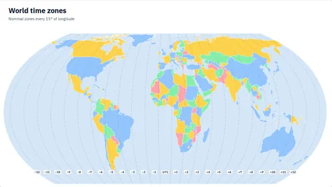 Time Zone MapShow UTC offsets on a world map, color US states or European countries by time zone, or pin your offices with…4 templates
 Sales Territory MapGroup states or countries into territories, name each one after its owner, and color regions by sales…6 templates
 Population Density MapHeatmaps of people per km² for the world, US states and Indian states, built from published population…6 templates
Regions 16
Asia-Pacific (APAC) MapThe Asia-Pacific region as most businesses define it: East Asia, Southeast Asia, South Asia and Oceania. Use…7 templatesAsia MapThe Asian continent with all its countries, from Turkey to Japan and Kazakhstan to Indonesia. Color it by…6 templatesCentral Asia MapThe five Central Asian countries — Kazakhstan, Uzbekistan, Turkmenistan, Kyrgyzstan and Tajikistan — between…6 templates Southeast Asia MapMyanmar, Thailand, Laos, Cambodia, Vietnam, Malaysia, Singapore, Indonesia, Brunei, the Philippines and…7 templates
 Europe MapAll European countries from Iceland to the Urals. Color them by region, highlight EU members, add capitals,…8 templates
 Australia & Oceania MapAustralia, New Zealand, Papua New Guinea and the Pacific islands of Melanesia, Micronesia and Polynesia, with…7 templates
 EMEA MapEurope, the Middle East and Africa on one map, the way sales and operations teams report it. Color the three…6 templates
 Africa MapAll of Africa's countries, from Morocco to South Africa. Color them by region, label the Atlantic and Indian…7 templates
 Middle East MapFrom Egypt and Turkey to Iran and the Arabian Peninsula, with the Persian Gulf, Red Sea and Gulf of Oman…6 templates
 South America MapThe 12 countries of South America plus French Guiana and the Falklands, between the Pacific and Atlantic…6 templates
 Europe and Asia MapEurope and Asia on one map — the Eurasian landmass from Portugal to Japan. Color the two continents or label…6 templates
 East Asia MapChina, Japan, the Koreas, Taiwan, Mongolia, Hong Kong and Macau, with the Sea of Japan, Yellow Sea and East…6 templates
 South Asia MapThe eight SAARC countries of the Indian subcontinent and its neighbours, with the Arabian Sea and Bay of…6 templates
 North America MapCanada, the United States, Mexico, Greenland, Central America and the Caribbean on one…7 templates
 Central America & Caribbean MapMexico, the seven Central American countries and the Caribbean islands, with the Caribbean Sea and Gulf of…6 templates
 Latin America (LATAM) MapMexico, Central America, the Caribbean and South America together, for LATAM sales, market and office…6 templates
USA & India 6
 USA Map MakerAll 50 states plus DC, with Alaska and Hawaii placed as insets. Label states, add capitals, color by category…10 templates
 Where Is It on the India Map? State LocatorPick a state or union territory to see it highlighted on India's map, with its capital pinned. Every locator…8 templates
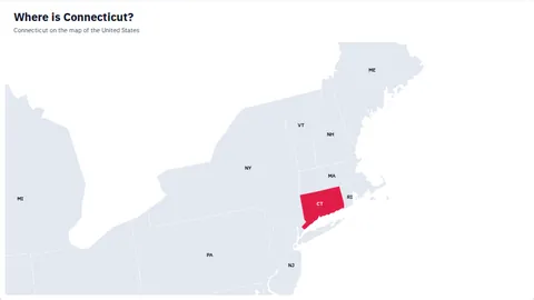 Where Is It on the US Map? State LocatorPick a state to see it highlighted on the map of the United States, with its capital pinned. Every locator…11 templates
 India Map MakerAll 28 states and 8 union territories, with India's official boundaries by default. Label states, add…7 templates
 US Regions MapThe four Census Bureau regions, the nine divisions, or the five everyday regions (including the Southwest).…6 templates
 India and Neighbouring Countries MapIndia with every country it borders by land and its sea neighbours, each in its own color and labeled. Uses…5 templates
Countries 104
 China Map MakerChina with its provinces, the capital Beijing and its neighbours. Click to recolor, add pins or paste your…6 templates
 Australia Map MakerAustralia with its states, the capital Canberra and the seas around it. Click to recolor, add pins or paste…6 templates
 Canada Map MakerCanada with its 13 provinces, the capital Ottawa and its neighbours. Click to recolor, add pins or paste your…6 templates
 UAE Map MakerUAE with its emirates, the capital Abu Dhabi and its neighbours. Click to recolor, add pins or paste your own…6 templates
 Japan Map MakerJapan with its 47 prefectures, the capital Tokyo and the seas around it. Click to recolor, add pins or paste…7 templates
 Saudi Arabia Map MakerSaudi Arabia with its 13 regions, the capital Riyadh and its neighbours. Click to recolor, add pins or paste…6 templates
 Philippines Map MakerThe Philippines with its provinces, the capital Manila and the seas around it. Click to recolor, add pins or…7 templates
 UK Map MakerThe UK with its 4 countries, the capital London and its neighbours. Click to recolor, add pins or paste your…7 templates
 Italy Map MakerItaly with its provinces, the capital Rome and its neighbours. Click to recolor, add pins or paste your own…7 templates
 Pakistan Map MakerPakistan with its 7 provinces, the capital Islamabad and its neighbours. Click to recolor, add pins or paste…6 templates
 New Zealand Map MakerNew Zealand with its regional councils, the capital Wellington and the seas around it. Click to recolor, add…6 templates
 Russia Map MakerRussia with its regions, the capital Moscow and its neighbours. Click to recolor, add pins or paste your own…7 templates
 South Africa Map MakerSouth Africa with its 9 provinces, the capital Pretoria and its neighbours. Click to recolor, add pins or…6 templates
 Spain Map MakerSpain with its 52 provinces, the capital Madrid and its neighbours. Click to recolor, add pins or paste your…7 templates
 Switzerland Map MakerSwitzerland with its 26 cantons, the capital Bern and its neighbours. Click to recolor, add pins or paste…6 templates
 Singapore Map MakerSingapore with its 5 regions, the capital Singapore and the seas around it. Click to recolor, add pins or…6 templates
 Malaysia Map MakerMalaysia with its 16 states, the capital Kuala Lumpur and its neighbours. Click to recolor, add pins or paste…6 templates
 Brazil Map MakerBrazil with its 27 states, the capital Brasília and its neighbours. Click to recolor, add pins or paste your…6 templates
 Tunisia Map MakerTunisia with its governorates, the capital Tunis and its neighbours. Click to recolor, add pins or paste your…6 templates
 Poland Map MakerPoland with its 16 voivodeships, the capital Warsaw and its neighbours. Click to recolor, add pins or paste…6 templates
 Jamaica Map MakerJamaica with its 14 parishes, the capital Kingston and the seas around it. Click to recolor, add pins or…6 templates
 South Korea Map MakerSouth Korea with its 17 provinces, the capital Seoul and its neighbours. Click to recolor, add pins or paste…6 templates
 Mexico Map MakerMexico with its states, the capital Mexico City and its neighbours. Click to recolor, add pins or paste your…6 templates
 Algeria Map MakerAlgeria with its provinces, the capital Algiers and its neighbours. Click to recolor, add pins or paste your…6 templates
 Georgia Map MakerGeorgia with its 12 regions, the capital Tbilisi and its neighbours. Click to recolor, add pins or paste your…6 templates
 France Map MakerFrance with its 18 regions, the capital Paris and its neighbours. Click to recolor, add pins or paste your…6 templates
 Oman Map MakerOman with its 11 regions, the capital Muscat and its neighbours. Click to recolor, add pins or paste your own…6 templates
 Costa Rica Map MakerCosta Rica with its 7 provinces, the capital San José and its neighbours. Click to recolor, add pins or paste…6 templates
 Belgium Map MakerBelgium with its 11 provinces, the capital Brussels and its neighbours. Click to recolor, add pins or paste…6 templates
 Bangladesh Map MakerBangladesh with its divisions, the capital Dhaka and its neighbours. Click to recolor, add pins or paste your…6 templates
 Netherlands Map MakerThe Netherlands with its provinces, the capital Amsterdam and its neighbours. Click to recolor, add pins or…6 templates
 Kazakhstan Map MakerKazakhstan with its regions, the capital Nur-Sultan and its neighbours. Click to recolor, add pins or paste…6 templates
 Turkey Map MakerTurkey with its 81 provinces, the capital Ankara and its neighbours. Click to recolor, add pins or paste your…6 templates
 Germany Map MakerGermany with its 16 states, the capital Berlin and its neighbours. Click to recolor, add pins or paste your…6 templates
 Qatar Map MakerQatar with its municipalities, the capital Doha and its neighbours. Click to recolor, add pins or paste your…6 templates
 Romania Map MakerRomania with its 42 counties, the capital Bucharest and its neighbours. Click to recolor, add pins or paste…6 templates
 Nigeria Map MakerNigeria with its 37 states, the capital Abuja and its neighbours. Click to recolor, add pins or paste your…6 templates
 Taiwan Map MakerTaiwan with its counties, the capital Taipei and the seas around it. Click to recolor, add pins or paste your…6 templates
 Cyprus Map MakerCyprus with its districts, the capital Nicosia and the seas around it. Click to recolor, add pins or paste…6 templates
 Belarus Map MakerBelarus with its 7 regions, the capital Minsk and its neighbours. Click to recolor, add pins or paste your…6 templates
 Hong Kong Map MakerHong Kong with its 18 districts, the capital Hong Kong and its neighbours. Click to recolor, add pins or…6 templates
 Indonesia Map MakerIndonesia with its provinces, the capital Jakarta and its neighbours. Click to recolor, add pins or paste…6 templates
 Ukraine Map MakerUkraine with its 25 regions, the capital Kyiv and its neighbours. Click to recolor, add pins or paste your…6 templates
 Finland Map MakerFinland with its 18 provinces, the capital Helsinki and its neighbours. Click to recolor, add pins or paste…6 templates
 Austria Map MakerAustria with its 9 states, the capital Vienna and its neighbours. Click to recolor, add pins or paste your…6 templates
 Ireland Map MakerIreland with its 34 counties, the capital Dublin and its neighbours. Click to recolor, add pins or paste your…6 templates
 Thailand Map MakerThailand with its 77 provinces, the capital Bangkok and its neighbours. Click to recolor, add pins or paste…7 templates
 Venezuela Map MakerVenezuela with its 26 states, the capital Caracas and its neighbours. Click to recolor, add pins or paste…6 templates
 Cambodia Map MakerCambodia with its 24 provinces, the capital Phnom Penh and its neighbours. Click to recolor, add pins or…6 templates
 Ghana Map MakerGhana with its regions, the capital Accra and its neighbours. Click to recolor, add pins or paste your own…6 templates
 Iceland Map MakerIceland with its 9 regions, the capital Reykjavík and the seas around it. Click to recolor, add pins or paste…6 templates
 Portugal Map MakerPortugal with its 20 districts, the capital Lisbon and its neighbours. Click to recolor, add pins or paste…6 templates
 Syria Map MakerSyria with its 15 provinces, the capital Damascus and its neighbours. Click to recolor, add pins or paste…6 templates
 Egypt Map MakerEgypt with its 27 governorates, the capital Cairo and its neighbours. Click to recolor, add pins or paste…6 templates
 Jordan Map MakerJordan with its 12 provinces, the capital Amman and its neighbours. Click to recolor, add pins or paste your…6 templates
 Bulgaria Map MakerBulgaria with its 28 provinces, the capital Sofia and its neighbours. Click to recolor, add pins or paste…6 templates
 Denmark Map MakerDenmark with its 5 regions, the capital Copenhagen and its neighbours. Click to recolor, add pins or paste…6 templates
 Ecuador Map MakerEcuador with its 24 provinces, the capital Quito and its neighbours. Click to recolor, add pins or paste your…6 templates
 Moldova Map MakerMoldova with its 40 districts, the capital Chisinau and its neighbours. Click to recolor, add pins or paste…6 templates
 Nepal Map MakerNepal with its administrative zones, the capital Kathmandu and its neighbours. Click to recolor, add pins or…6 templates
 Bhutan Map MakerBhutan with its 20 districts, the capital Thimphu and its neighbours. Click to recolor, add pins or paste…6 templates
 Latvia Map MakerLatvia with its municipalities, the capital Riga and its neighbours. Click to recolor, add pins or paste your…6 templates
 Liberia Map MakerLiberia with its 15 counties, the capital Monrovia and its neighbours. Click to recolor, add pins or paste…6 templates
 Mauritius Map MakerMauritius with its 16 districts, the capital Port Louis and the seas around it. Click to recolor, add pins or…6 templates
 Mongolia Map MakerMongolia with its 22 provinces, the capital Ulan Bator and its neighbours. Click to recolor, add pins or…6 templates
 Mozambique Map MakerMozambique with its 11 provinces, the capital Maputo and its neighbours. Click to recolor, add pins or paste…6 templates
 Samoa Map MakerSamoa with its 11 regions, the capital Apia and the seas around it. Click to recolor, add pins or paste your…6 templates
 Bahrain Map MakerBahrain with its 5 governorates, the capital Manama and the seas around it. Click to recolor, add pins or…6 templates
 Andorra Map MakerAndorra with its 7 regions, the capital Andorra la Vella and its neighbours. Click to recolor, add pins or…6 templates
 Guinea Map MakerGuinea with its 34 prefectures, the capital Conakry and its neighbours. Click to recolor, add pins or paste…6 templates
 Angola Map MakerAngola with its 18 provinces, the capital Luanda and its neighbours. Click to recolor, add pins or paste your…6 templates
 Kenya Map MakerKenya with its provinces, the capital Nairobi and its neighbours. Click to recolor, add pins or paste your…6 templates
 Sri Lanka Map MakerSri Lanka with its 25 districts, the capital Colombo and the seas around it. Click to recolor, add pins or…6 templates
 Ethiopia Map MakerEthiopia with its 11 administrative states, the capital Addis Ababa and its neighbours. Click to recolor, add…6 templates
 Fiji Map MakerFiji with its 5 divisions, the capital Suva and the seas around it. Click to recolor, add pins or paste your…6 templates
 Bolivia Map MakerBolivia with its 9 departments, the capital Sucre and its neighbours. Click to recolor, add pins or paste…6 templates
 Kuwait Map MakerKuwait with its 6 provinces, the capital Kuwait City and its neighbours. Click to recolor, add pins or paste…6 templates
 Peru Map MakerPeru with its 26 departments, the capital Lima and its neighbours. Click to recolor, add pins or paste your…6 templates
 Gabon Map MakerGabon with its 9 provinces, the capital Libreville and its neighbours. Click to recolor, add pins or paste…6 templates
 Haiti Map MakerHaiti with its 10 departments, the capital Port-au-Prince and its neighbours. Click to recolor, add pins or…6 templates
 North Korea Map MakerNorth Korea with its 11 provinces, the capital Pyongyang and its neighbours. Click to recolor, add pins or…6 templates
 Norway Map MakerNorway with its counties, the capital Oslo and its neighbours. Click to recolor, add pins or paste your own…6 templates
 Sweden Map MakerSweden with its 21 counties, the capital Stockholm and its neighbours. Click to recolor, add pins or paste…6 templates
 Tanzania Map MakerTanzania with its 30 regions, the capital Dodoma and its neighbours. Click to recolor, add pins or paste your…6 templates
 Vietnam Map MakerVietnam with its provinces, the capital Hanoi and its neighbours. Click to recolor, add pins or paste your…6 templates
 Serbia Map MakerSerbia with its 25 districts, the capital Belgrade and its neighbours. Click to recolor, add pins or paste…6 templates
 El Salvador Map MakerEl Salvador with its 14 departments, the capital San Salvador and its neighbours. Click to recolor, add pins…6 templates
 Greece Map MakerGreece with its 14 regions, the capital Athens and its neighbours. Click to recolor, add pins or paste your…6 templates
 Argentina Map MakerArgentina with its 24 provinces, the capital Buenos Aires and its neighbours. Click to recolor, add pins or…6 templates
 Bahamas Map MakerThe Bahamas with its 30 districts, the capital Nassau and the seas around it. Click to recolor, add pins or…6 templates
 Bosnia and Herzegovina Map MakerBosnia and Herzegovina with its 18 cantons, the capital Sarajevo and its neighbours. Click to recolor, add…6 templates
 Myanmar Map MakerMyanmar with its 14 states, the capital Nay Pyi Taw and its neighbours. Click to recolor, add pins or paste…6 templates
 Chile Map MakerChile with its 16 regions, the capital Santiago and its neighbours. Click to recolor, add pins or paste your…6 templates
 Colombia Map MakerColombia with its 34 departments, the capital Bogotá and its neighbours. Click to recolor, add pins or paste…6 templates
 Croatia Map MakerCroatia with its 21 counties, the capital Zagreb and its neighbours. Click to recolor, add pins or paste your…6 templates
 Cuba Map MakerCuba with its 17 provinces, the capital Havana and the seas around it. Click to recolor, add pins or paste…6 templates
 Czech Republic Map MakerThe Czech Republic with its 14 regions, the capital Prague and its neighbours. Click to recolor, add pins or…6 templates
 Kyrgyzstan Map MakerKyrgyzstan with its 8 regions, the capital Bishkek and its neighbours. Click to recolor, add pins or paste…6 templates
 Laos Map MakerLaos with its 17 provinces, the capital Vientiane and its neighbours. Click to recolor, add pins or paste…6 templates
 Morocco Map MakerMorocco with its regions, the capital Rabat and its neighbours. Click to recolor, add pins or paste your own…6 templates
 Nicaragua Map MakerNicaragua with its 17 departments, the capital Managua and its neighbours. Click to recolor, add pins or…6 templates
 Panama Map MakerPanama with its 12 provinces, the capital Panamá and its neighbours. Click to recolor, add pins or paste your…6 templates
 Papua New Guinea Map MakerPapua New Guinea with its 20 provinces, the capital Port Moresby and its neighbours. Click to recolor, add…6 templates
 Sudan Map MakerSudan with its 17 states, the capital Khartoum and its neighbours. Click to recolor, add pins or paste your…6 templates
No map maker matches that yet — try a continent or country name, or open the world map and use the map picker.
About Map Maker
PowerPoint downloads are native freeform shapes, named so you can find them in the Selection Pane.
Two columns from Excel or Google Sheets become a heatmap or color groups, with names, codes and common spellings recognised.
Search about 25,000 cities, drop pins, size them by value and connect them with routes.
Nothing is uploaded unless you export: your map is saved in your own browser.
Questions
Is Map Maker free?
Yes. Every map maker here is free, with no sign-up and no watermark. Your work is saved in your own browser, and what you download is yours to use in presentations, reports and documents, including at work.
Can I edit the maps in PowerPoint?
Yes. Download → PowerPoint gives a slide where every country, state or province is its own named freeform shape, grouped with the labels, pins and legend, so you can recolor or move any of them in PowerPoint, Keynote or Google Slides.
Which maps can I make?
The world, the continents, business regions such as APAC, EMEA and LATAM, the seas and oceans, time zones, and states or provinces for 240+ countries — including all 50 US states, 3,220 US counties and county equivalents, and India's 28 states and 8 union territories.
How do I color a map with my own data?
Open any map maker, click Add data and paste two columns from Excel or Google Sheets — a region name and a number or group — or upload a CSV or Excel file. Numbers become a heatmap with a legend; text becomes color groups.
Which borders do the maps use?
Natural Earth's international (de facto) view by default; the India map makers open with India's official boundaries. World and India maps switch between the two in Style → Map → Border view, and every download uses the view you pick.
Map data: Natural Earth (public domain) · US counties: U.S. Census Bureau · Cities: GeoNames (CC BY 4.0)