

Germany Maps Powerpoint Ppt Template Bundles





Try Before you Buy Download Free Sample Product
 Impress Your
Audience
 100%
Editable
 Save Hours
of Time


Discover the rich tapestry of Germanys history and infrastructure with our comprehensive PPT on Germany Maps. Unearth the past with an Ancient Germany Map, showcasing the evolution of the nation. Navigate the present with detailed Germany Rail Routes and Autobahns Network Maps, offering insights into the countrys efficient transportation systems. Explore Germanys demographic landscape through a Population Density Map, providing valuable data for strategic planning. Whether you are a history enthusiast, a traveler, or a researcher, this PPT is an invaluable tool, offering a holistic view of Germanys past, present, and future. Engage your audience with visually compelling maps that tell the story of this fascinating European nation.
People who downloaded this PowerPoint presentation also viewed the following :
Germany Maps Powerpoint Ppt Template Bundles with all 16 slides:
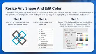
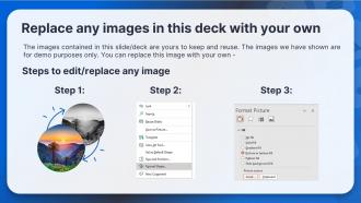
Use our Germany Maps Powerpoint Ppt Template Bundles to effectively help you save your valuable time. They are readymade to fit into any presentation structure.








FAQs for Germany Maps Powerpoint
German maps hold profound historical significance, documenting territorial changes, political evolution, and cultural development from medieval times through modern reunification. These cartographic records showcase Germany's fragmented past as the Holy Roman Empire, Prussian expansion, wartime border shifts, and Cold War division, ultimately enabling historians, educators, and policymakers to understand geographic influences on national identity and strategic decision-making.
Modern cartographic techniques have revolutionized German map accuracy through satellite imagery, GPS technology, digital surveying, and GIS systems. These advanced methods enable precise geographical data collection, real-time updates, and detailed terrain modeling, with urban planners, transportation authorities, and emergency services finding significantly enhanced operational efficiency and strategic decision-making capabilities.
Thematic maps of Germany effectively convey socio-economic data through color coding, statistical overlays, choropleth mapping, and data visualization techniques that highlight regional variations. These specialized maps enable policymakers, researchers, and businesses to identify economic disparities, population trends, and investment opportunities across German states, ultimately delivering strategic insights for resource allocation and market expansion decisions.
Germany's topographic maps distinctively feature the North German Plain's subtle elevation changes, the Rhine Valley's detailed river systems, and the Bavarian Alps' dramatic contour patterns. These geographic characteristics create unique cartographic challenges compared to other European countries, with German mapping agencies developing specialized techniques for representing low-gradient terrains and industrial river corridors, ultimately delivering enhanced precision for urban planning and environmental management.
Digital mapping applications revolutionize geographic information accessibility in Germany by providing real-time data, multilingual interfaces, offline functionality, and barrier-free design features for users with disabilities. These platforms enable government agencies, businesses, and citizens to access detailed topographic data, urban planning information, and navigation services instantly, while GPS integration and mobile optimization ensure seamless geographic information delivery across diverse user needs.
Political maps of Germany serve essential functions including identifying the 16 federal states (Länder), understanding regional governance structures, analyzing electoral districts, and examining administrative boundaries for policy implementation. These maps enable businesses, researchers, and government entities to navigate Germany's complex federal system, assess regional market opportunities, and understand jurisdictional frameworks, ultimately delivering strategic insights for expansion planning and regulatory compliance.
Cultural landmarks significantly shape German tourist maps by serving as primary focal points, navigation anchors, and thematic organizing elements that guide route planning and visitor flow. These landmarks, from Brandenburg Gate in Berlin to Neuschwanstein Castle in Bavaria, enable map designers to create intuitive wayfinding systems while highlighting cultural districts, with many tourism boards finding that landmark-centered designs ultimately enhance visitor experiences and streamline exploration.
Maps serve as foundational tools for German urban planning, enabling zoning analysis, infrastructure development, transportation optimization, environmental impact assessment, and demographic planning. Through advanced GIS technologies and detailed cadastral mapping, German cities like Munich and Hamburg streamline development approvals, enhance resource allocation, and deliver sustainable urban growth, ultimately providing citizens with better services and more livable communities.
Satellite imagery and GIS technology enable detailed German mapping through high-resolution data capture, terrain analysis, infrastructure monitoring, land use classification, and real-time updates. These systems streamline cartographic processes by integrating multiple data sources, automated feature recognition, and precise coordinate systems, with mapping agencies and urban planners finding that this combination delivers significantly enhanced accuracy and operational efficiency.
Historical maps of Germany reveal dramatic territorial shifts through wars, unification, and division, showcasing the Holy Roman Empire's fragmentation, Prussian expansion, and 20th-century border changes. These cartographic records enable historians, educators, and policymakers to understand geopolitical evolution, with many institutions finding that visual territorial documentation enhances strategic analysis and cultural understanding.
Natural features significantly influence Germany's cartographic representation through topographical variations, drainage patterns, elevation changes, and regional boundaries that cartographers must accurately depict. Rivers like the Rhine and Danube, along with mountain ranges such as the Alps and Black Forest, create natural landmarks that enhance navigation precision, define territorial divisions, and provide essential geographic context, ultimately delivering more comprehensive spatial understanding for businesses operating across Germany's diverse landscape.
Representing Germany's diverse geography presents challenges including scale variations, feature prioritization, regional complexity, topographical differences, and urban-rural balance across sixteen federal states. These mapping constraints require strategic compromise between detail and clarity, with many cartographers finding that multi-layered approaches or specialized regional focuses ultimately deliver more effective geographic communication and user comprehension.
German maps incorporate multilingual labeling, standardized international symbols, and demographic-specific design elements to serve diverse populations including tourists, business travelers, and local communities. Through clear iconography, English translations in tourist areas, and culturally appropriate visual markers, these maps enhance navigation accessibility across different user groups, ultimately delivering improved wayfinding experiences and broader market appeal for map publishers.
Map projection choices significantly affect Germany's representation through distortion of area, shape, angles, and distances, with each projection prioritizing different geographic properties. Mercator projections can exaggerate Germany's northern regions while compressing southern areas, whereas equal-area projections like Albers maintain accurate proportional sizing, and conformal projections preserve shape integrity, ultimately enabling cartographers, urban planners, and businesses to select projections that deliver precise spatial analysis for infrastructure development and strategic geographic decision-making.
Online mapping platforms have revolutionized geographic interaction through real-time navigation, interactive exploration, street-level imagery, cultural landmark discovery, and personalized route optimization. These digital tools enable travelers, businesses, and residents to seamlessly navigate German cities, explore historical sites, optimize logistics operations, and enhance tourism experiences, ultimately delivering greater accessibility and deeper geographic understanding across diverse user segments.
-
Great work on designing the presentation. I just loved it!
-
The templates are easy to get, and the chat customer support is excellent.