


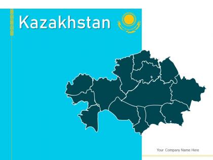
Kazakhstan map geographical locations regions currency notes




Try Before you Buy Download Free Sample Product
 Impress Your
 Audience
 100%
100% Editable
 Save Hours
 of Time


Our Kazakhstan Map Geographical Locations Regions Currency Notes are topically designed to provide an attractive backdrop to any subject. Use them to look like a presentation pro.
People who downloaded this PowerPoint presentation also viewed the following :
Kazakhstan map geographical locations regions currency notes with all 12 slides:
Use our Kazakhstan Map Geographical Locations Regions Currency Notes to effectively help you save your valuable time. They are readymade to fit into any presentation structure.




FAQs for Kazakhstan map geographical locations
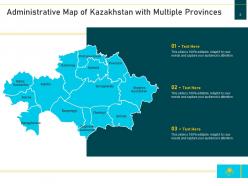
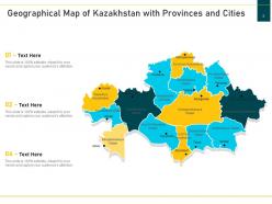
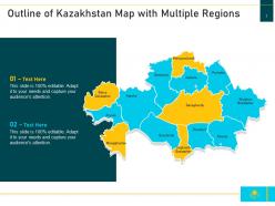
Kazakhstan's major geographical features include the vast Kazakh Steppe, the Altai Mountains in the east, the Caspian lowlands in the west, the Aral Sea basin, and extensive desert regions like the Kyzylkum. These diverse landscapes enable strategic resource extraction, agricultural development, and transportation corridors, with many industries finding that Kazakhstan's geographical diversity ultimately delivers significant economic opportunities and competitive advantages.
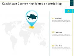
Kazakhstan ranks as the world's ninth-largest country by land area, covering approximately 2.7 million square kilometers, making it larger than Western Europe and roughly four times the size of Texas. This vast territory positions Kazakhstan as the largest landlocked nation globally, with many multinational corporations finding that its strategic location between Europe and Asia, combined with extensive natural resources across diverse geographical regions, delivers significant opportunities for trade routes, energy exploration, and agricultural development.
The Ural and Altai Mountains serve as significant geographical boundaries and natural resource centers, with the Urals forming Kazakhstan's northwestern border with Russia and the Altai range defining the eastern frontier with China and Mongolia. These mountain systems influence regional climate patterns, provide mineral wealth including gold and copper deposits, and support distinct ecosystems, ultimately enhancing Kazakhstan's strategic positioning for cross-border trade and resource development.
Kazakhstan's vast continental geography creates extreme temperature variations, with hot summers and harsh winters, while its landlocked position limits moisture access, resulting in arid and semi-arid conditions across most regions. The country's diverse topography, from northern steppes to southern deserts and eastern mountains, enables distinct microclimates that support varied agricultural zones, with many regions finding strategic advantage in specialized crop production and resource extraction.
Kazakhstan's key rivers include the Irtysh, Ishim, Ural, Syr Darya, and Ili, which serve as vital lifelines for agriculture, industry, and urban development. These waterways enable irrigation for vast agricultural regions, support hydroelectric power generation, and facilitate transportation networks, with many cities finding that strategic positioning along these rivers delivers enhanced trade opportunities and economic growth.
The Caspian Sea significantly shapes Kazakhstan's western geography through its vast coastline and influences the nation's economy via substantial oil and gas reserves, fishing industries, and transportation networks. These coastal resources enable Kazakhstan to develop major energy extraction operations, support maritime commerce, and establish strategic trade routes, ultimately delivering economic diversification and competitive advantage in global energy markets.
Kazakhstan's primary ecosystems include temperate grasslands, semi-arid steppes, desert regions, forest-steppes, and alpine zones, distributed across distinct geographical bands from north to south. These diverse ecosystems support varied agricultural and resource extraction industries, with northern steppes enabling large-scale grain production, while southern deserts contain significant mineral deposits, ultimately providing Kazakhstan with diverse economic opportunities across multiple sectors.
Kazakhstan's steppes provide vast expanses of fertile grasslands ideal for wheat cultivation, livestock grazing, and diverse crop production through their rich chernozem soils and continental climate patterns. These expansive plains enable large-scale agricultural operations across millions of hectares, with grain farming and cattle ranching delivering significant export revenues and food security for the nation.
Kazakhstan faces geographical challenges including vast distances between resource deposits and markets, harsh continental climate affecting extraction operations, water scarcity in mining regions, and limited transport infrastructure connecting remote sites. These factors increase operational costs and complexity, though many energy companies find that strategic investment in pipeline networks and mining infrastructure ultimately delivers competitive advantages in global markets.
Kazakhstan's mountainous terrain constrains Almaty's expansion southward while promoting vertical development, whereas Nur-Sultan's steppe location enables horizontal growth across vast plains. These geographic factors influence infrastructure planning, transportation networks, and population density patterns, with both cities strategically leveraging their natural settings to enhance economic zones and residential districts.
The Baikonur Cosmodrome serves as the world's oldest and largest operational space launch facility, strategically positioned in Kazakhstan's vast steppes to maximize launch efficiency and safety. Its location in the sparsely populated Kyzylorda region capitalizes on Kazakhstan's expansive geography, providing extensive unpopulated areas for rocket debris, while the latitude enables optimal orbital trajectories for international space missions.
Kazakhstan's central location between Europe, Asia, and the Middle East creates significant trade advantages, connecting major markets through established corridors like the Trans-Caspian and Northern routes. While landlocked status presents logistical challenges, the country's strategic position enables efficient transit operations, with neighboring partnerships in Russia, China, and Central Asian markets ultimately delivering enhanced trade volumes and regional economic integration opportunities.
Human activity has significantly altered Kazakhstan's natural geography through extensive mining operations, large-scale agricultural development, industrial expansion, and urban construction projects. These transformations have reshaped landscapes across sectors like oil extraction in western regions and wheat farming in northern areas, while infrastructure development connects remote territories, ultimately delivering economic growth and resource accessibility in an increasingly diversified national economy.
Kazakhstan faces water scarcity from arid climates, cross-border pollution affecting the Caspian Sea and major rivers, desertification from the Aral Sea disaster, and air quality issues from industrial neighbors. These environmental challenges present both restoration opportunities and strategic partnerships, with many regional organizations finding that collaborative water management, sustainable agriculture practices, and environmental technology adoption ultimately deliver improved resource security and enhanced international cooperation across Central Asia.
Kazakhstan's vast geography supports biodiversity through diverse ecosystems spanning steppes, deserts, mountains, and wetlands, creating habitats for over 6,000 plant species and numerous endangered animals. These varied landscapes enable targeted conservation strategies, with protected areas like Altyn-Emir and Korgalzhyn reserves preserving critical migration routes and endemic species, ultimately delivering ecological stability and sustainable tourism opportunities.
-
Qualitative and comprehensive slides.