


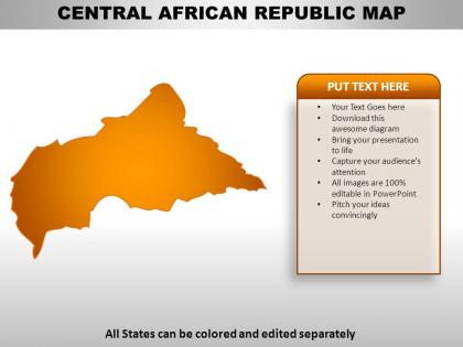
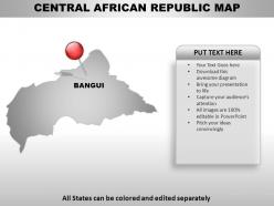
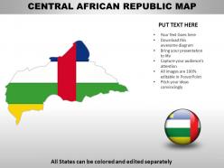
Central african republic country powerpoint maps




Try Before you Buy Download Free Sample Product
 Impress Your
 Audience
 100%
100% Editable
 Save Hours
 of Time


Your thoughts will row your boat to victory. Let our Central African Republic Country Powerpoint Maps be your cox.
People who downloaded this PowerPoint presentation also viewed the following :
Central african republic country powerpoint maps with all 7 slides:
Bring on your charisma with full force. Create unbridled enthusiasm with our Central African Republic Country Powerpoint Maps.
FAQs for Central african republic
The Central African Republic's key geographical features include the Ubangi and Chari river systems, the Bamingui-Bangoran plateau, dense tropical rainforests in the south, savanna grasslands in the north, and the strategic position connecting West and East Africa. These diverse landscapes enable varied economic opportunities through agriculture, mining, and forestry, with topographical and thematic maps helping organizations identify optimal locations for infrastructure development, resource extraction, and regional trade networks across this landlocked nation.
Topographic maps of the Central African Republic illustrate elevation changes through contour lines, color gradients, shaded relief, and elevation markers that showcase the country's diverse terrain. These cartographic tools enable researchers, government planners, and development organizations to visualize the transition from eastern highlands to western lowlands, ultimately supporting infrastructure planning, agricultural development, and resource management across this geographically varied nation.
Political maps serve as essential tools for visualizing the Central African Republic's administrative structure, including its 14 prefectures, 2 economic prefectures, and the capital commune of Bangui, along with sub-prefectures and communes. These detailed visualizations enable government officials, international organizations, and businesses to understand jurisdictional boundaries, resource allocation patterns, and governance frameworks, ultimately facilitating more effective policy implementation and strategic decision-making across this diverse nation.
Thematic maps highlight socio-economic issues in the Central African Republic by visualizing data through color coding, symbols, and statistical overlays that reveal poverty distribution, literacy rates, and educational infrastructure gaps. These visualization tools enable policymakers, NGOs, and international organizations to identify underserved regions, allocate resources strategically, and track development progress, ultimately delivering targeted interventions and improved outcomes.
The best sources for accurate Central African Republic maps include government cartographic agencies, international organizations like the UN Office for Coordination of Humanitarian Affairs, OpenStreetMap collaborative platforms, and specialized geographic data providers such as Natural Earth and World Bank mapping services. These sources streamline research and planning by offering regularly updated boundaries, infrastructure details, and demographic overlays, with many organizations finding that combining multiple authoritative sources ultimately delivers comprehensive geographic intelligence and enhanced decision-making capabilities.
Historical maps of the Central African Republic reveal colonial boundaries imposed by French administrators, administrative districts designed for resource extraction, and territorial divisions that often ignored indigenous communities and traditional lands. These cartographic records demonstrate the transition from Ubangi-Shari colonial territory to an independent nation in 1960, with many contemporary organizations finding that understanding this mapping evolution enhances regional development planning and cultural preservation efforts.
Satellite images enhance understanding of Central African Republic's land use by providing real-time data on deforestation patterns, agricultural zones, mining activities, and urban expansion across remote regions. These technologies enable government agencies, international development organizations, and urban planners to monitor infrastructure development, assess environmental changes, and optimize resource allocation strategies, ultimately delivering more informed policy decisions and sustainable development outcomes.
GIS technology enables comprehensive mapping and analysis of Central African Republic's natural resources through satellite imagery integration, spatial data modeling, geological survey digitization, and real-time monitoring systems. Mining companies and conservation organizations utilize these capabilities to identify mineral deposits, track deforestation patterns, and optimize resource extraction planning, ultimately delivering enhanced environmental management and strategic resource development across the region.
Cartographers creating detailed maps of remote Central African Republic areas face challenges including limited ground access, dense forest canopy blocking satellite imagery, inadequate infrastructure for survey equipment, scarce local data sources, and security concerns in unstable regions. These obstacles require strategic combinations of aerial surveys, satellite technology, and local partnerships, with many mapping organizations finding that collaborative approaches with regional experts ultimately deliver more accurate geographic data and enhanced operational efficiency.
Cultural and linguistic maps reveal the Central African Republic's rich ethnic tapestry by illustrating the geographic distribution of over 80 distinct ethnic groups, including the Baya, Banda, Mandjia, and Sara peoples, alongside their corresponding languages such as Sango, French, and numerous local dialects. These maps enable researchers, policymakers, and organizations to understand demographic patterns, facilitate targeted development programs, and enhance cultural preservation efforts, ultimately delivering more effective governance and social cohesion across this linguistically diverse nation.
Deforestation in the Central African Republic significantly reduces biodiversity by fragmenting habitats, eliminating species corridors, and destroying critical ecosystems that ecological maps reveal through declining forest cover and wildlife distribution patterns. These maps enable conservation organizations, government agencies, and international bodies to track habitat loss, identify priority protection areas, and develop strategic interventions that streamline resource allocation while ultimately delivering enhanced biodiversity preservation and sustainable land management outcomes.
Interactive web maps enhance local engagement in the Central African Republic by visualizing humanitarian needs, resource distribution, and infrastructure gaps, making complex issues accessible to communities and stakeholders. These digital tools enable advocacy organizations, local governments, and NGOs to demonstrate critical challenges like healthcare access, education deficits, and security concerns, ultimately facilitating more informed decision-making and targeted resource allocation.
Common misconceptions about Central African Republic's geography include assuming it's entirely desert, lacks water resources, has uniform terrain, and sits in West Africa rather than central Africa. Detailed topographic and thematic maps clarify these by revealing the country's diverse landscapes, extensive river networks including the Ubangi River, varied elevations, and strategic central location, ultimately enabling better resource planning, investment decisions, and regional development strategies for organizations operating across African markets.
Transportation maps reveal Central African Republic's infrastructure challenges through road networks, river systems, airport locations, and connectivity gaps between regions. These maps highlight limited paved roads, seasonal accessibility issues, and heavy reliance on waterways for commerce, with many organizations finding that strategic infrastructure investments can enhance regional trade, economic development, and ultimately improve connectivity across this landlocked nation's diverse terrain.
Including indigenous territories in Central African Republic mapping is crucial for protecting ancestral lands, preserving traditional knowledge systems, supporting customary governance structures, and maintaining cultural heritage sites. This strategic documentation enables indigenous communities to secure land rights, access traditional resources, and preserve oral histories, while helping conservation organizations and government agencies develop culturally-sensitive policies that ultimately deliver sustainable development and enhanced cultural continuity.
-
Excellent work done on template design and graphics.
-
Innovative and attractive designs.