


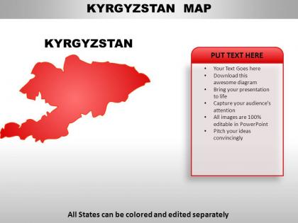
Kyrgyzstan country powerpoint maps




Try Before you Buy Download Free Sample Product
 Impress Your
 Audience
 100%
100% Editable
 Save Hours
 of Time


Be a man for all seasons with our Kyrgyzstan Country PowerPoint Maps. Whatever the weather they will work for you.
People who downloaded this PowerPoint presentation also viewed the following :
Kyrgyzstan country powerpoint maps with all 7 slides:
Electrify their minds with our Kyrgyzstan Country PowerPoint Maps. Switch them on with your ideas.

FAQs for Kyrgyzstan
Kyrgyzstan's maps prominently feature the Tian Shan and Pamir mountain ranges, Issyk-Kul Lake, the Ferghana Valley, and the Naryn River system, with over 90% of the territory being mountainous terrain. These topographical elements are crucial for businesses in tourism, mining, and agriculture, enabling strategic planning for infrastructure development, resource extraction, and regional connectivity projects across Central Asia.
Historical maps of Kyrgyzstan often contained significant geographical inaccuracies, outdated political boundaries, and limited topographical detail due to surveying constraints and political influences of their respective eras. Contemporary maps leverage satellite imagery, GPS technology, and advanced cartographic software to deliver precise geographical data, updated administrative divisions, and comprehensive infrastructure details, with many organizations finding that modern digital mapping enhances strategic planning and operational efficiency.
Digital mapping technologies revolutionize Kyrgyzstan's tourism by providing GPS navigation for remote areas, virtual trail guides, interactive cultural site information, and real-time weather updates for mountain regions. These platforms enable tour operators to offer safer expeditions, help visitors discover hidden attractions like Issyk-Kul's lesser-known shores, and streamline trip planning, ultimately delivering enhanced visitor experiences and supporting the country's growing adventure tourism sector.
Maps of Kyrgyzstan depict its cultural and ethnic diversity through ethnolinguistic distributions, religious site locations, cultural region boundaries, and traditional migration patterns across its mountainous terrain. These cartographic representations enable organizations, educational institutions, and government agencies to understand demographic complexities, plan inclusive services, and develop culturally sensitive policies, ultimately delivering enhanced regional governance and community engagement strategies.
Cartographic techniques for Kyrgyzstan's protected areas include topographic contour mapping, satellite imagery integration, color-coded zoning systems, elevation modeling, and biodiversity overlay mapping. These methods enable environmental agencies, tourism boards, and conservation organizations to streamline park management, enhance visitor navigation, and deliver comprehensive ecological information, with many institutions finding that strategic visual mapping ultimately supports both conservation efforts and sustainable tourism development.
Border disputes have significantly influenced Kyrgyzstan's mapping through contested territorial boundaries with Uzbekistan and Tajikistan, creating areas marked as disputed or requiring frequent cartographic updates. These ongoing conflicts have led to multiple map versions across different time periods, with many international organizations and governments finding that accurate border representation remains challenging, ultimately affecting regional planning, resource allocation, and diplomatic relations in Central Asia.
Traditional Kyrgyz nomadic routes in historical maps appear as seasonal pathways connecting pastures, water sources, and trading posts, often marked by dotted lines or cultural annotations showing migration patterns. Modern maps typically display these same regions through topographical features, roads, and administrative boundaries, while many organizations increasingly integrate historical route data with GPS technology to preserve cultural heritage, ultimately delivering enhanced understanding of land use patterns and supporting sustainable tourism development in rural communities.
Political maps of Kyrgyzstan emphasize administrative boundaries, cities, regions, and governmental divisions, while physical maps highlight topographical features like the Tian Shan mountains, valleys, and elevation changes. These complementary mapping approaches enable organizations to strategically analyze both jurisdictional frameworks and geographical challenges, with many businesses and institutions finding that combining both perspectives delivers comprehensive insights for infrastructure planning, resource allocation, and regional development initiatives.
Interactive maps enhance understanding of Kyrgyzstan's geography by enabling users to explore topographical features, regional boundaries, economic zones, and cultural landmarks through dynamic layering, zoom capabilities, and real-time data overlays. These digital tools streamline geographic analysis by combining elevation data, demographic information, and infrastructure details, with many educational institutions and tourism organizations finding that interactive visualization ultimately delivers deeper spatial comprehension and more engaging learning experiences.
Maps of Kyrgyzstan commonly use topographic symbols for mountain ranges and peaks, water body markers for lakes and rivers, administrative boundary lines, city symbols with population indicators, and elevation contours with color gradients. These cartographic elements enable researchers, businesses, and government agencies to analyze geographical patterns, plan infrastructure projects, and assess regional development opportunities, with many organizations finding that detailed symbolic representation enhances strategic decision-making across sectors.
Elevation maps reveal Kyrgyzstan's dramatic topographical diversity, from valleys below 500 meters to peaks exceeding 7,000 meters, which directly correlates with distinct climate zones and precipitation patterns. These visualizations enable researchers, agricultural planners, and development organizations to understand how altitude creates microclimates across regions, ultimately supporting strategic resource allocation and climate-adaptive planning initiatives.
Relief maps significantly enhance educational initiatives for Kyrgyzstan's geography by providing three-dimensional visualization of the country's mountainous terrain, valleys, and topographical features, making complex geographical concepts more accessible and memorable. Through tactile and visual learning approaches, educational institutions find that students better understand elevation changes, regional connectivity, and environmental patterns, ultimately delivering improved spatial comprehension and geographic literacy across diverse learning environments.
Maps aid disaster management in Kyrgyzstan by identifying high-risk zones, optimizing evacuation routes, and enabling real-time emergency response coordination. These geographic tools streamline resource allocation, enhance early warning systems, and facilitate post-disaster recovery planning, with emergency agencies finding that detailed topographic and hazard mapping ultimately delivers faster response times and more effective risk mitigation strategies.
Resources for accessing high-quality maps of Kyrgyzstan include government cartographic agencies, international mapping services like Google Maps and OpenStreetMap, specialized geographic databases, academic institutions, and professional presentation template providers. These platforms enable researchers, businesses, and organizations to access detailed topographic data, administrative boundaries, and customizable visual formats, with many finding that combining multiple sources delivers comprehensive geographic intelligence for strategic planning, educational purposes, and commercial applications across various sectors.
Thematic maps reveal Kyrgyzstan's economic landscape by displaying agricultural zones, mining locations, industrial centers, trade routes, and resource distribution patterns. These visualizations enable businesses, government agencies, and investors to identify market opportunities, assess infrastructure needs, and make strategic decisions about resource allocation, ultimately delivering competitive advantages in sectors like agriculture, mining, and tourism development.
-
Very unique, user-friendly presentation interface.
-
Great quality product.