


New Zealand Maps Powerpoint Ppt Template Bundles




Try Before you Buy Download Free Sample Product
 Impress Your
 Audience
 100%
100% Editable
 Save Hours
 of Time


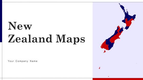
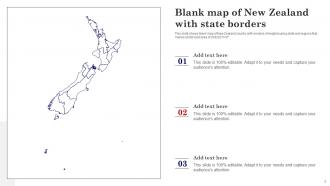
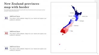
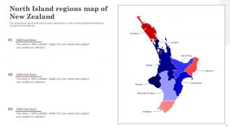
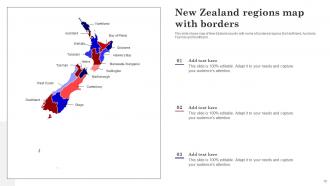
Unveil the beauty and insights of Aotearoa with our New Zealand Maps PowerPoint PPT package, an essential resource for educators, researchers, and explorers. Begin your journey with a Blank Map of New Zealand, offering a customizable canvas for a personalized exploration of the islands. Dive into regional nuances with the New Zealand Provinces Map, providing a detailed breakdown of administrative divisions. Gain a comprehensive understanding of the countrys characteristics through the New Zealand Distribution Map, showcasing geographic features and diversity. Explore the varied landscapes further with the New Zealand Regions Map, revealing distinctive areas of interest. Elevate your presentations with captivating visuals and foster a deeper connection with New Zealands geography, provinces, and regional attributes.
People who downloaded this PowerPoint presentation also viewed the following :
New Zealand Maps Powerpoint Ppt Template Bundles with all 24 slides:
Use our New Zealand Maps Powerpoint Ppt Template Bundles to effectively help you save your valuable time. They are readymade to fit into any presentation structure.










FAQs for New Zealand Maps Powerpoint
New Zealand maps include topographic maps for hiking and terrain analysis, road maps for navigation and travel planning, geological maps for resource exploration, tourist maps highlighting attractions and activities, and digital interactive maps for real-time navigation. These maps differ through specialized symbology, scale precision, and targeted information layers, with topographic maps emphasizing elevation contours and natural features, while tourist maps focus on accessibility and points of interest, ultimately delivering comprehensive geographic solutions for diverse user needs.
Topographic maps of New Zealand enhance outdoor navigation by providing detailed elevation contours, terrain features, track markers, water sources, and hazard indicators essential for backcountry travel. These comprehensive maps enable hikers to plan safer routes, estimate travel times, identify campsites and emergency exits, while navigating New Zealand's diverse landscapes from alpine regions to coastal tracks, ultimately delivering greater confidence and security for outdoor adventures.
New Zealand's cartographic evolution spans from early Māori navigational traditions and Captain Cook's coastal surveys to modern satellite-based digital mapping systems. These historical developments have fundamentally shaped contemporary map-making through enhanced accuracy standards, integration of indigenous geographical knowledge, and advanced GIS technologies, with many geographical institutions finding that this layered historical approach ultimately delivers more comprehensive spatial data and culturally inclusive mapping solutions.
Digital maps and mobile applications revolutionize New Zealand exploration by providing real-time navigation, offline accessibility, interactive trail information, weather updates, and location-based recommendations. Through GPS technology and comprehensive databases, travelers can navigate remote areas more safely, discover hidden attractions, and access detailed information about hiking tracks, accommodations, and local services, ultimately delivering enhanced travel experiences and greater confidence in exploring New Zealand's diverse landscapes.
Thematic maps highlighting New Zealand's cultural and environmental aspects include demographic distributions, indigenous Māori territories, biodiversity zones, climate patterns, and land use classifications. These specialized cartographic tools enhance research capabilities, policy development, and educational outcomes by visualizing complex spatial relationships, ultimately delivering deeper insights for conservation efforts, urban planning, and cultural preservation initiatives.
GIS systems contribute to understanding New Zealand's geography by enabling detailed spatial analysis, environmental monitoring, demographic mapping, hazard assessment, and resource management across the nation's diverse landscapes. Through advanced data visualization and modeling capabilities, government agencies, researchers, and urban planners can analyze earthquake patterns, track biodiversity changes, and optimize infrastructure development, ultimately delivering enhanced decision-making for sustainable development and disaster preparedness.
Climate maps of New Zealand reveal distinct regional weather patterns by displaying temperature variations, rainfall distribution, wind patterns, and seasonal changes across the North and South Islands. These visual tools enable meteorologists, agricultural planners, and tourism operators to understand microclimates, predict seasonal variations, and make informed decisions about crop planning, infrastructure development, and resource allocation, ultimately delivering more accurate weather forecasting and strategic regional planning.
**INPUT**: What resources are available for educators to teach students about New Zealand's geography using maps? **OUTPUT**: Educational resources for teaching New Zealand's geography include interactive digital atlases, topographic map collections, cultural heritage mapping tools, climate data visualizations, and region-specific activity guides. These materials enhance classroom learning by combining traditional cartography with multimedia elements, hands-on exercises, and comparative analysis activities, ultimately delivering engaging geographical literacy while helping students understand New Zealand's diverse landscapes, cultural regions, and environmental characteristics. [Word count: 60]
Travelers can use topographic maps, regional tourism maps, and GPS applications to identify walking trails, scenic lookouts, local reserves, and cultural sites beyond mainstream destinations. By studying detailed maps alongside local recommendations, visitors discover secluded beaches, historic settlements, and natural formations throughout both islands, ultimately creating more authentic experiences while avoiding crowded tourist hotspots.
Interactive maps revolutionize New Zealand tourism by enabling personalized itinerary planning, real-time attraction discovery, and seamless navigation to local businesses, restaurants, and accommodations. These digital platforms enhance visitor experiences while driving revenue to regional operators, with many tourism boards finding that interactive mapping increases tourist engagement and extends average stays across destinations.
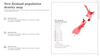
Population density maps reveal New Zealand's urbanization patterns by contrasting high-density urban centers with sparse rural areas, showing concentrated growth in Auckland, Wellington, and Christchurch. These visualizations enable urban planners, government agencies, and businesses to identify development opportunities, infrastructure needs, and market expansion zones, ultimately delivering strategic insights for resource allocation and sustainable city planning initiatives.
Mapping New Zealand's diverse landscapes presents both challenges and successes, with rugged terrain, volcanic activity, and remote islands creating survey difficulties, while advanced satellite technology and GIS systems enable detailed topographical accuracy. Through strategic combinations of aerial photography, GPS positioning, and geological surveys, cartographers successfully capture everything from alpine regions to coastal features, ultimately delivering comprehensive mapping solutions that enhance navigation, resource management, and tourism development across increasingly complex geographical environments.
Maps communicate land use and zoning changes in New Zealand's urban areas through color-coded overlays, boundary delineations, density indicators, and temporal comparison layers that highlight residential, commercial, and mixed-use developments. These visual tools enable urban planners, developers, and local councils to track growth patterns, assess infrastructure needs, and make strategic decisions about resource allocation, ultimately delivering enhanced urban planning efficiency and more sustainable community development outcomes.
Indigenous knowledge has significantly transformed New Zealand's contemporary mapping practices by incorporating Māori place names, traditional navigation methods, cultural boundaries, and ancestral connections to land. These practices enhance cartographic accuracy while respecting indigenous perspectives, with government agencies, environmental organizations, and urban planners increasingly integrating mātauranga Māori to create culturally informed, comprehensive mapping solutions that deliver deeper territorial understanding.
Cartography addresses New Zealand's environmental challenges by mapping biodiversity hotspots, tracking deforestation patterns, monitoring water quality changes, and identifying conservation priorities across diverse ecosystems. Through GIS technology and satellite imagery, conservation organizations streamline habitat protection efforts, enhance species monitoring programs, and optimize resource allocation, with many finding that detailed environmental mapping ultimately delivers more targeted conservation strategies and measurable ecological outcomes.
-
Professionally designed slides with color coordinated themes and icons. Perfect for enhancing the style of the presentations.
-
SlideTeam offers so many variations of designs and topics. It’s unbelievable! Easy to create such stunning presentations now.