

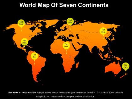
World map of seven continents




Try Before you Buy Download Free Sample Product
 Impress Your
 Audience
 100%
100% Editable
 Save Hours
 of Time


Combine forces to attain goals with our World Map Of Seven Continents. Indulge in joint endeavours.
People who downloaded this PowerPoint presentation also viewed the following :
World map of seven continents with all 5 slides:
Enumerate the benefits of joint endeavour with our World Map Of Seven Continents. Encourage folks to combine forces.




FAQs for World map
Each continent features distinct geographical characteristics: Asia's Himalayas and vast plains, Africa's Sahara Desert and Rift Valley, North America's Rocky Mountains and Great Lakes, South America's Andes and Amazon Basin, Antarctica's ice sheets, Europe's peninsulas and rivers, and Australia's Outback deserts. These diverse landscapes create unique ecosystems and climate patterns, ultimately shaping regional development opportunities, resource distribution, and strategic advantages for nations seeking to leverage their geographical positioning in an increasingly interconnected global economy.
Cultural practices across continents vary dramatically due to historical migration patterns, religious influences, colonial experiences, geographic isolation, and economic development levels. While Europe emphasizes individualism and structured social systems, Asia prioritizes collective harmony and ancestral traditions, Africa maintains strong tribal and community bonds, and the Americas blend indigenous heritage with colonial influences, ultimately creating distinct regional identities shaped by centuries of environmental adaptation and cross-cultural exchange.
Each continent hosts diverse ecosystems crucial for global biodiversity, including Africa's savannas and rainforests, Asia's tropical forests and tundra, North America's temperate forests and grasslands, South America's Amazon rainforest, Europe's deciduous forests, Australia's unique desert and reef systems, and Antarctica's polar ecosystem. These interconnected biomes support millions of species while providing essential services like climate regulation, carbon storage, and resource cycling, with many conservation organizations finding that protecting continental ecosystem diversity ultimately delivers enhanced global environmental stability and sustainable resource management for future generations.
Historical events have fundamentally reshaped continental political boundaries through colonization, wars, independence movements, and diplomatic negotiations, creating the modern nation-state system we see today. Colonial powers like Britain, France, and Spain redrew maps across Africa, Asia, and the Americas, while subsequent independence movements, world wars, and treaties continue influencing borders, ultimately delivering the complex geopolitical landscape that defines international relations and trade.
Europe features Germanic, Romance, and Slavic languages like English, Spanish, and Russian, reflecting centuries of empire-building and cultural exchange. Asia encompasses Mandarin, Hindi, and Arabic among hundreds of others, while Africa's linguistic diversity includes Arabic, Swahili, and colonial languages, with North America dominated by English and Spanish, South America by Spanish and Portuguese, and Australia by English, ultimately demonstrating how migration, colonization, and trade shaped global communication patterns.
Climate change impacts each continent through rising temperatures, shifting precipitation patterns, and extreme weather events, affecting their unique ecosystems and populations differently. While Africa faces increased drought and desertification, Antarctica experiences ice sheet loss, Asia confronts monsoon disruptions, and small island nations battle sea-level rise, ultimately creating migration pressures and resource challenges that require strategic adaptation across all regions.
Each continent offers distinct economic resources: Asia dominates manufacturing and technology, North America leads in agriculture and energy, Europe excels in finance and luxury goods, Africa provides minerals and oil, South America supplies commodities like soybeans and copper, Australia delivers mining exports, and Antarctica holds research value. These resource distributions create interconnected trade networks where continents leverage their comparative advantages, with Asia's manufacturing hubs, Africa's raw materials, and America's agricultural exports driving global supply chains that ultimately deliver economic specialization and enhanced international commerce.
Migration patterns vary significantly across continents, with Asia and Europe experiencing high intra-regional movement, Africa seeing substantial rural-to-urban migration, and the Americas attracting diverse international flows. Economic opportunities, political stability, climate change, and demographic shifts drive these movements, with regions like the Gulf States, North America, and European Union increasingly becoming migration hubs that reshape global workforce distribution and economic landscapes.
Major rivers serve as lifelines for civilizations by providing freshwater, fertile soil through seasonal flooding, transportation routes, and trade corridors across all continents. From the Nile supporting ancient Egypt to the Amazon sustaining diverse communities and the Ganges enabling agricultural prosperity, these waterways deliver economic growth, population centers, and cultural exchange, ultimately creating the foundation for sustainable development and strategic regional advantages.
Population density varies dramatically across continents, with Asia containing over 60% of global population despite occupying 30% of land area, while Australia and Antarctica remain sparsely populated. This uneven distribution creates significant urban planning challenges, with Asian megacities like Tokyo and Delhi requiring innovative infrastructure solutions, vertical development strategies, and sustainable resource management systems, ultimately driving global best practices in high-density urban design.
Major tourism hotspots include Europe's Mediterranean coastlines and historic cities, Asia's cultural landmarks and beaches, North America's national parks and metropolitan areas, Africa's safari destinations and natural wonders, South America's archaeological sites and rainforests, Australia's coastal attractions, and Antarctica's expedition cruises. These destinations streamline economic growth by generating employment, attracting foreign investment, and enhancing infrastructure development, with many regions finding that tourism ultimately delivers sustainable revenue streams and competitive positioning in global markets.
Continents collaborate on global issues through international organizations, multilateral agreements, shared research initiatives, cross-border funding mechanisms, and coordinated policy frameworks. These collaborative approaches streamline resource allocation, enhance information sharing, and accelerate response times, with many nations finding that strategic partnerships ultimately deliver more effective solutions to climate adaptation, pandemic preparedness, and sustainable development challenges.
Continents promote their unique identities through distinctive cultural traditions, languages, economic specializations, and regional governance systems, while participating in global trade networks, international organizations, and cross-continental partnerships. This strategic combination enables regions like Asia's technological innovation, Europe's regulatory frameworks, and Africa's resource wealth to contribute specialized value to the global economy, ultimately delivering competitive advantages through cultural diversity while maintaining seamless international collaboration.
Each continent faces distinct environmental challenges including deforestation in South America and Africa, desertification across Africa and Asia, urbanization pressures in Europe and North America, climate change impacts in Antarctica and Australia, and resource extraction throughout Asia. These challenges present both conservation obstacles and opportunities for sustainable development, with many countries finding that strategic environmental policies, international cooperation, and green technology investments ultimately deliver enhanced ecosystem resilience and long-term economic stability.
Continental representation in educational materials significantly shapes geographic literacy by influencing spatial awareness, cultural perspectives, and global interconnectedness understanding through map projections, scale emphasis, and regional focus selections. While traditional Mercator projections often distort size relationships, modern educational approaches increasingly incorporate diverse map styles and digital tools, with many schools finding that interactive globe technologies and culturally balanced content enhance students' comprehensive worldview and geographic reasoning skills.
-
Visually stunning presentation, love the content.
-
Appreciate the research and its presentable format.