


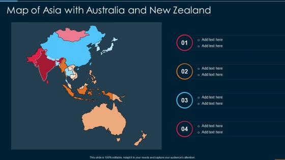
Map Of Asia With Australia And New Zealand




Try Before you Buy Download Free Sample Product
 Impress Your
 Audience
 100%
100% Editable
 Save Hours
 of Time


Our Map Of Asia With Australia And New Zealand are topically designed to provide an attractive backdrop to any subject. Use them to look like a presentation pro.
People who downloaded this PowerPoint presentation also viewed the following :
Map Of Asia With Australia And New Zealand with all 6 slides:
Use our Map Of Asia With Australia And New Zealand to effectively help you save your valuable time. They are readymade to fit into any presentation structure.





FAQs for Map Of Asia With Australia
Key factors shaping global climate patterns include solar radiation distribution, ocean currents, atmospheric circulation, topography, and latitude positioning. These elements interact to create diverse geographical features through weathering processes, precipitation patterns, and temperature variations, ultimately influencing ecosystems, agricultural zones, and human settlement patterns across continents, with many regions finding their economic development directly tied to these climate-driven geographical advantages.
Urbanization transforms geographical landscapes through land conversion, infrastructure development, habitat fragmentation, altered water systems, and modified microclimates. These changes create both environmental challenges and opportunities for sustainable development, with many cities increasingly adopting green infrastructure, urban planning strategies, and ecosystem restoration projects to balance growth with environmental stewardship, ultimately delivering more resilient urban environments.
Geographical features fundamentally shape cultures through resource availability, trade patterns, settlement configurations, agricultural practices, and social structures. Mountain ranges create isolated communities with distinct traditions, while coastal regions develop maritime cultures and extensive trade networks, river valleys foster agricultural civilizations, and desert environments produce nomadic societies, ultimately delivering unique cultural identities and adaptive social systems.
Geographic information systems revolutionize data analysis by combining spatial data with traditional datasets, enabling pattern recognition, predictive modeling, and location-based insights across multiple variables simultaneously. Through advanced mapping and analytics, organizations in urban planning, retail, healthcare, and logistics streamline resource allocation, optimize service delivery, and enhance strategic decision-making, ultimately delivering competitive advantages and improved operational efficiency.
Tectonic activity significantly reshapes regional geography through mountain formation, valley creation, coastline modification, volcanic landscape development, and seismic zone establishment. These geological processes ultimately influence settlement patterns, agricultural productivity, natural resource distribution, and infrastructure planning, with regions like the Pacific Ring of Fire demonstrating how tectonic forces create both challenges and economic opportunities for affected areas.
Population distribution significantly influences resource management by determining water allocation, energy infrastructure placement, transportation networks, and waste management systems across regions. Dense urban areas require intensive resource coordination and sustainable planning, while sparse rural populations need distributed solutions, with many governments finding that strategic resource allocation based on demographic patterns ultimately delivers improved efficiency and environmental sustainability.
Geographical factors contributing to natural disasters include tectonic plate boundaries, coastal proximity, elevation changes, climate patterns, and soil composition. These factors create vulnerabilities that can be mitigated through strategic urban planning, early warning systems, and infrastructure development, with many regions finding that comprehensive risk assessment and community preparedness ultimately reduce disaster impacts significantly.
Rivers and other bodies of water shape trade routes by providing natural transportation corridors, reducing shipping costs, and enabling access to inland markets and resources. These waterways facilitate economic development through port cities, manufacturing hubs, and agricultural zones, with regions like the Mississippi River system and Rhine corridor demonstrating how water-based infrastructure ultimately delivers competitive advantages and sustained regional prosperity.
Climate change presents coastal communities with rising sea levels, increased storm intensity, erosion acceleration, saltwater intrusion, and habitat displacement challenges. These environmental shifts significantly impact infrastructure resilience, agricultural productivity, and population stability, with many coastal cities increasingly investing in adaptive strategies like seawall construction, managed retreat programs, and sustainable development planning to enhance long-term viability.
Historical geographical maps reveal past civilizations through settlement patterns, trade routes, territorial boundaries, resource distribution, and urban development over time. These cartographic records enable historians and archaeologists to understand how ancient societies adapted to their environments, expanded their influence, and interacted with neighboring cultures, ultimately delivering insights into economic systems, political structures, and social organization that shaped human development across different regions and periods.
Biogeography examines how species are distributed across geographic regions, revealing patterns shaped by climate, geology, evolutionary history, and human activities. This understanding enables conservation organizations, environmental agencies, and research institutions to predict species responses to climate change, design effective protected areas, and develop targeted conservation strategies, ultimately delivering better biodiversity preservation and ecosystem management outcomes.
Political geography influences international relations through territorial disputes, resource control, strategic positioning, border demarcations, and geopolitical alliances that shape diplomatic dynamics. These geographic factors drive conflicts in regions like the South China Sea, Eastern Europe, and the Middle East, while also creating opportunities for trade partnerships, security cooperation, and economic integration, ultimately determining national power balances and international stability.
Geographical barriers significantly influence migration patterns by channeling movement along accessible routes, creating bottlenecks at border crossings, and concentrating populations in gateway cities. Mountains, deserts, and water bodies redirect migration flows toward established corridors, with many regions finding that these natural constraints ultimately shape economic development, urban planning strategies, and cross-border infrastructure investments.
Geography addresses social justice and equity issues by mapping disparities in resource access, housing quality, environmental hazards, and public services across different communities and demographics. Through spatial analysis and community mapping, geographers help identify environmental racism, food deserts, and unequal infrastructure distribution, ultimately enabling policymakers and organizations to develop targeted interventions and more equitable resource allocation strategies.
Current trends in geographical education include interactive digital mapping, virtual field trips, GIS (Geographic Information Systems) integration, satellite imagery analysis, and augmented reality exploration tools. These technologies enhance learning by providing real-time data visualization, immersive global experiences, and hands-on spatial analysis capabilities, with many educational institutions finding that students develop stronger geographical literacy and critical thinking skills through these dynamic, technology-enhanced approaches.
-
The PPT layout is great and it has an effective design that helps in presenting corporate presentations. It's easy to edit and the stunning visuals make it an absolute steal!
-
I looked at their huge selection of themes and designs. They appeared to be ideal for my profession. I'm sure I'll grab a few of them.