


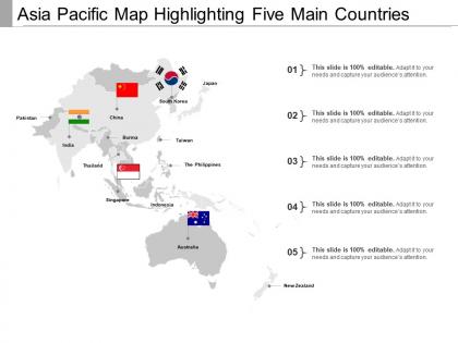
Asia pacific map





Try Before you Buy Download Free Sample Product
 Impress Your
 Audience
 100%
100% Editable
 Save Hours
 of Time


Folks arrive in bigger and bigger groups due to our Asia Pacific Map. It brings in the droves.
People who downloaded this PowerPoint presentation also viewed the following :
Asia pacific map with all 5 slides:
Every message you broadcast should be accompanied by timeless design. Ready made affordable Asia Pacific Map help get your point across.




FAQs for
So Asia Pacific is basically everything around the Pacific Ocean - think of it as this huge rim connecting Asia to Oceania and stretching toward the Americas. You've got island chains like Japan, Philippines, Indonesia, plus peninsulas like Korea and Indochina. Geography here is wild honestly - Himalayas up north, tropical islands down south. All those active tectonic plates make for crazy volcanoes and earthquakes too. Oh and if you're ever looking at maps of this area, the Pacific Ocean is like your reference point for everything.
So basically the whole Asia Pacific region is getting constantly reshaped by tectonic plates crashing into each other. The Pacific Ring of Fire? That's from multiple plates colliding and one sliding under another - creates all those volcanoes and earthquakes. Japan gets hit with so many earthquakes because the Pacific plate keeps diving under the Philippine Sea plate. The Himalayas actually formed when the Indo-Australian plate rammed into the Eurasian plate, and they're still growing taller every year which is pretty wild. All this plate movement is what created the mountain ranges, volcanic islands, and those crazy deep ocean trenches you see on maps.
The Mekong and Yangtze are basically where everyone lives in Asia Pacific. These rivers created all the fertile areas that became huge farming regions and massive cities. China's entire economic center follows the Yangtze, honestly it's wild how much happens along that river. Meanwhile the Mekong supports like six different countries. They're major transport routes too, though there's been some political mess with dams on the Mekong recently. Ancient civilizations literally built themselves around these waterways and they still drive the economy today. Want to understand population patterns or trade? Just trace the rivers.
Dude, it's wild how much climate change is messing with the Asia Pacific right now. Sea levels are rising and places like Tuvalu might literally disappear - that's terrifying. Monsoons across Southeast Asia aren't following their usual patterns anymore. The Himalayas are losing glaciers fast, which screws over billions who depend on those river systems. Oh, and don't get me started on the Great Barrier Reef bleaching. Agricultural zones are shifting too as temps climb. Honestly, if you're planning anything long-term in that region, you've gotta account for this stuff because it's only getting worse.
Dude, those island nations totally run the show in Asia Pacific. Japan, Indonesia, Philippines - they're like gatekeepers for all the major shipping lanes. Indonesia's position is honestly insane - it sits right between two oceans. That gives these countries massive leverage over trade routes and military stuff. They also mess with maritime boundaries in interesting ways, which affects fishing rights and who gets to drill for oil where. New Zealand's in there too, obviously. You can't really understand regional politics without looking at how these island positions shape everything. Pretty crazy geography when you think about it.
Dude, the population shift in Asia Pacific is crazy right now. Cities like Tokyo, Shanghai, and Jakarta are literally draining people from rural areas - we're talking millions moving for jobs. China and India are going through the most intense changes, with everyone flocking to coastal cities. Even tiny countries are seeing people pile into just one or two major hubs. Oh, and if you're digging into demographic data for that region? Focus on metro areas instead of looking at whole countries. That's honestly where you'll see what's really happening population-wise. The rural-to-urban migration is wild to track.
Yeah, Asia Pacific is loaded with resources. Indonesia and Australia have tons of oil/gas, China and Australia are coal powerhouses. Rice dominates Southeast Asia agriculture, plus rubber plantations everywhere. Honestly, the geography is perfect for fishing too - all those coastlines and islands. Resources totally dictate where people cluster and how economies grow. Australia's mining boom shows this perfectly. Actually, I almost mentioned Saudi Arabia before remembering that's not even the right region lol. If you're thinking investments, definitely watch how these resources create trade flows between countries. It's pretty fascinating stuff.
So basically Asia Pacific's geography is like a natural trading system. Massive coastlines everywhere, plus straits like Malacca that are super strategic. The mountains inland forced everyone toward the coasts - that's why Singapore, Hong Kong, and Shanghai got so huge economically. Rivers like the Yangtze became perfect trade routes too. Countries sitting on major shipping chokepoints? They turned into trade hubs. Landlocked places got left behind though, which kinda sucks for them. Oh and pro tip - if you're studying this stuff, map out the shipping routes first. Shows you exactly where all the economic action is.
Oh totally! Look at any map of Asia Pacific and you'll see how mountains and water basically drew the borders for everyone. The Himalayas are like this massive wall between India, China, and Nepal - makes perfect sense as boundaries. Island nations obviously get separated by ocean channels, and even the Korean DMZ follows the landscape. It's pretty smart actually, since these features were great for defense back in the day. Colonial powers just went with what geography already provided. Southeast Asia's island chains are probably the most obvious example of this - though I guess that's kind of stating the obvious lol. Terrain tells you everything about regional politics.
Oh totally, geography is huge for this stuff. The Himalayas literally cut off South Asia from East Asia - like a massive wall. Then you've got Southeast Asia's crazy island setup that isolated groups for centuries (Papua New Guinea has 800+ languages, which is insane). Japan and the Philippines developed their own thing because of water barriers. Honestly, whenever I'm trying to figure out why certain ethnic groups clash or trade together, I just pull up a topographical map first. Mountain ranges and rivers basically drew the cultural boundaries way before any government did. Makes everything click into place.
So the big three are Indo-Burma, Sundaland (that's Malaysia/Indonesia area), and the Philippines. Honestly the biodiversity there is just insane. Islands let species evolve in isolation, plus you've got tropical climates and all these different microclimates from the crazy topography. The Wallace Line is super cool too - it literally separates different evolutionary zones between Indonesia and Australia. But here's the thing that sucks: massive deforestation is destroying these areas fast. If you're doing conservation work, these should be your top priority since they've got the most species AND the biggest threats. Makes sense to focus where it matters most, right?
Yeah so countries that constantly deal with typhoons and earthquakes basically become disaster prep masters out of necessity. Japan's absolutely insane at this - their earthquake drills are like clockwork after what happened in 2011. The Philippines and Indonesia have really upped their warning systems too after getting destroyed repeatedly. It's kinda morbid but nature's honestly the best teacher for this stuff. Most island nations have these crazy detailed evacuation plans now. Building codes are way stricter. Even regular people know exactly what to do when shit hits the fan, which is pretty impressive when you think about it.
Asia Pacific agriculture is basically a tale of two extremes. River deltas in Vietnam and Bangladesh? Total rice goldmines thanks to all that water. Meanwhile Japan and Singapore are importing like crazy because they just don't have the space. Honestly, the geographic lottery is pretty brutal here. Mountains and tiny islands make farming tough, but monsoon regions can feed billions when everything lines up right. Climate change is screwing with rainfall patterns now too. Sea levels rising = goodbye coastal farms. If you're looking at food policy stuff, definitely dig into supply chains first. That's where things fall apart.
Dude, tourism geography is like a money printer for Asia Pacific countries. Thailand's beaches and temples? They've created entire service industries around them. New Zealand literally branded themselves as the "adventure tourism" capital just from having crazy landscapes. Wild part is - one volcano or coral reef can employ thousands of people. Hotels pop up, restaurants follow, then transport companies and tour guides. It's not just tourist money either, these jobs stick around for decades. Oh and Indonesia's doing the same thing btw. Honestly, natural features become straight-up currency in this region.
Honestly, water management in Asia Pacific is such a mess. Rivers like the Mekong cross like 6 countries, so good luck getting everyone to agree on anything. Then you've got monsoons that either flood everything or disappear completely - there's no middle ground. Most major cities are stupidly built right in flood zones too. Mountains feed into these flat river basins where downstream countries fight constantly over water rights. Climate change isn't helping since it's making the extremes worse. I'd start with watershed maps to see who actually controls what, then figure out the politics from there.
-
Excellent design and quick turnaround.
-
I discovered this website through a google search, the services matched my needs perfectly and the pricing was very reasonable. I was thrilled with the product and the customer service. I will definitely use their slides again for my presentations and recommend them to other colleagues.