

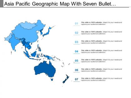
Asia pacific geographic map with seven bullet points




Try Before you Buy Download Free Sample Product
 Impress Your
Audience
 100%
Editable
 Save Hours
of Time


Get a gut feeling with our Asia Pacific Geographic Map With Seven Bullet Points. You will come up with a brilliant idea.
People who downloaded this PowerPoint presentation also viewed the following :
Asia pacific geographic map with seven bullet points with all 5 slides:
Increase the chances of acquiring gains with our Asia Pacific Geographic Map With Seven Bullet Points. It will improve your fortunes.


FAQs for Asia pacific geographic map with
So the Pacific Ocean is basically what holds this whole region together - it's got Asia's eastern coast on one side and all these island nations scattered around. There's crazy geographic diversity too. Himalayas, different coastlines from Russia all the way down to Australia. The Ring of Fire cuts right through, which explains all the earthquakes and volcanoes. Honestly, it's wild how the ocean itself connects places that are thousands of miles apart. Both economically and culturally. When you're looking at this region, don't just think about the land - the Pacific is really what makes it all work as one area.
So Asia Pacific's crazy climate diversity is actually why it's such a biodiversity goldmine. Monsoons create these wet/dry cycles that tons of species have adapted to over time. Plus you've got arctic tundra up north in Russia, then tropical rainforests down in Indonesia - totally different worlds supporting completely different animals. Honestly, it blows my mind that pandas, orangutans, and snow leopards all live in the same general region. Each climate zone basically created its own unique species communities. If you're doing conservation work there, those climate gradients are huge for planning habitat corridors.
So basically all the crazy geology in Asia Pacific comes down to tectonic plates smashing into each other. The Pacific Plate keeps ramming into continental plates, which is how you get the Himalayas and all those volcanic islands in Indonesia. Japan's whole island chain exists because of this too - kind of insane if you think about it. All that plate movement is also why earthquakes and tsunamis are so common there. My geology prof used to say it's like watching Earth throw a tantrum in slow motion. Anyway, if you're doing any construction projects over there, you'd better account for all that seismic stuff.
Honestly, natural resources are huge in the Asia Pacific - they've basically shaped how entire countries developed. Australia and Indonesia? Built on mining exports. Brunei and Malaysia used their oil and gas to grow super fast. Thailand and Vietnam turned their fertile land into agricultural export machines. Geography really does determine a lot, which is kinda crazy when you think about it. But here's the catch - having resources doesn't always mean you're better off. Lots of countries actually get screwed over by the "resource curse." So yeah, if you're looking at any Asia Pacific economy, check out their natural resources first.
Okay so the main ones are the Yangtze and Yellow Rivers in China, plus the Mekong that runs through Southeast Asia, and the Ganges-Brahmaputra in South Asia. They're not just rivers - they're literally how billions of people survive through farming, transport, all that stuff. The Mekong feeds about 60 million people alone just from fishing and rice. Here's the thing though - pretty much every major city and industrial area grew up around these rivers. I always tell people to check river proximity first when you're analyzing economic data because that's where everything happens. Makes sense when you think about it.
Dude, the changes are insane - cities like Singapore literally build new coastline while places like Manila just keep sprawling outward. They're chopping down forests, redirecting rivers, the whole deal. Bangkok's urban sprawl blew my mind when I was there last year, couldn't see where it ended. All that concrete means you lose tons of wildlife habitat and get these crazy hot spots in the city. Plus more flooding and crappy air quality. Water cycles get totally messed up too. If you're doing any long-term work there, just assume the landscape will look completely different in five years.
Dude, mountains basically force everyone into valleys and coastal spots where you can actually grow food and build stuff. Japan's a perfect example - everyone's crammed along the coast while the mountain interior is dead empty. Same thing happens in Nepal with people clustering around river valleys. Farming on steep slopes? Good luck with that. Transportation becomes a total pain too. What's interesting is how these mountain barriers create these isolated communities that end up developing their own unique cultures over generations. Honestly, if you're ever looking at population data for Asia Pacific, just overlay it with elevation maps first - it'll make everything click.
Sea levels are genuinely messing up coastlines across Asia Pacific. Tuvalu and Kiribati could literally disappear - honestly mind-blowing when you think about it. Manila, Bangkok, all these major cities are dealing with constant flooding now. The ports and agricultural areas that basically run the regional economy? They're getting hammered. Your supply chains will definitely take a hit from this stuff. I'd start figuring out which areas you're connected to are most at risk. Pacific islands and low-lying coastal spots should probably be top priority for backup planning.
Dude, monsoons literally run the show for farming across Asia. Summer brings those crazy heavy rains that flood rice paddies - perfect growing conditions. Then comes the dry season for harvest time. The timing's got to be spot-on or you're screwed. India, Thailand, Vietnam - they've all structured their agriculture around these cycles for centuries. Oh, and if you're thinking about investing in anything agriculture-related over there? Bad monsoon = terrible harvests for months. I learned that the hard way watching commodity prices tank after India had a delayed monsoon a few years back.
Dude, the whole Asia Pacific region is getting wrecked by climate change. Sea levels are rising so fast that places like Tuvalu are literally going underwater - it's wild. The Himalayas are losing all their glaciers, which is bad news since those feed the major rivers. Half the Great Barrier Reef's coral is already bleached and dead. Coastal areas everywhere are getting eaten away by erosion, and the monsoons aren't following their usual patterns anymore. Oh, and river deltas are shifting too. If you're doing any planning stuff that goes beyond like 5-10 years, you'd better account for this because it's happening way faster than anyone expected.
Dude, those island nations basically run the show in Asia Pacific. Japan and Indonesia are massive trade players, while tiny Singapore somehow became this crazy financial powerhouse. All the major shipping lanes flow right through these scattered islands - it's actually insane how much global commerce depends on them. They control everything from fishing rights to where submarine cables get laid. Plus they're super strategic militarily, sitting right between continents. Honestly, if you're trying to understand any regional strategy, just look at the island chains first. That's where all the action happens.
Dude, geography explains like 90% of why countries beef with each other in Asia Pacific. Look at the South China Sea - it's all about those shipping routes. The Himalayas aren't just pretty mountains, they're causing water fights between neighbors. Taiwan Strait? Pure geography making everything messy. Same with Kashmir honestly. When you're trying to figure out any conflict over there, just pull up Google Maps first. Rivers that cross borders = water drama. Oil fields = everyone wants a piece. Islands that control trade routes = instant tension. It's wild how much terrain dictates politics, but once you see the pattern it's super obvious.
So there's basically three big biogeographical zones in Asia Pacific. You've got the Oriental region - that's Southeast Asia and southern China, absolutely packed with biodiversity. Think orangutans and crazy tropical rainforests. Up north is the Palearctic region with temperate stuff like Siberian tigers and giant pandas. Australia and New Guinea make up the Australasian region, which is honestly wild because they split off so early. That's why you get all those weird marsupials and cassowaries. Oh, and if you're doing conservation work, definitely check out where these regions meet - those transition zones are biodiversity goldmines.
Dude, history basically created all the weird borders you see in Asia Pacific. Colonial powers just drew random straight lines - look at Korea's DMZ or how Europeans chopped up Southeast Asia ignoring actual ethnic groups. Wars changed everything too. WWII shrunk Japan's territory, and partition split off Pakistan and Bangladesh. Even modern trade routes still follow old empire paths, which is kinda crazy when you think about it. My professor always said to check the historical backstory first - it'll explain like 90% of the geographical weirdness in any region.
Honestly, trade routes are everything in Asia Pacific. Like 25% of all global shipping goes through places like the Strait of Malacca - it's insane how much stuff moves through there every day. Singapore and Hong Kong? They basically exist because they're perfectly positioned as port hubs. These shipping lanes don't just move cargo though. They've determined where major cities sprouted up, created weird political dependencies between countries, and shaped entire economies. I always tell people - if you're trying to understand any Asia Pacific country's economy, look at their access to these trade corridors first. It'll explain so much.
-
Easy to edit slides with easy to understand instructions.
-
Understandable and informative presentation.