

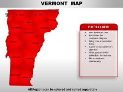
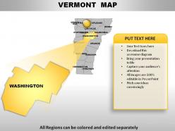
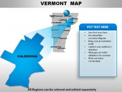
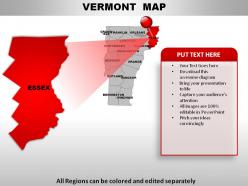
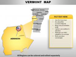
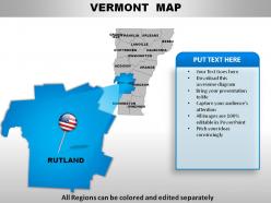
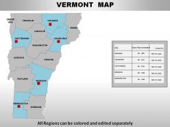
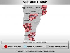
Usa vermont state powerpoint maps




Try Before you Buy Download Free Sample Product
 Impress Your
 Audience
 100%
100% Editable
 Save Hours
 of Time


Making your presentations look perfect through our ready made USA Vermont State Powerpoint Maps. Timeless design in seconds.
People who downloaded this PowerPoint presentation also viewed the following :
Usa vermont state powerpoint maps with all 28 slides:
Never give a presentation lacking world class design. With affordable USA Vermont State Powerpoint Maps there is never any reason to put together a bland project.
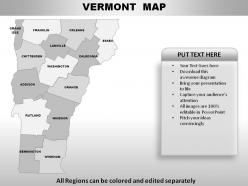



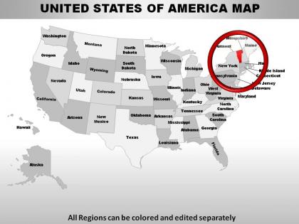
FAQs for Usa vermont
Vermont maps reveal the state's evolution from disputed territory to agricultural powerhouse, documenting land grants, railroad expansion, town formations, and boundary settlements with New York and New Hampshire. These cartographic records enable historians, planners, and researchers to trace settlement patterns, economic transitions, and infrastructure development, with many institutions finding that historical maps provide crucial insights for contemporary land use planning and heritage preservation efforts.
Technological advancements have revolutionized Vermont mapping through GPS surveying, satellite imagery, GIS systems, drone photography, and digital cartography platforms. These technologies streamline data collection, enhance accuracy, and enable real-time updates, with state agencies, environmental organizations, and tourism boards finding that interactive digital maps deliver better resource management, improved public services, and enhanced visitor experiences.
Vermont's topographic maps feature contour lines showing elevation changes, detailed terrain representation including the Green Mountains, precise scale measurements, and comprehensive geographic symbols for natural and man-made features. These specialized maps enable hikers, planners, and researchers to navigate Vermont's mountainous landscape effectively, plan development projects strategically, and conduct environmental studies, with many outdoor enthusiasts finding them essential for backcountry exploration.
Vermont's diverse geography, from the Green Mountains to Lake Champlain and Connecticut River valleys, necessitates specialized topographical, recreational, and hydrological maps emphasizing elevation changes, ski trails, and watershed boundaries. These geographical variations enable cartographers to create targeted resources for outdoor enthusiasts, agricultural planners, and tourism sectors, with many organizations finding that detailed terrain mapping enhances navigation accuracy and strategic land use planning.
Cultural landmarks and attractions serve as primary focal points in Vermont tourism maps, highlighting historic sites, covered bridges, artisan studios, maple farms, and scenic byways to guide visitor experiences. These featured destinations help tourists navigate between must-see locations like Shelburne Museum, Ben & Jerry's factory, and fall foliage routes, ultimately creating cohesive itineraries that showcase Vermont's heritage while supporting local businesses and regional economic development.
Interactive maps enhance Vermont exploration by providing real-time trail conditions, GPS navigation, elevation profiles, weather overlays, and points of interest like waterfalls or scenic viewpoints. These digital tools streamline outdoor planning by integrating topographical data, difficulty ratings, and user reviews, ultimately delivering safer hiking experiences and helping visitors discover hidden gems across Vermont's diverse terrain.
Individuals can create customized Vermont maps using USGS topographic data, Vermont GIS databases, Google My Maps, ArcGIS Online, and specialized mapping software like QGIS or MapInfo. These resources enable users to incorporate demographic data, geological features, and custom overlays, with many organizations finding that personalized mapping enhances project visualization and decision-making capabilities.
Vermont maps incorporate detailed environmental overlays, conservation zones, protected watersheds, sustainable forestry areas, and agricultural preservation districts to guide responsible development. These comprehensive mapping tools enable municipalities, developers, and conservation organizations to balance economic growth with ecological protection, ultimately delivering strategic land use decisions that preserve Vermont's natural heritage while supporting sustainable community development.
Vermont's most notable hiking trails include the Long Trail, Appalachian Trail, Mount Mansfield's ridgeline routes, Camel's Hump trails, and Green Mountain summit paths. These trails are represented on topographic maps through detailed contour lines, elevation markers, and trail classifications, with many outdoor recreation organizations finding that modern GPS-enabled trail maps enhance navigation accuracy while streamlining route planning for hikers.
Municipal maps across Vermont vary significantly in detail levels, zoning classifications, infrastructure coverage, and geographic scale, reflecting each town's unique characteristics and regulatory needs. While rural communities like those in the Northeast Kingdom focus on forest management and agricultural zones, urban areas such as Burlington emphasize commercial districts and transit networks, with many municipalities finding that customized mapping approaches better serve their specific planning and development requirements.
Educational institutions can leverage Vermont maps to teach geography through topographical analysis, watershed studies, regional climate patterns, and settlement evolution across different historical periods. These visual tools enhance student understanding by connecting Vermont's unique landscape features with historical events like early colonial settlements and industrial development, ultimately delivering more engaging geography and history lessons while helping students develop critical spatial analysis skills.
Common misconceptions include Vermont being larger than neighboring New Hampshire, having significant coastal access, and featuring predominantly flat terrain suitable for large-scale agriculture. Many maps underscore Vermont's mountainous Green Mountain spine, compact borders with just four neighboring states, and landlocked position, while its actual agricultural areas are primarily in valleys and specific regions rather than statewide.
Cartographers handle Vermont's waterways through selective representation, scale-appropriate detail levels, and standardized symbols that distinguish between major rivers, streams, and lakes. They prioritize prominent features like Lake Champlain and the Connecticut River while using generalization techniques for smaller tributaries, ultimately delivering clear navigation aids that balance geographic accuracy with visual clarity for outdoor enthusiasts and researchers.
Vermont maps significantly enhance local business visibility and tourism revenue by providing accurate location data, highlighting attractions, restaurants, and accommodations, and enabling GPS navigation for visitors. These mapping tools streamline tourist experiences while helping businesses like ski resorts, maple farms, and boutique shops reach target audiences more effectively, ultimately delivering increased foot traffic and seasonal revenue growth across Vermont's tourism-dependent economy.
Historical maps of Vermont reveal cultural evolution through documenting settlement patterns, transportation networks, town boundaries, land use changes, and demographic shifts over time. These cartographic records enable researchers, educators, and historians to trace how agricultural communities transformed into modern settlements, how transportation influenced economic development, and how geographic features shaped cultural boundaries, ultimately delivering comprehensive insights into Vermont's social and economic transformation across different historical periods.
-
Great product with effective design. Helped a lot in our corporate presentations. Easy to edit and stunning visuals.
-
Great designs, Easily Editable.