


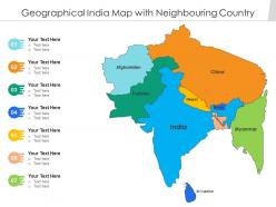
Geographical india map with neighbouring country





Try Before you Buy Download Free Sample Product
 Impress Your
 Audience
 100%
100% Editable
 Save Hours
 of Time


Our Geographical India Map With Neighbouring Country are topically designed to provide an attractive backdrop to any subject. Use them to look like a presentation pro.
People who downloaded this PowerPoint presentation also viewed the following :
Geographical india map with neighbouring country with all 2 slides:
Use our Geographical India Map With Neighbouring Country to effectively help you save your valuable time. They are readymade to fit into any presentation structure.

FAQs for Geographical india map
So for India's geography, the big things to focus on are the Himalayas up north - they're basically this huge wall along the border. Then you've got the Ganges and Indus rivers flowing through all those plains. The Deccan Plateau takes up most of the south, and there's these mountain ranges called the Western and Eastern Ghats running down the coasts. Oh, and the Thar Desert's in the northwest corner. The coastline's massive too - like 7,500 km along the Arabian Sea and Bay of Bengal. Those five features are pretty much what you need to know for any India map quiz or whatever.
Looking at India's map, you can totally see how the geography creates crazy different climates. The Himalayas up north? Pure alpine weather. Then you've got the Thar Desert out west being all dry and harsh. Coastal areas stay pretty tropical year-round. What's wild is how the Western Ghats literally split Karnataka - one side gets dumped on with rain, the other stays dry. Those flat Indo-Gangetic plains across the north get brutally hot and sticky in summer. Honestly, if you're planning any trips there, just assume you'll need completely different clothes for each region!
So basically, India's rivers are like the skeleton of the whole country - they carved out all the major plains and deltas you see on maps. The Ganges-Brahmaputra creates that huge northern plain across multiple states. Then you've got peninsular rivers like Godavari and Krishna shaping the coastal areas. Cities and farmland basically follow these river patterns, which makes sense when you think about it. Even state borders often trace along rivers! Pro tip: when you're looking at any India map, follow the rivers first. They'll show you why everything is where it is - settlements, boundaries, all of it.
Check out where the big industrial clusters are - Maharashtra and Gujarat are packed with factories right along the coast because of their ports. Makes total sense for trade. The northern plains? That's all agriculture thanks to the river systems. Mining stuff is concentrated in Jharkhand and Odisha out east. Bangalore's kinda interesting as this isolated tech bubble in the south. Railway lines are actually a decent indicator of economic activity - denser networks usually mean more business. Oh, and definitely cross-check with state GDP numbers if you can find them.
So India's got three main mountain ranges - the Himalayas up north, Western Ghats on the west coast, and Eastern Ghats on the east. The Himalayas are honestly the most important climate-wise since they block those freezing winds from Central Asia and trap all the monsoon moisture. That's what gives India those crazy distinct wet/dry seasons. Western Ghats dump tons of rain on the coast but leave everything inland pretty dry. The Eastern ones are more broken up so they don't really mess with weather as much. Just saying though - if you're planning a trip there, definitely check which side of the mountains you'll be on!
So those maps use color-coded symbols to show where resources are concentrated. Coal shows up as black clusters in places like Jharkhand and Odisha, iron ore appears in reddish zones. Oil and gas fields have their own little icons - you'll spot them along the western coast mostly. Agricultural areas get different colors too, which honestly makes some maps look pretty chaotic. Rivers are highlighted since they're key for hydroelectric stuff. Oh, and always check the legend first or you'll be staring at random symbols wondering what the hell they mean. Trust me on that one.
Looking at India's geography is like having a cheat code for understanding old trade routes. The Himalayas basically funneled everyone through specific mountain passes - no other choice really. Rivers like the Ganges? Total highways for moving goods around. Mumbai and Chennai became huge trading spots because they had these perfect natural harbors, plus the monsoons worked in their favor. It's wild how you can trace the Silk Road connections just by following the landscape. Oh, and the spice routes make so much more sense when you see the coastline layout. Seriously, check out a physical map before diving into any trade history - those ancient merchants weren't dumb, they just followed what made geographical sense.
So if you look at India's map, the cities basically hug the rivers and coasts - makes sense, right? You'll see these dense gray patches where Mumbai, Delhi, and Bangalore are. Rural areas are everywhere else, mostly green farmland stretching across those huge interior plains. The difference is honestly pretty dramatic when you zoom out. Cities look like tight clusters of roads and buildings, while rural spots are way more spread out with scattered villages. Oh, and if you can find a population density overlay, that'll show the urban-rural split super clearly - those are usually the most helpful for this kind of thing.
Dude, so those parks and sanctuaries are basically where India keeps all its coolest biodiversity stuff. They're spread out across different climate zones - Himalayas, Western Ghats, you know the drill. But here's the thing, they're not just random green spots that look nice on maps (though they totally do). These areas actually work as wildlife corridors connecting different landscapes. Think of them like the lungs for each region - sounds cheesy but it's true lol. The placement is pretty smart too, linking up various geographical features. Makes sense when you really look at it.
So basically, geography is everything when it comes to why Indian states are so different. The Himalayas isolated mountain communities for centuries, which is why they have totally unique languages. Coastal areas? They developed these whole maritime trading cultures. Meanwhile Rajasthan's desert created nomadic traditions - makes total sense when you think about it. River plains like the Ganges connected people through trade routes, but then you had the Western Ghats literally cutting communities off from each other. Honestly, just look at any map and trace the mountains, rivers, and barriers. You'll see exactly why the food, festivals, and even architecture varies so much between states.
So basically, India's map is super helpful for disaster stuff because you can literally see where all the bad things happen. The Himalayas? Earthquake central. Coastal areas get slammed by cyclones and tsunamis. Rivers flood like clockwork - honestly, you'd think people would stop building there by now. But the cool thing is the terrain mapping has gotten crazy detailed, so evacuation routes actually make sense. You'll spot which communities are stuck in the worst spots, like right on fault lines. Plus instead of having one generic emergency plan (which never works), they can position supplies ahead of time and make plans that fit each specific area.
Dude, definitely grab a physical map of India before you go - GPS gets weird in remote spots. Group your destinations by region and climate so you're not zigzagging across the country like a maniac. Check monsoon timing too, especially if you're hitting mountains or coast. The elevation changes are no joke there. Rail and highway connections between major cities are pretty solid, but honestly? India's just massive. I'd cluster attractions that are close together rather than trying to see everything. Oh and maybe avoid planning beach days during monsoon season unless you're into that whole dramatic weather thing.
So India's got like 15 main agricultural zones - they base it on rainfall, temperature, soil, that stuff. The north has those huge Indo-Gangetic plains where most wheat and rice comes from. Cotton and sugarcane dominate the Deccan plateau. Coastal areas are huge for rice and spices, especially that spice belt along the Western Ghats (which is honestly pretty cool). Rajasthan's dry zones grow bajra and pulses mostly. Then there's the northeast with tea plantations and this rotating farming thing they do. It's actually smart how different states ended up specializing in whatever grows best there.
So basically, if you look at India's population map, it's all about following the water and good farmland. The Ganges plains are absolutely jam-packed with people - same with the coasts and river deltas where the soil doesn't suck. Meanwhile, you've got these huge empty spaces in places like Rajasthan's deserts and up in the Himalayas where it's just too harsh to live comfortably. It's pretty logical when you think about it. People cluster where they can actually grow food and make a decent living. Just trace the major rivers on any map and boom - that's where all the population hotspots are gonna be.
So India's geography is honestly pretty intense to deal with. Those Himalayas up north? Total nightmare for building roads or connecting with other countries - costs are insane. Then you've got the coasts getting hammered by cyclones and sea level stuff, especially out east. During monsoon season, rivers like the Ganges just go crazy and flood everything. Meanwhile the desert areas and Deccan Plateau can't get enough water - it's like the opposite problem entirely. If you're planning anything there, just know the logistics get messy fast because of all this geographical chaos.
-
Great quality product.
-
Awesomely designed templates, Easy to understand.