


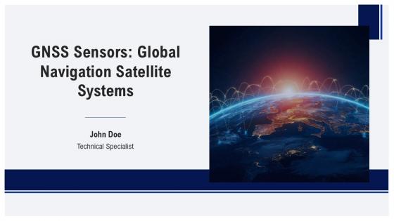
GNSS Sensors Global Navigation Satellite Systems PPT Template ST AI




Try Before you Buy Download Free Sample Product
 Impress Your
 Audience
 100%
100% Editable
 Save Hours
 of Time


This professional PowerPoint presentation deck provides an in-depth exploration of GNSS Sensors and global navigation satellite systems. It covers key topics including system architecture, signal processing, and applications. Perfect for industry professionals, educators, and students seeking comprehensive knowledge in satellite navigation technology.
People who downloaded this PowerPoint presentation also viewed the following :
GNSS Sensors Global Navigation Satellite Systems PPT Template ST AI with all 40 slides:
Use our GNSS Sensors Global Navigation Satellite Systems PPT Template ST AI to effectively help you save your valuable time. They are readymade to fit into any presentation structure.










FAQs for GNSS Sensors Global Navigation Satellite Systems PPT
Okay so GNSS sensors work in three parts. Your antenna grabs signals from multiple satellites at once, which is honestly pretty impressive when you think about it. Then the receiver figures out how long each signal took to travel - that tells you the distance to each satellite. Finally there's a processor that does triangulation math to pinpoint where you actually are. Just keep your antenna pointed at open sky if you want good accuracy. Trees and buildings mess with the signals way more than you'd expect.
Urban GNSS gets tricky because buildings bounce signals around like crazy - that's your main headache right there. But newer receivers are pretty smart about it. They pull from multiple satellite networks (GPS, GLONASS, Galileo, BeiDou) so you've got way more signals to work with. RTK corrections help too when they're available. The fancy ones have anti-jamming built in, which sounds excessive but honestly saves you in dense areas. Oh, and pairing with inertial sensors is clutch - fills in those dead zones when you lose signal completely. Makes a huge difference compared to basic phone GPS.
Think of GNSS as the foundation - your car's gotta know where it is before figuring out where to go. Pretty straightforward concept. It gets you within a few centimeters usually, which is wild when you think about it. But here's the thing - GPS totally craps out in tunnels or between skyscrapers downtown. That's why self-driving cars don't rely on it alone. They'll combine GNSS with cameras and lidar so if one system fails, the others pick up the slack. It's like having multiple friends double-check your math homework, except way more important obviously.
Dude, GNSS changed everything for surveying. We went from meter-level accuracy to centimeter precision - it's honestly crazy how much better the data is now. RTK positioning gives you real-time coordinates instead of waiting around for hours doing post-processing. Multi-constellation receivers make everything so much faster too. Oh, and you can finally survey spots that used to be impossible because of bad satellite coverage. The time savings alone are worth it - jobs that took days now wrap up in hours. I mean, who doesn't want better results in less time?
So basically, your phone's GPS is decent for everyday stuff - gets you within 3-5 meters which is fine for navigation. But professional GNSS? That's a whole different beast. We're talking centimeter precision, sometimes even millimeter level accuracy. Professional gear tracks way more satellites at once and handles interference much better. Plus they're built like tanks since surveyors actually depend on this stuff working perfectly. I mean, finding a coffee shop is one thing, but mapping property lines? That's serious business. If your project needs sub-meter accuracy, you'll have to shell out for the real deal unfortunately.
GNSS and IMUs work great together - you're basically combining data streams for way better accuracy. When GPS cuts out in tunnels or between buildings, your IMU keeps tracking movement. LiDAR adds the obstacle detection piece. The fusion algorithms are where it gets interesting though - they weight each sensor based on how reliable it is at that moment. Honestly took me forever to wrap my head around Kalman filters when I first started with this stuff. But if you're building something, that's your starting point for handling all the data properly.
Ugh, cities are the worst for GPS honestly. Buildings block signals from satellites, so your receiver can't "see" enough of them for good positioning. Signals also bounce off windows and walls before hitting your antenna - creates multiple paths that totally mess with accuracy. Dense areas with tall buildings? Forget about it. You'll get way more noise and it takes forever to get a fix. If you're dealing with this a lot, maybe look into multi-frequency receivers or combine it with other tech like visual-inertial stuff. Makes a huge difference.
So basically, multi-frequency GNSS receivers pick up signals from different bands - L1, L2, L5, that stuff. Each frequency gets messed with differently by the ionosphere, so when you combine them you can cancel out most of that atmospheric junk. Way more accurate than single-frequency - we're talking centimeters instead of meters. Also you've got better backup if one signal gets blocked. I mean, if you're doing anything that needs precision, it's kind of a no-brainer to spend the extra money on multi-frequency. Single-frequency feels pretty outdated at this point honestly.
So basically the atmosphere screws with GPS signals pretty badly. Your receiver gets confused because the ionosphere and troposphere slow down satellite signals at different rates, which messes up distance calculations. Rain and snow can scatter the signals too - though clouds aren't nearly as problematic as most people assume. Temperature and humidity changes also affect how fast signals travel through the air. If you need decent accuracy, grab a multi-frequency receiver with atmospheric corrections built in. RTK systems are honestly your best bet for centimeter-level precision since they compensate for most atmospheric interference in real-time.
Dude, GNSS sensors are seriously clutch for disaster response. They pinpoint exactly where rescue teams are and track people in real-time. Normal communication goes down when disasters hit, but these keep working to coordinate everything. The location accuracy is honestly wild now - like, really precise stuff. Emergency teams use them for safe evacuation routes and figuring out where to deploy resources. You can even monitor ground movement to predict floods or landslides, which is kinda mind-blowing. My advice? Get GNSS devices built into your emergency plans now, before you're scrambling during an actual crisis.
Yeah, GPS jamming and spoofing are real problems. Basically attackers can either block your signal completely or send fake location data to mess with your systems. Military and aviation sectors are super paranoid about this - honestly for good reason. But civilian stuff gets hit too. Autonomous cars, financial systems that need GPS timing, critical infrastructure - they're all sitting ducks. Your best bet is using signal authentication and having backup positioning sources. Also watch for weird patterns in your GNSS data. Catching attacks early makes a huge difference.
Dude, GNSS sensors are seriously changing the whole logistics game. You get pinpoint tracking - like down to the meter accurate. Routes can be tweaked in real-time, and customers actually know when their stuff's arriving instead of guessing. Honestly, people are so spoiled now with Amazon that anything less feels prehistoric. When delays hit, you'll spot them instantly and pivot around the mess. My advice? Don't go crazy at first - test it on one major route, prove it works, then expand. Way smarter than diving headfirst into some massive rollout.
Multi-constellation support is getting way better - that's the big one. Real-time kinematic positioning is becoming way more accessible too, so centimeter accuracy won't be just for fancy surveying gear anymore. 5G and IoT integration is happening fast for better positioning. The anti-spoofing tech is honestly crucial now since that's becoming a real problem. AI error correction is going standard too. But here's what I'd really watch - sensor fusion with visual odometry and inertial nav. That's where things get interesting for autonomous stuff. The whole fusion approach is kinda where the magic happens, you know?
GNSS sensors are surprisingly useful for environmental stuff! You can track wildlife migration, monitor ground subsidence, even coastal erosion. Some receivers detect atmospheric water vapor for weather research - honestly didn't know that was a thing until recently. There's also this cool technique called GNSS reflectometry where reflected signals measure soil moisture, snow depth, and sea levels. Pretty accurate too. I'd start with basic positioning applications first though. Once you're comfortable with the data workflows, then dive into the fancier environmental sensing features. Don't overwhelm yourself right off the bat.
Look, GNSS tracking is sketchy because you're basically following someone's every move without them knowing. Privacy violation much? Then there's the whole data misuse thing - companies sell your location info or use it for stuff you never agreed to. People start acting weird when they know they might be tracked too. My cousin works in tech and says this happens more than you'd think. If you're doing any tracking, be upfront about it. Tell people what you're collecting and why. Don't keep the data forever either.
-
If you have visited their site and failed to find the products, try reaching the customer service because it will be the case that you didn't use the search bar well.
-
It's always a delight to see new templates from you! I am extremely pleased with the fact that they are easy to modify and fit any presentation layout in seconds!