


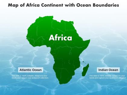
Map of africa continent with ocean boundaries




Try Before you Buy Download Free Sample Product
 Impress Your
 Audience
 100%
100% Editable
 Save Hours
 of Time


Our Map Of Africa Continent With Ocean Boundaries are topically designed to provide an attractive backdrop to any subject. Use them to look like a presentation pro.
People who downloaded this PowerPoint presentation also viewed the following :
Map of africa continent with ocean boundaries with all 2 slides:
Use our Map Of Africa Continent With Ocean Boundaries to effectively help you save your valuable time. They are readymade to fit into any presentation structure.
FAQs for Map of africa continent
UNCLOS is your main one - that's the UN Convention on the Law of the Sea from '82. Most African countries signed it, so they get the standard 12-mile territorial waters and 200-mile economic zones. There's also stuff like the Abuja Treaty for regional cooperation, but honestly that's more secondary. UNCLOS really covers the basics you'll need. Oh, and check if countries actually ratified it versus just signing - there's a difference and it matters for disputes. I think I mixed those up once when I was looking into the whole Somalia thing.
So basically territorial waters go 12 nautical miles out - that's where African countries have total control, like it's actually their territory. EEZs are way bigger though, stretching 200 miles out. Here's where it gets interesting: in EEZs they only get economic rights, not full sovereignty. Think of it like owning your house vs having mining rights somewhere else. Territorial waters? They control everything - who fishes, who passes through, all of it. EEZs are different - they get the fishing and seabed stuff but can't stop foreign ships from cruising through. Always figure out which zone you're looking at first when reading about maritime disputes.
Dude, it's basically all about colonial boundaries. European powers just drew random lines without caring about geography or who actually lived there. Fast forward to independence - these new countries got stuck with the same messy borders, which then carried over to their ocean claims. The Gulf of Guinea is a perfect example where former colonies all bump into each other. Here's the crazy part though - we're talking billions in oil and fishing rights now. What used to be some colonial admin's lazy mapwork has turned into massive legal fights. Honestly, just pull up any old colonial map when you're looking at these disputes. It explains like 80% of what's happening.
Yeah, climate change is seriously messing with Africa's ocean boundaries. Sea levels rising means coastlines are shifting, which changes where they measure territorial waters from. Fish populations are moving too because of warmer water temps and different currents - some species are relocating crazy fast. This creates new fights over fishing rights between countries. Honestly, the whole situation changes so quickly it's hard to keep up. Your best bet is following UNCLOS updates and regional maritime agreements since they're constantly tweaking rules to deal with these climate-related boundary changes.
So piracy totally screws up how African countries can patrol their waters. Naval forces are already stretched super thin, right? Instead of catching illegal fishing or smuggling, they're just trying to keep ships from getting hijacked. Somalia's the obvious example, but the Gulf of Guinea is pretty bad too. It creates this awful cycle - weak patrols lead to more crime, which means you need even more security resources. At least some countries are trying to work together now. The Yaoundé thing lets them pool their naval assets, which honestly makes way more sense than everyone going it alone.
So Africa's got this huge coastline touching three different oceans, which sounds cool but actually creates a nightmare for fishing management. Different countries have overlapping waters and fish don't exactly respect borders, you know? West Africa's especially chaotic - all these nations trying to get their policies to line up. Some countries can enforce rules better than others, which makes everything uneven. There are groups like CECAF trying to coordinate between countries, but honestly results are all over the place. The whole setup makes it really hard to stop overfishing when everyone's working with different rules.
Look, the main issues are money and tech - most African coastal countries just don't have the crazy expensive deep-sea equipment needed for accurate mapping. Political fights with neighboring countries make it worse since border disputes can drag on forever. Honestly, the coordination between different government agencies is a total mess too. UNCLOS requirements are super strict about documentation which adds another layer of complexity. Regional partnerships are probably your friend's best shot here - and international assistance programs, though those can be slow to actually materialize. It's genuinely one of those problems that sounds simpler than it actually is.
Yeah so UNCLOS gives African coastal countries the same deal as everyone else - 12 nautical miles territorial waters and a 200-mile zone for fishing/mineral rights. Tons of West African countries are still fighting over where their boundaries actually are though, which honestly seems like a nightmare to sort out. The cool part is countries can push their continental shelf claims way past 200 miles if they can prove the geology. I'd just check the UN's maritime database for whatever specific country you're looking at - way easier than trying to track down individual treaties.
So the AU basically creates these neutral spaces where countries can talk through their ocean boundary fights instead of dragging each other to international court. Way cheaper honestly. They bring in technical people, help set up shared fishing zones - that kind of thing. What's cool is they actually get the regional politics better than outside organizations do. Joint development areas are becoming pretty popular where countries can work together on oil stuff while still arguing about exact borders lol. If you're dealing with maritime issues at work, definitely worth watching what they're up to.
So satellite imagery is totally changing how African countries figure out their ocean borders. GPS coordinates and real-time data mean you can track coastline shifts and spot disputed areas super accurately - beats the hell out of sending boats with measuring tape! Nigeria and Ghana have used this tech to settle boundary fights because it gives neutral proof of where borders actually are. Plus it catches illegal fishing and resource theft. Honestly, the resolution on some of these satellites is insane now. If you're dealing with boundary stuff, definitely push for satellite integration in your mapping work.
Honestly, these unresolved ocean boundaries are screwing over fishing communities all along Africa's coast. Fishermen can't plan sustainable routes when they don't even know where their waters end. Shipping companies just avoid the disputed areas entirely, which kills port revenue. The whole mess makes it nearly impossible to develop offshore oil and gas resources too. Illegal fishing thrives in these fuzzy boundary zones - way easier to get away with it. Communities lose the fish stocks they've depended on for generations. My take? Regional maritime agreements are probably the only real solution here. Without clear boundaries, coastal economies stay stuck.
So basically neighboring African countries just sit down and work out their ocean borders directly - way smarter than dragging things through international courts for years. Nigeria and Equatorial Guinea did this really well, especially for oil stuff. These deals usually cover fishing rights, where exactly the borders are, that kind of thing. Honestly it's just faster and both countries know what they're getting into for investments. Oh and if you're following any maritime disputes, check what bilateral talks are happening first - that's usually how things actually get sorted out, not through some fancy tribunal.
Honestly, indigenous communities are the real MVPs when it comes to ocean boundary fights in Africa. Coastal groups in places like Senegal and Kenya are constantly battling to get their traditional fishing areas legally recognized. They're super smart about mixing old-school knowledge with legal strategies too. What really gets me is how governments will sign these maritime deals without even asking local fishers first - so these communities end up having to challenge everything after the fact. My advice? Start with the community organizations. They've got the historical background and local support that you can't get anywhere else. Plus they know which boundaries actually matter to people's livelihoods.
Ugh, illegal fishing in those disputed African waters is such a mess. Big industrial ships from rich countries just roll up and strip everything - even baby fish that haven't had a chance to reproduce yet. Meanwhile, local fishermen who've been doing this for generations can't compete and lose their main income source. The whole ecosystem gets screwed up too. Honestly makes me so mad seeing the scale of it. Regional countries really need to team up on enforcement though - I mean, fish swim wherever they want regardless of borders. That's probably the best shot at actually fixing this nightmare.
Ugh, ocean boundaries are such a mess and it's killing marine life. When borders aren't clear, countries just point fingers while fish populations crash. Nobody wants to take responsibility for the overlapping areas, but everyone's happy to overfish them. Meanwhile, illegal boats slip through the cracks where there's no jurisdiction at all. Migratory species? They're screwed the moment they cross into unprotected waters. I honestly think the whole system needs an overhaul. Your best shot is backing regional deals that actually define who manages what based on science, not politics.
-
Excellent design and quick turnaround.