


Environmental analysis tools and techniques powerpoint presentation slides
Environmental analysis, whether micro or macro, has a significant impact on the tracking and success of marketing activities. Where microanalysis is based on the nearby environment under which the company operates, macro analysis affects all the business enterprises PESTEL. Here is a competently designed Environmental Analysis Tools and Techniques template to gather data for strategic decision-making. The PPT presentation aims to identify and assess both present and future business threats and opportunities. Also, it will determine the impact of environmental forces on the business model. The deck presents details on the financial dashboard, the need to conduct the analysis, key trends, industry forces, etc. The insightful template includes steps involved in environmental analysis, tools to identify factors 5C, PESTAL, techniques to scan the factors SWOT, STEP, and more. The PPT presentation also exhibits the BCG matrix, Porters five forces model, competitive profile matrix, McKinsey portfolio matrix, TWOS matrix, SPACE matrix, quantitative matrix, etc. The deck showcases the forecasted impact of the environmental variables and a financial dashboard for business impact tracking. Download this 100 percent editable template now.
Environmental analysis, whether micro or macro, has a significant impact on the tracking and success of marketing activitie..























-

- Google Slides is a new FREE Presentation software from Google.
- All our content is 100% compatible with Google Slides.
- Just download our designs, and upload them to Google Slides and they will work automatically.
- Amaze your audience with SlideTeam and Google Slides.
-

Want Changes to This PPT Slide? Check out our Presentation Design Services
-

- WideScreen Aspect ratio is becoming a very popular format. When you download this product, the downloaded ZIP will contain this product in both standard and widescreen format.
-
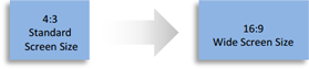
- Some older products that we have may only be in standard format, but they can easily be converted to widescreen.
- To do this, please open the SlideTeam product in Powerpoint, and go to
- Design ( On the top bar) -> Page Setup -> and select "On-screen Show (16:9)” in the drop down for "Slides Sized for".
- The slide or theme will change to widescreen, and all graphics will adjust automatically. You can similarly convert our content to any other desired screen aspect ratio.
Compatible With Google Slides

Get This In WideScreen
You must be logged in to download this presentation.


Do you want to remove this product from your favourites?
PowerPoint presentation slides
This complete presentation has PPT slides on wide range of topics highlighting the core areas of your business needs. It has professionally designed templates with relevant visuals and subject driven content. This presentation deck has total of fourty six slides. Get access to the customizable templates. Our designers have created editable templates for your convenience. You can edit the color, text and font size as per your need. You can add or delete the content if required. You are just a click to away to have this ready-made presentation. Click the download button now.

People who downloaded this PowerPoint presentation also viewed the following :
Content of this Powerpoint Presentation
Slide 1: This slide introduces Environmental Analysis Tools & Techniques. State Your Company Name and begin.
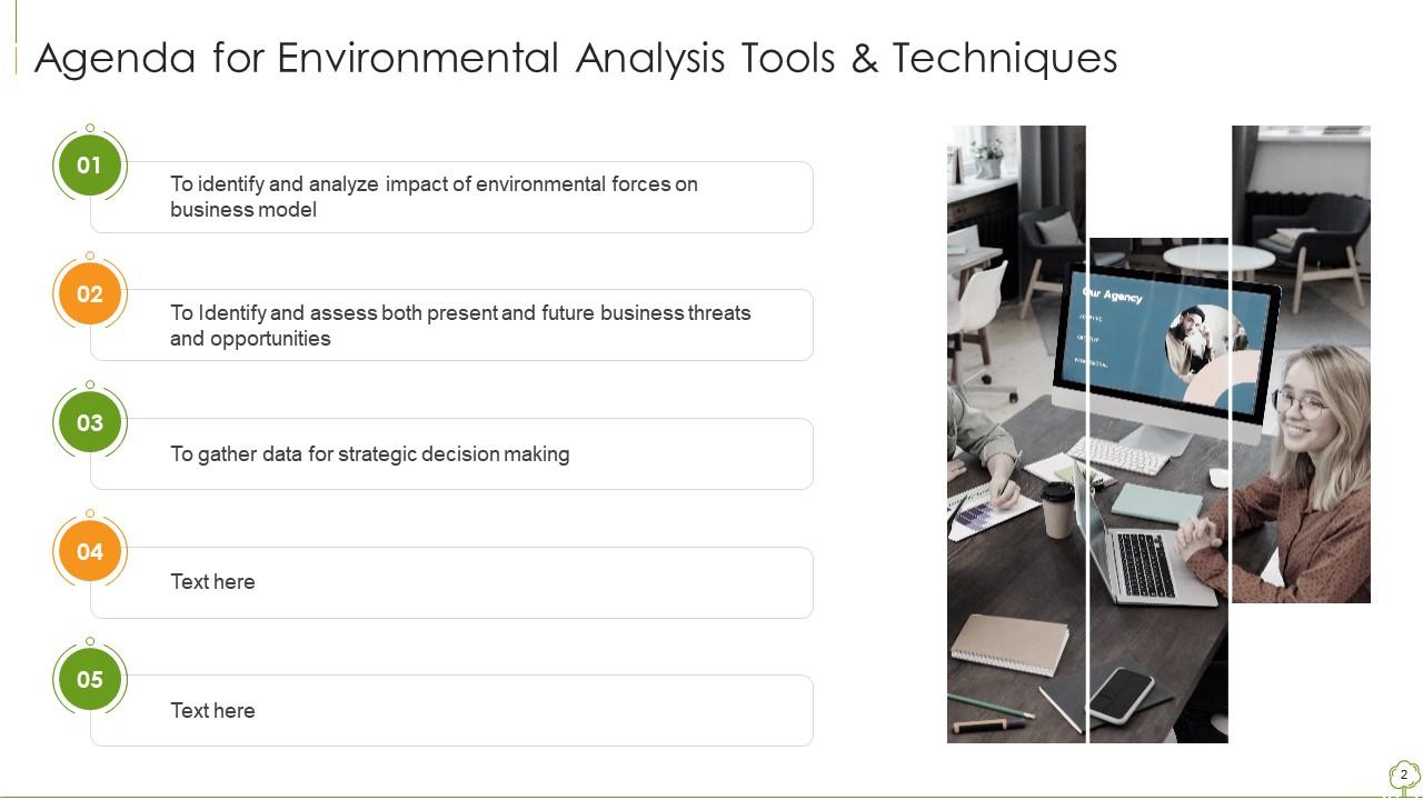
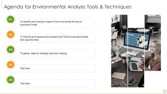
Slide 2: This slide shows Agenda for Environmental Analysis Tools & Techniques.
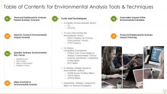
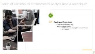
Slide 3: This slide presents Table of Contents for Environmental Analysis Tools & Techniques.
Slide 4: This slide shows title for topics that are to be covered next in the template.
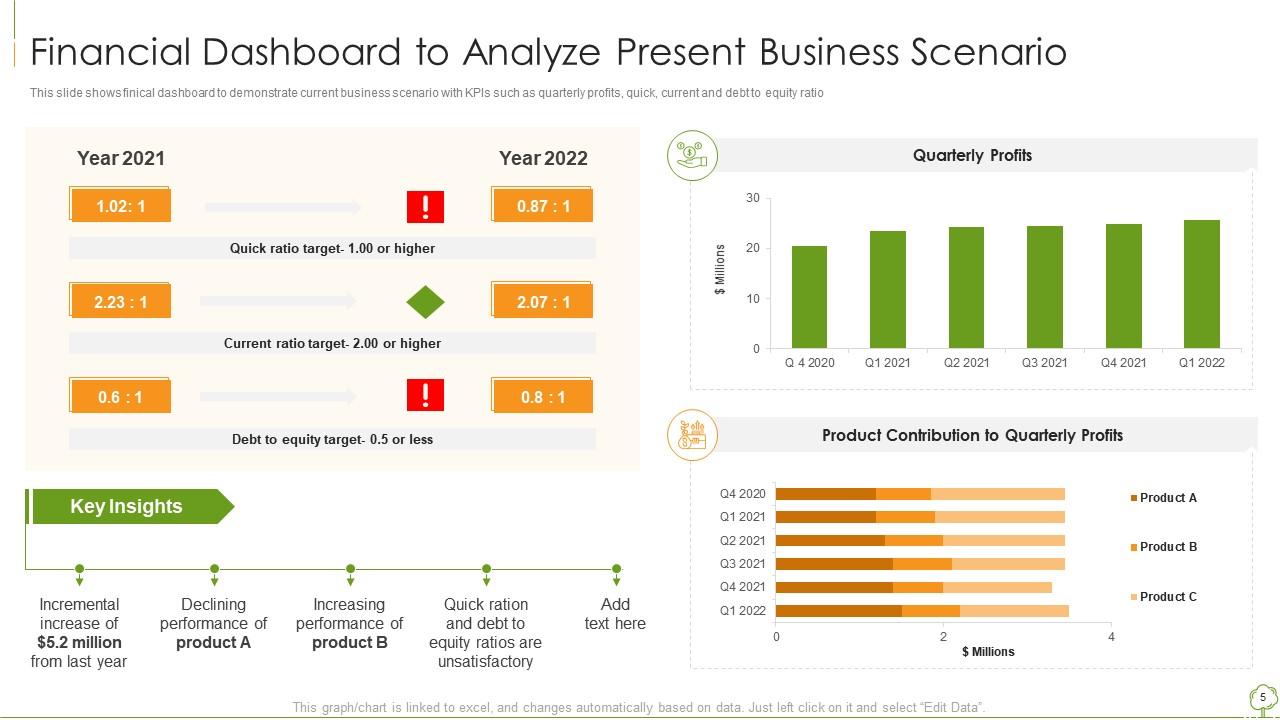
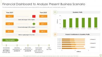
Slide 5: This slide displays Financial Dashboard to Analyze Present Business Scenario.
Slide 6: This slide shows title for topics that are to be covered next in the template.
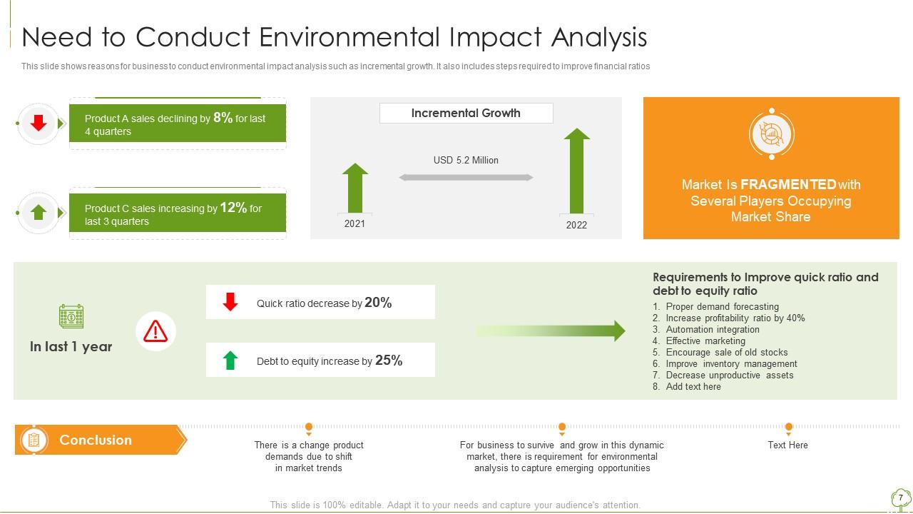
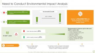
Slide 7: This slide represents Need to Conduct Environmental Impact Analysis.
Slide 8: This slide shows title for topics that are to be covered next in the template.
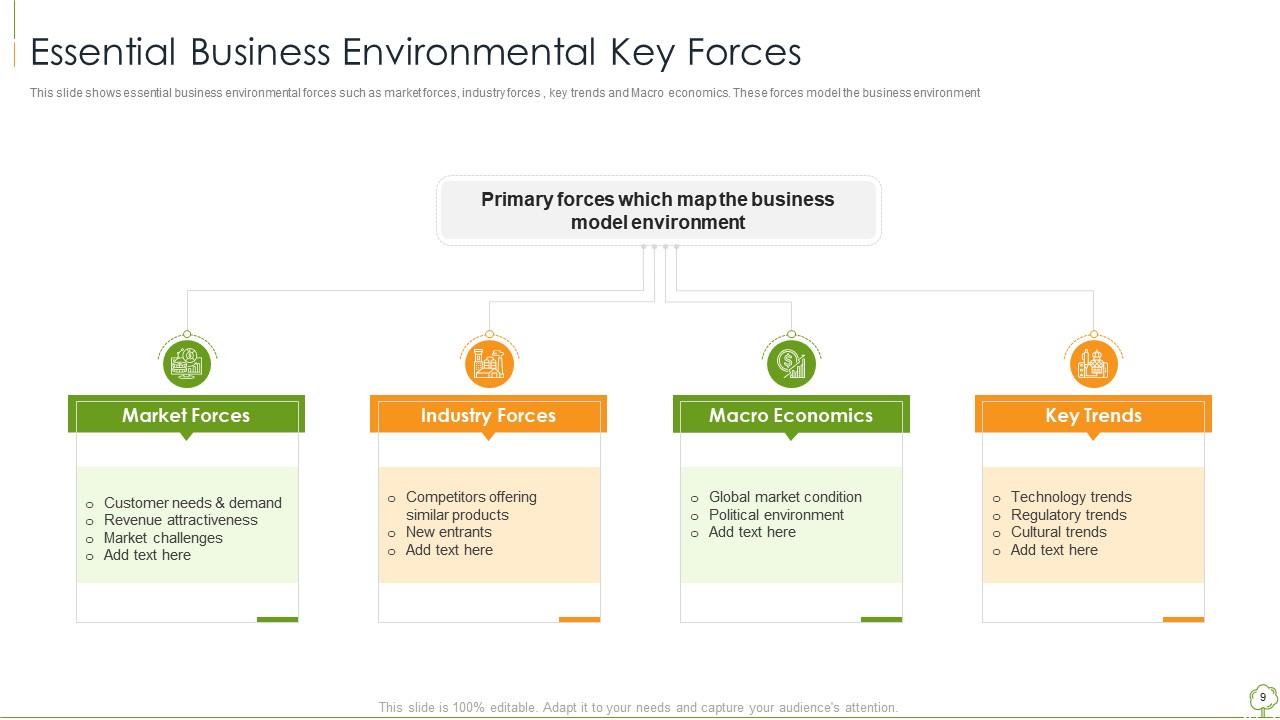
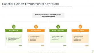
Slide 9: This slide showcases essential business environmental forces such as market forces, industry forces , etc.
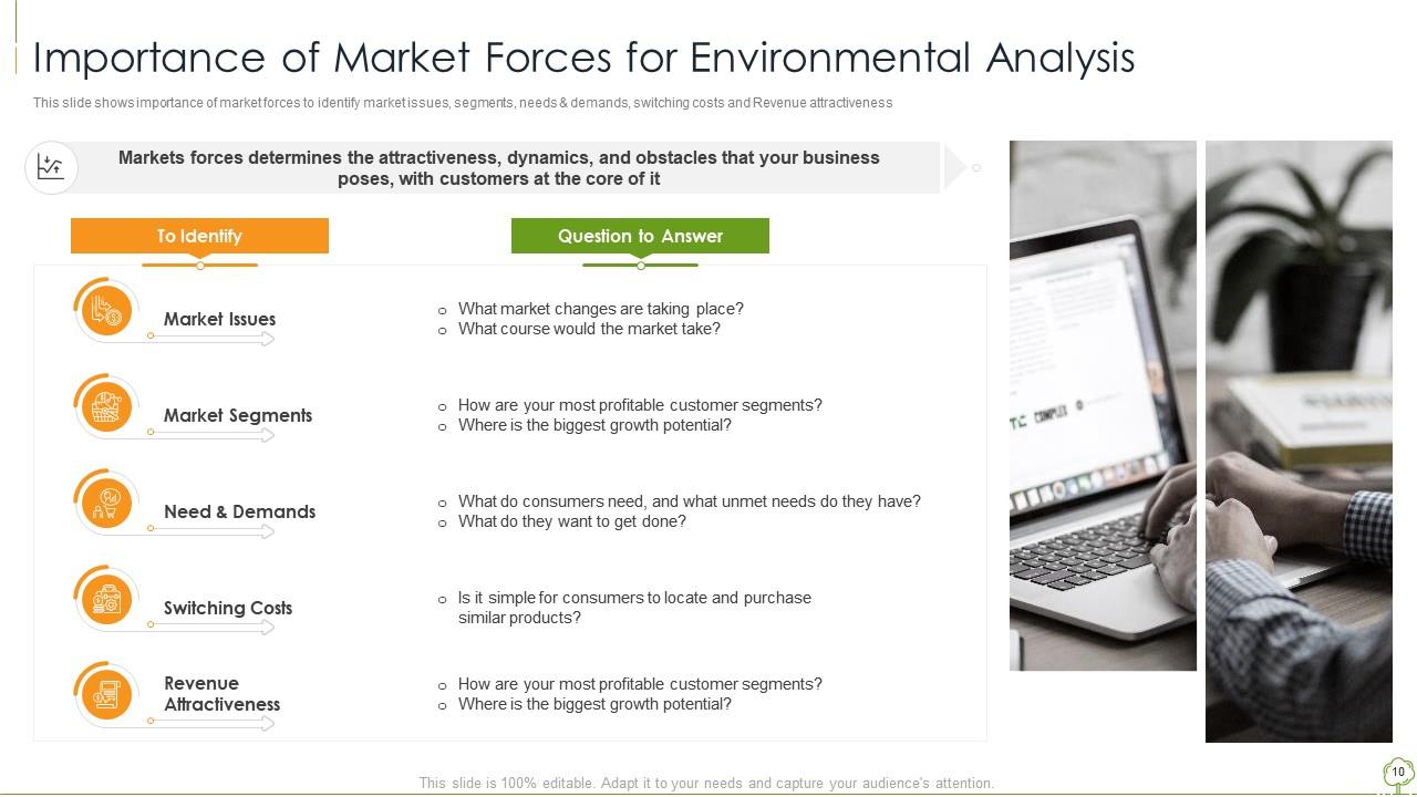
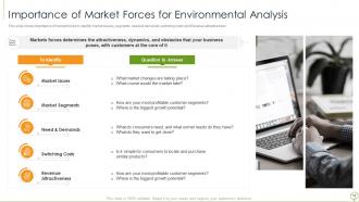
Slide 10: This slide presents importance of market forces to identify market issues, segments, needs & demands, etc.
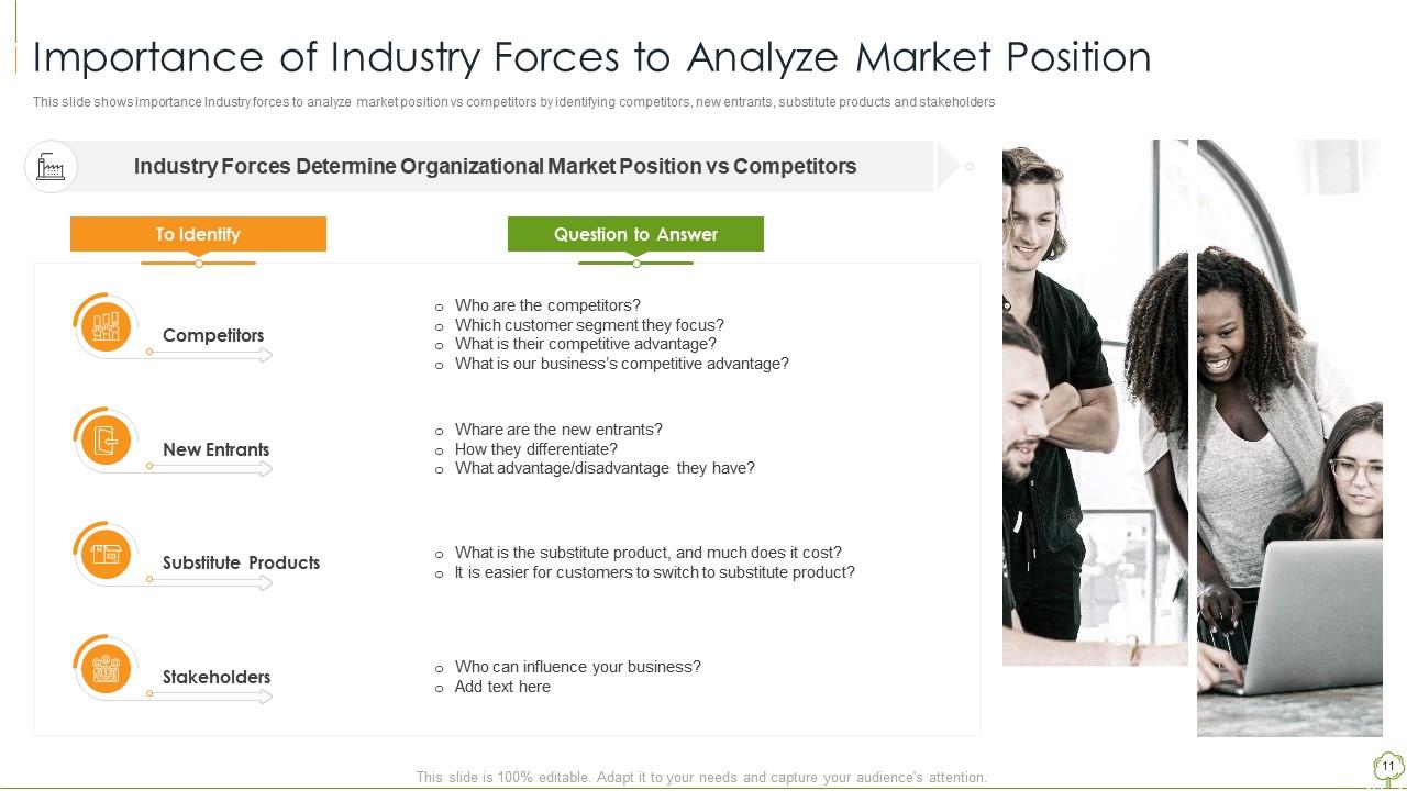
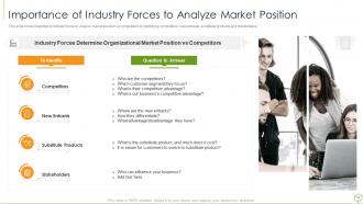
Slide 11: This slide displays Importance of Industry Forces to Analyze Market Position.
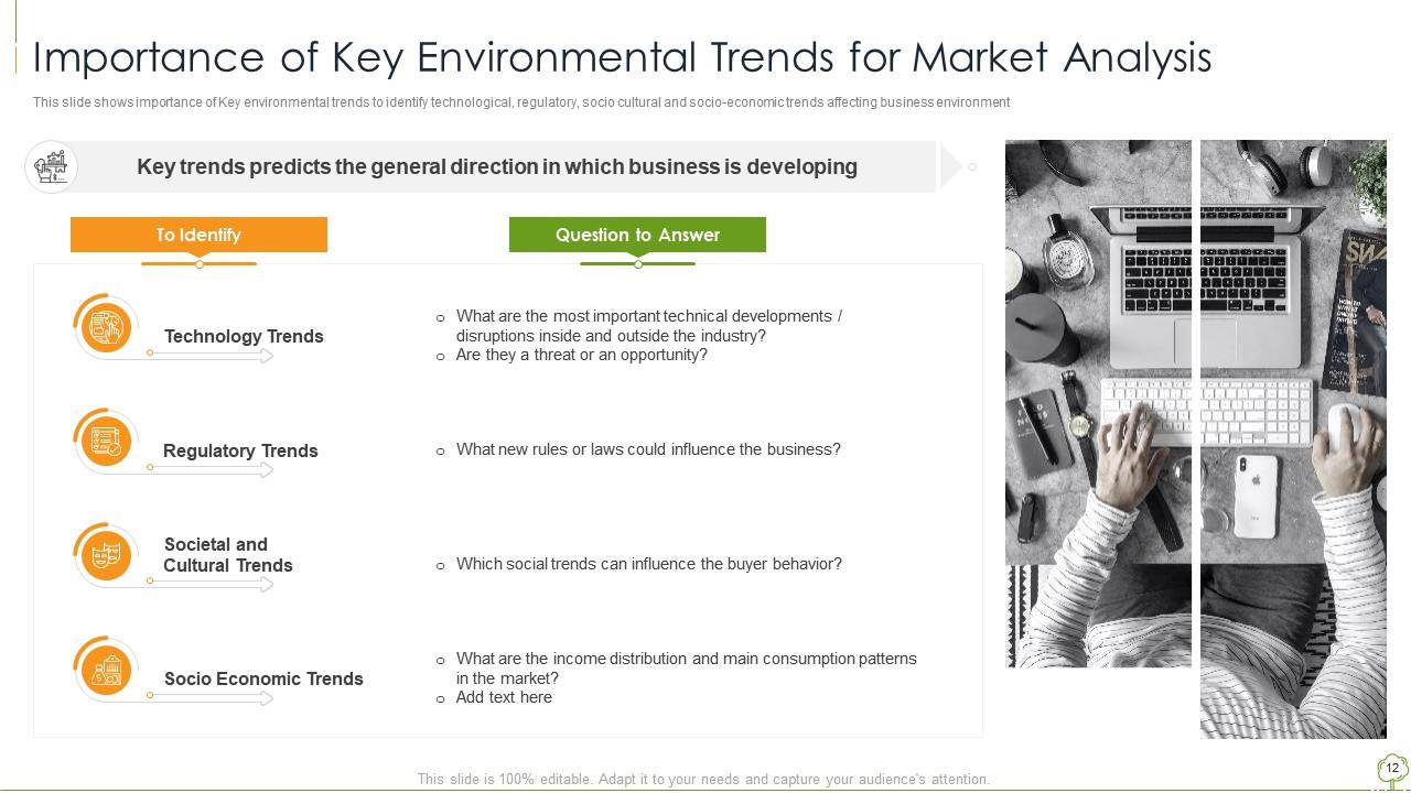
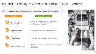
Slide 12: This slide represents Importance of Key Environmental Trends for Market Analysis.
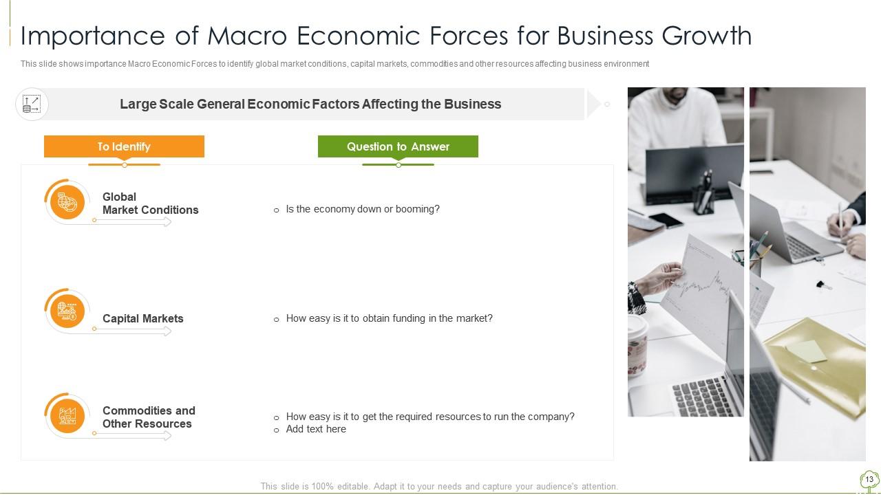
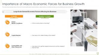
Slide 13: This slide showcases Importance of Macro Economic Forces for Business Growth.
Slide 14: This slide shows title for topics that are to be covered next in the template.
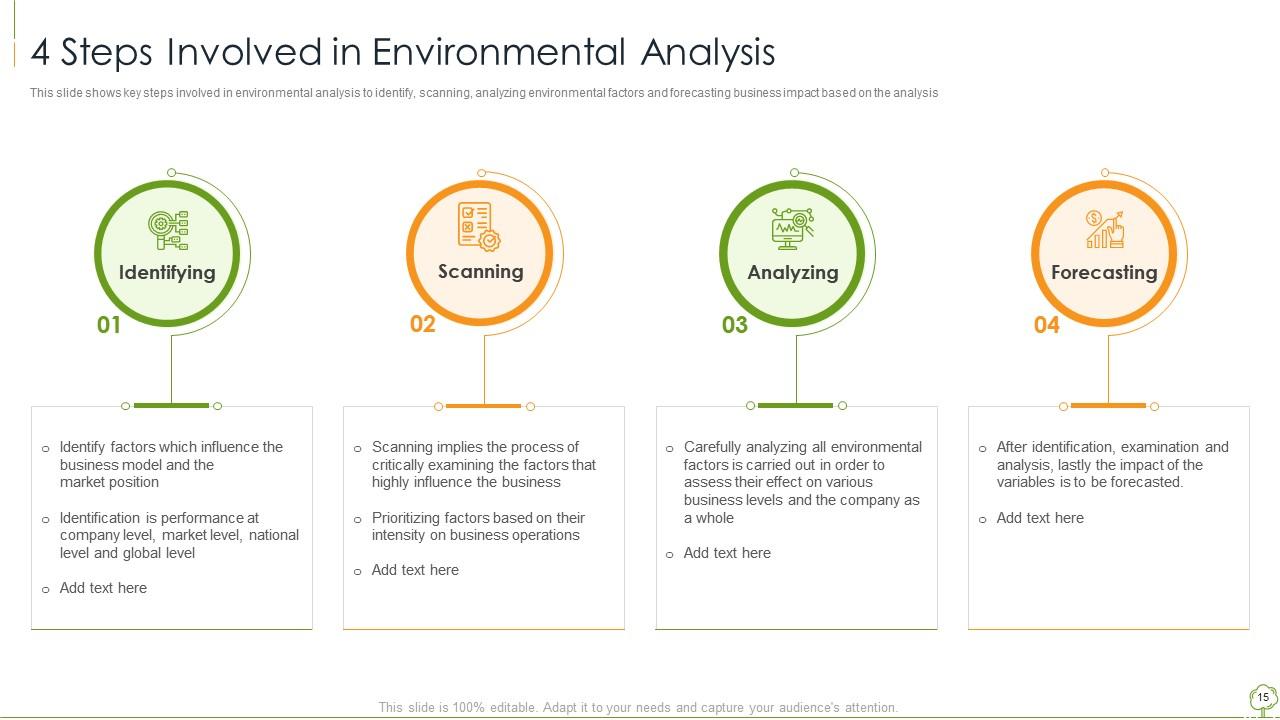
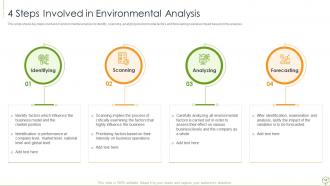
Slide 15: This slide presents key steps involved in environmental analysis to identify, scanning, etc.
Slide 16: This slide shows title for topics that are to be covered next in the template.
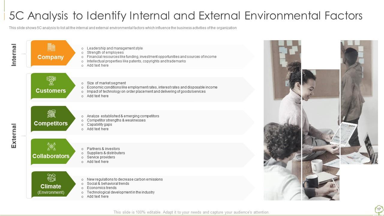
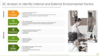
Slide 17: This slide displays 5C Analysis to Identify Internal and External Environmental Factors.
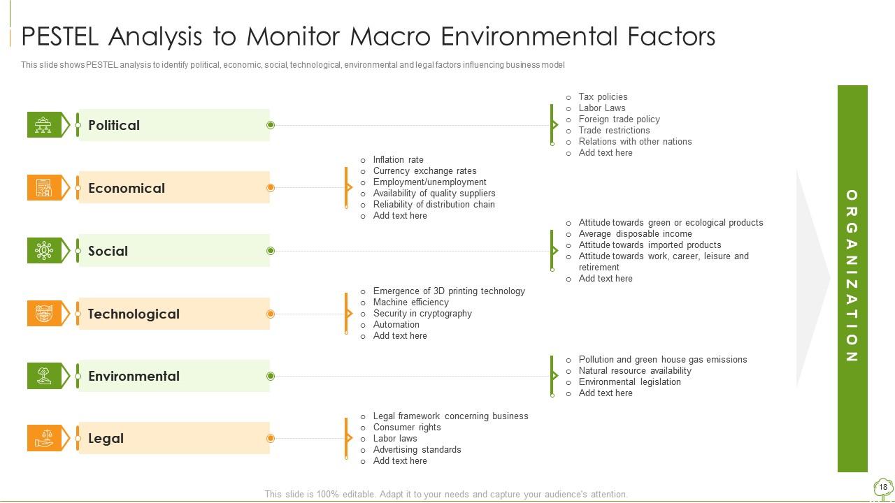
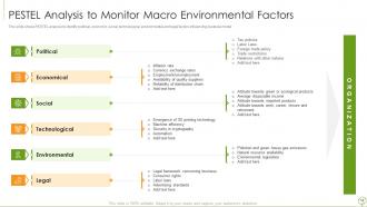
Slide 18: This slide represents PESTEL Analysis to Monitor Macro Environmental Factors.
Slide 19: This slide shows title for topics that are to be covered next in the template.
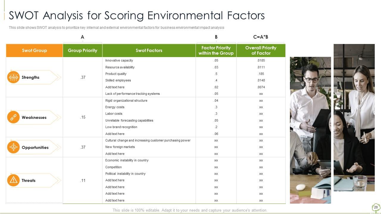
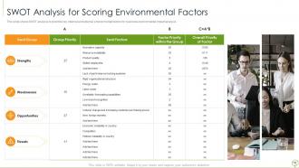
Slide 20: This slide presents SWOT analysis to prioritize key internal and external environmental factors.
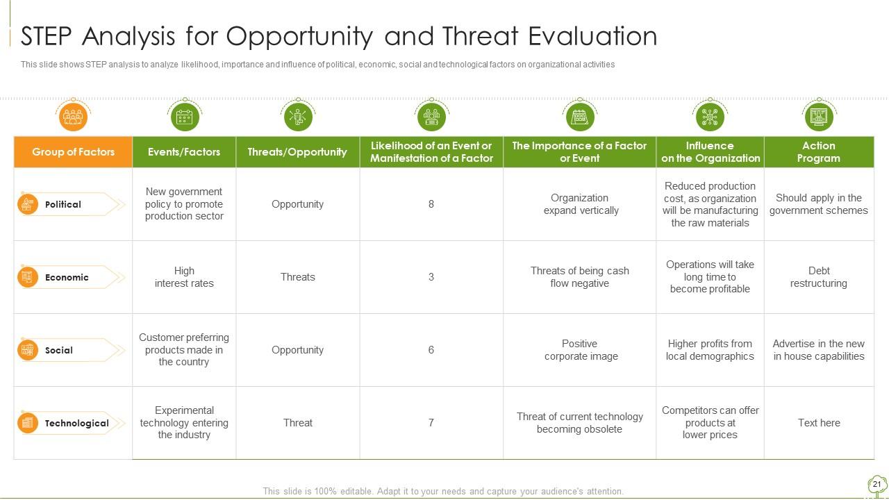
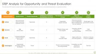
Slide 21: This slide displays STEP analysis to analyze likelihood, importance and influence of political, economic, social and technological factors.
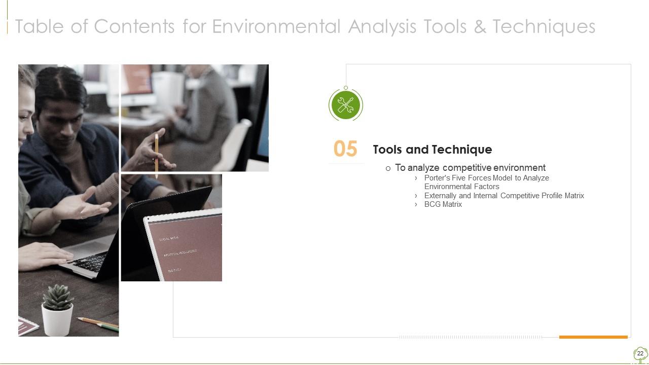
Slide 22: This slide shows title for topics that are to be covered next in the template.
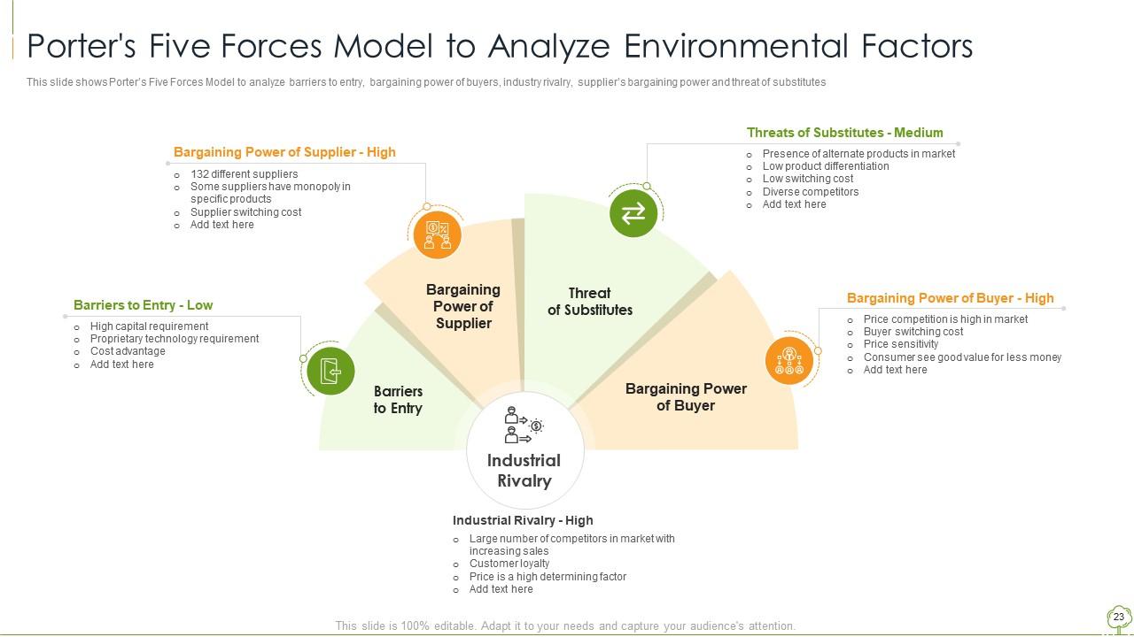
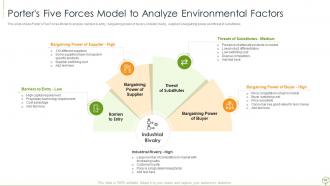
Slide 23: This slide represents Porter's Five Forces Model to Analyze Environmental Factors.
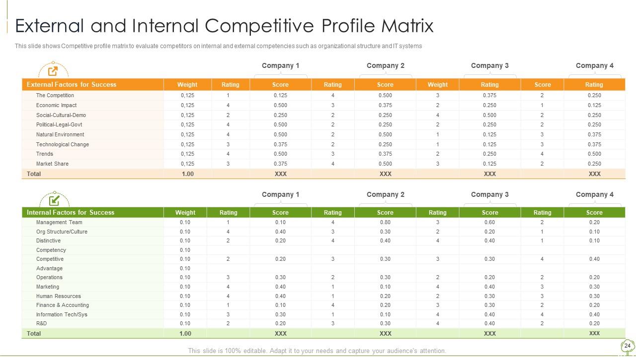
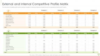
Slide 24: This slide showcases Competitive profile matrix to evaluate competitors on internal and external competencies.
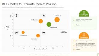
Slide 25: This slide shows BCG Matrix for long-term strategic planning and to help business consider growth opportunities.
Slide 26: This slide shows title for topics that are to be covered next in the template.
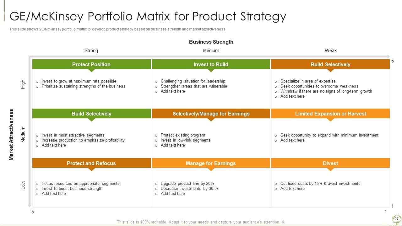
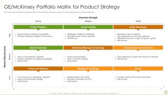
Slide 27: This slide presents GE/McKinsey portfolio matrix to develop product strategy based on business strength.
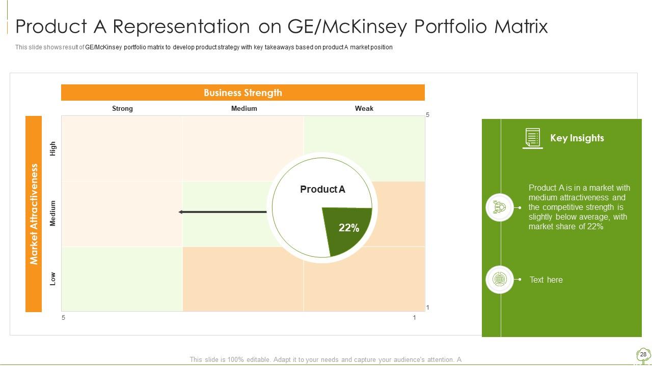
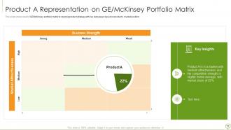
Slide 28: This slide displays Product A Representation on GE/McKinsey Portfolio Matrix.
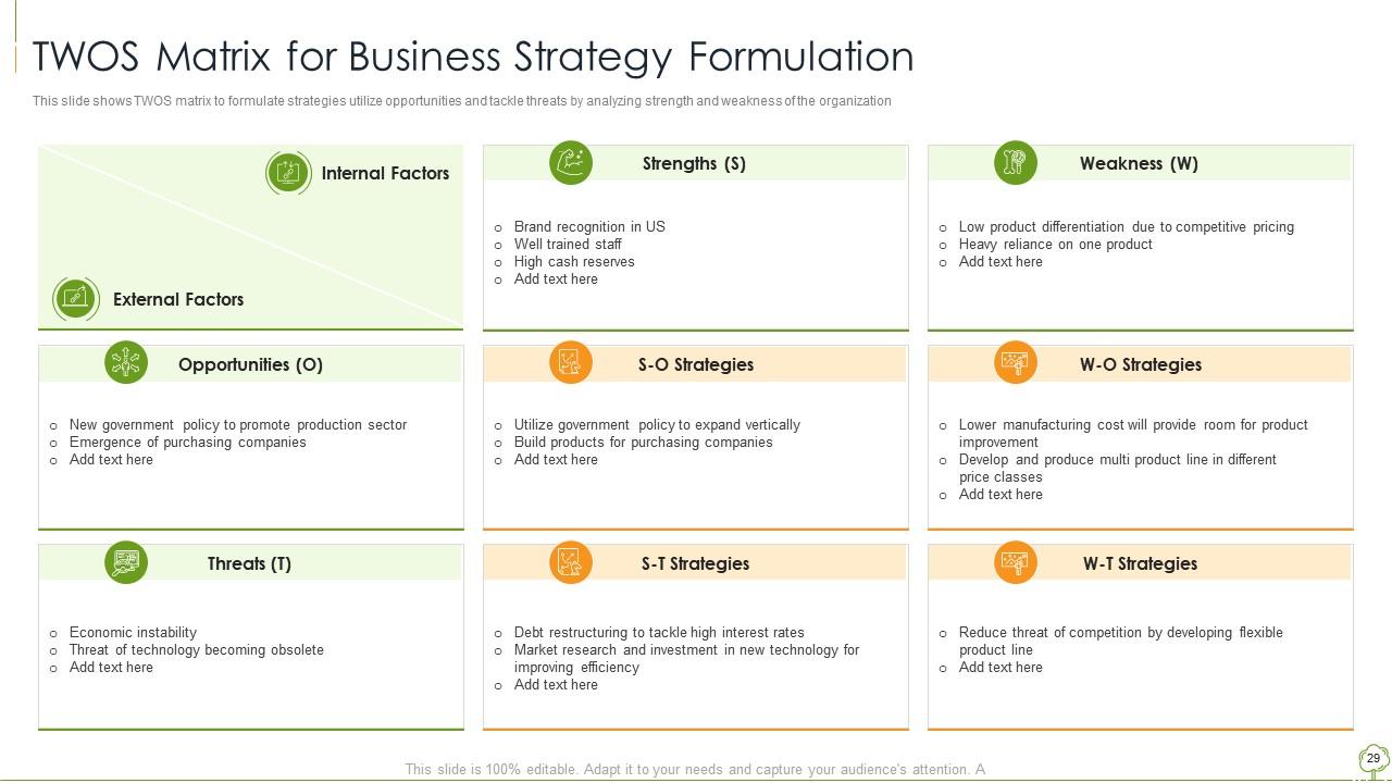
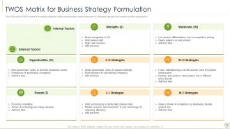
Slide 29: This slide represents TWOS matrix to formulate strategies, utilize opportunities and tackle threats.
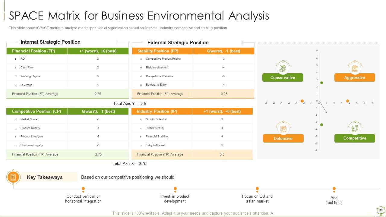
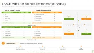
Slide 30: This slide showcases SPACE matrix to analyze market position of organization.
Slide 31: This slide shows title for topics that are to be covered next in the template.
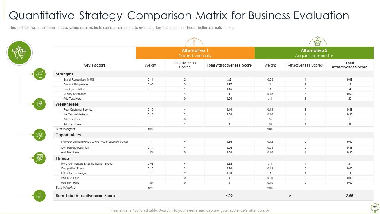
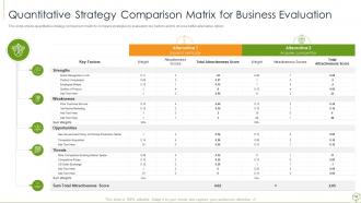
Slide 32: This slide presents Quantitative Strategy Comparison Matrix for Business Evaluation.
Slide 33: This slide shows title for topics that are to be covered next in the template.
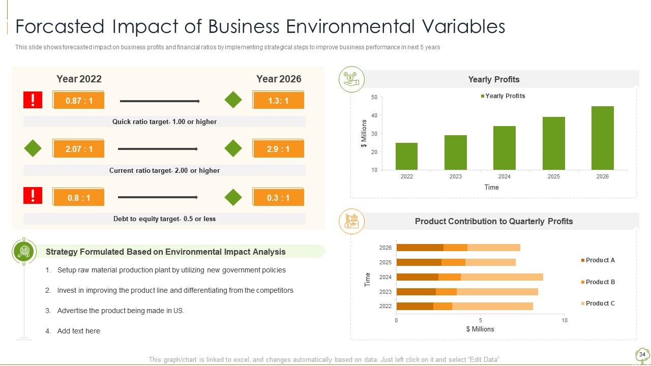
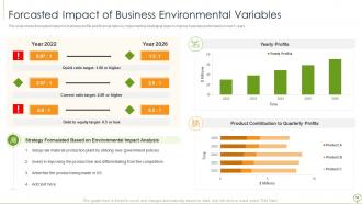
Slide 34: This slide presents Forcasted Impact of Business Environmental Variables.
Slide 35: This slide shows title for topics that are to be covered next in the template.
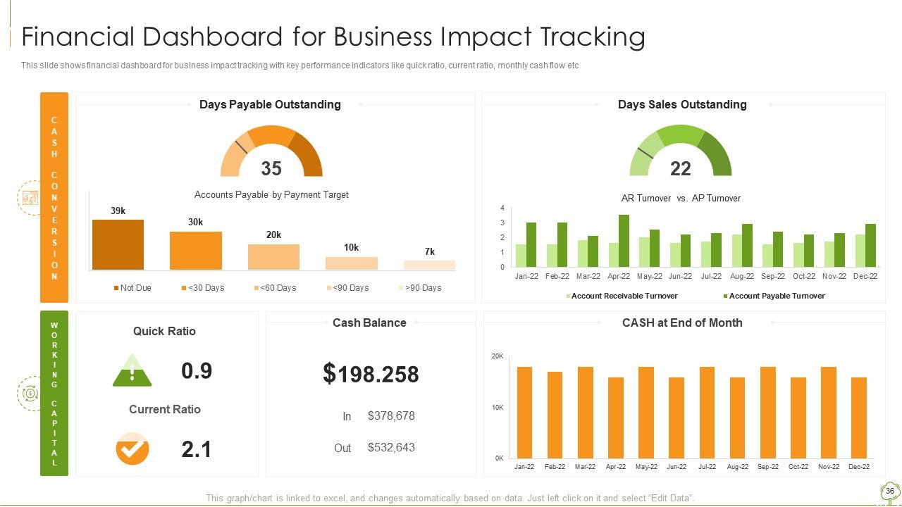
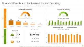
Slide 36: This slide presents Financial Dashboard for Business Impact Tracking.
Slide 37: This slide displays Icons for Environmental Analysis Tools & Techniques.
Slide 38: This slide is titled as Additional Slides for moving forward.
Slide 39: This slide shows Post It Notes. Post your important notes here.
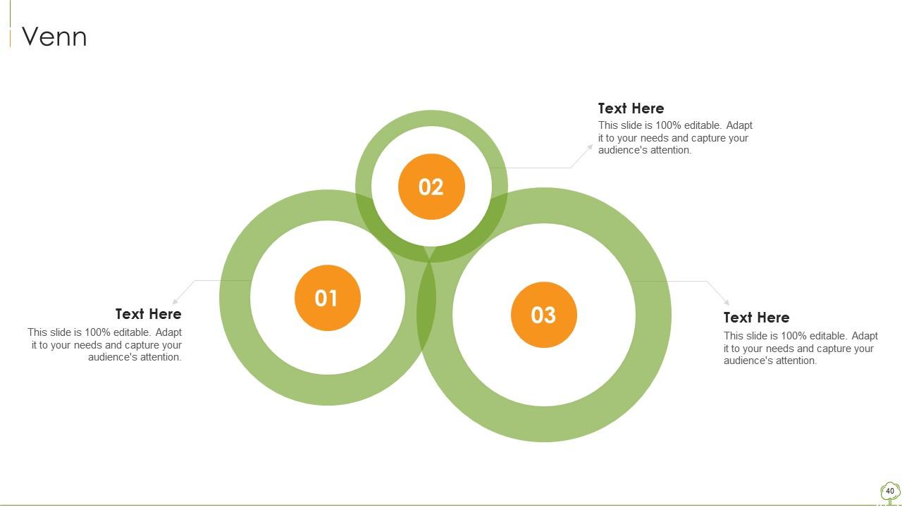
Slide 40: This slide depicts Venn diagram with text boxes.
Slide 41: This is Our Target slide. State your targets here.
Slide 42: This is an Idea Generation slide to state a new idea or highlight information, specifications etc.
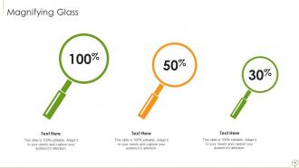
Slide 43: This slide showcases Magnifying Glass to highlight information, specifications etc
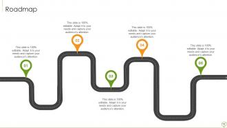
Slide 44: This slide presents Roadmap with additional textboxes.
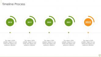
Slide 45: This is a Timeline slide. Show data related to time intervals here.
Slide 46: This is a Thank You slide with address, contact numbers and email address.
Environmental analysis tools and techniques powerpoint presentation slides with all 55 slides:
Use our Environmental Analysis Tools And Techniques Powerpoint Presentation Slides to effectively help you save your valuable time. They are readymade to fit into any presentation structure.
-
Great product with effective design. Helped a lot in our corporate presentations. Easy to edit and stunning visuals.
-
Enough space for editing and adding your own content.
-
Use of different colors is good. It's simple and attractive.
-
Great product with highly impressive and engaging designs.
-
Good research work and creative work done on every template.
