Top 10 Canada map PowerPoint Templates with Professional Designs
Save time and engage your audience with our fully editable PowerPoint PPT Templates and Slides.
-

Location Vancouver City Canada Map PPT Summary AT
Do not compromise on a template that erodes your messages impact. Introducing our engaging Location Vancouver City Canada Map PPT Summary AT complete deck, thoughtfully crafted to grab your audiences attention instantly. With this deck, effortlessly download and adjust elements, streamlining the customization process. Whether you are using Microsoft versions or Google Slides, it fits seamlessly into your workflow. Furthermore, it is accessible in JPG, JPEG, PNG, and PDF formats, facilitating easy sharing and editing. Not only that you also play with the color theme of your slides making it suitable as per your audiences preference.
-

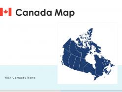
Canada Map Showing Major Provinces And Cities PPT Outline AT
Do not compromise on a template that erodes your messages impact. Introducing our engaging Canada Map Showing Major Provinces And Cities PPT Outline AT complete deck, thoughtfully crafted to grab your audiences attention instantly. With this deck, effortlessly download and adjust elements, streamlining the customization process. Whether you are using Microsoft versions or Google Slides, it fits seamlessly into your workflow. Furthermore, it is accessible in JPG, JPEG, PNG, and PDF formats, facilitating easy sharing and editing. Not only that you also play with the color theme of your slides making it suitable as per your audiences preference.
-
Canada Map With Major Provinces And Territories PPT Slides AT
Do not compromise on a template that erodes your messages impact. Introducing our engaging Canada Map With Major Provinces And Territories PPT Slides AT complete deck, thoughtfully crafted to grab your audiences attention instantly. With this deck, effortlessly download and adjust elements, streamlining the customization process. Whether you are using Microsoft versions or Google Slides, it fits seamlessly into your workflow. Furthermore, it is accessible in JPG, JPEG, PNG, and PDF formats, facilitating easy sharing and editing. Not only that you also play with the color theme of your slides making it suitable as per your audiences preference.
-
Canada map regions states digital interconnected map survey
Deliver a credible and compelling presentation by deploying this Canada Map Regions States Digital Interconnected Map Survey. Intensify your message with the right graphics, images, icons, etc. presented in this complete deck. This PPT template is a great starting point to convey your messages and build a good collaboration. The twelve slides added to this PowerPoint slideshow helps you present a thorough explanation of the topic. You can use it to study and present various kinds of information in the form of stats, figures, data charts, and many more. This Canada Map Regions States Digital Interconnected Map Survey PPT slideshow is available for use in standard and widescreen aspects ratios. So, you can use it as per your convenience. Apart from this, it can be downloaded in PNG, JPG, and PDF formats, all completely editable and modifiable. The most profound feature of this PPT design is that it is fully compatible with Google Slides making it suitable for every industry and business domain.
-
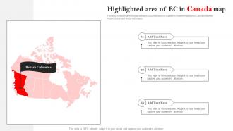
Highlighted Area Of Bc In Canada Map
This slide shows marked region of British Columbia which is located in Westernmost part of Canada between Pacific Ocean and Rocky Mountains. Presenting our set of slides with Highlighted Area Of BC In Canada Map. This exhibits information on three stages of the process. This is an easy to edit and innovatively designed PowerPoint template. So download immediately and highlight information on Highlighted Area, BC In Canada Map.
-
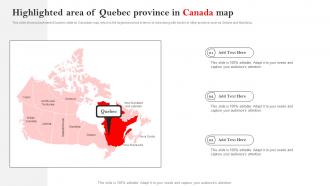
Highlighted Area Of Quebec Province In Canada Map
This slide shows placement of Quebec state on Canadian map, which is the largest province in terms of area along with border of other province such as Ontario and Manitoba. Introducing our premium set of slides with Highlighted Area Of Quebec Province In Canada Map. Ellicudate the three stages and present information using this PPT slide. This is a completely adaptable PowerPoint template design that can be used to interpret topics like Highlighted Area Of Quebec, Province In Canada Map. So download instantly and tailor it with your information.
-
Map Of The United States With Canada PPT Information AT
Do not compromise on a template that erodes your messages impact. Introducing our engaging Map Of The United States With Canada PPT Information AT complete deck, thoughtfully crafted to grab your audiences attention instantly. With this deck, effortlessly download and adjust elements, streamlining the customization process. Whether you are using Microsoft versions or Google Slides, it fits seamlessly into your workflow. Furthermore, it is accessible in JPG, JPEG, PNG, and PDF formats, facilitating easy sharing and editing. Not only that you also play with the color theme of your slides making it suitable as per your audiences preference.
-
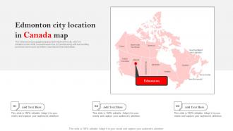
Edmonton City Location In Canada Map
This slide shows geographical placement of Edmonton city, which is situated on the North Saskatchewan river of Canada along with surrounding provinces name such as British Columbia and Saskatchewan. Introducing our premium set of slides with Edmonton City Location In Canada Map. Ellicudate the three stages and present information using this PPT slide. This is a completely adaptable PowerPoint template design that can be used to interpret topics like Edmonton City Location, Canada Map. So download instantly and tailor it with your information.
-
Detailed Map Of Canada Overview PPT PowerPoint AT
While your presentation may contain top notch content, if it lacks visual appeal, you are not fully engaging your audience. Introducing our Detailed Map Of Canada Overview PPT PowerPoint AT deck, designed to engage your audience. Our complete deck boasts a seamless blend of Creativity and versatility. You can effortlessly customize elements and color schemes to align with your brand identity. Save precious time with our pre designed template, compatible with Microsoft versions and Google Slides. Plus, its downloadable in multiple formats like JPG, JPEG, and PNG. Elevate your presentations and outshine your competitors effortlessly with our visually stunning 100 percent editable deck.
-
North America Canada Provinces Map Overview PPT Information AT
Navigate the vast landscapes of North America with our Canada Provinces Map Overview PPT. This premium presentation deck offers a captivating visual storytelling experience, showcasing detailed maps and insightful data visualization of Canadas provinces. Each editable slide is designed for clarity and impact, making it perfect for corporate presentations, educational sessions, or strategic discussions. Whether youre crafting a pitch deck for investors or developing informative content for stakeholders, our professional PPT ensures your message resonates. Elevate your presentations with creative layouts and engaging graphics that highlight the unique features of each province, all optimized for Google Slides and Keynote.
-
Location Of Vancouver City In Canada Map
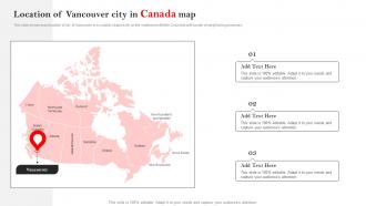
This slide shows exact location of city of Vancouver in a coastal, seaport city on the mainland in British Columbia with border of neighboring provinces. Presenting our set of slides with Location Of Vancouver City In Canada Map. This exhibits information on three stages of the process. This is an easy to edit and innovatively designed PowerPoint template. So download immediately and highlight information on Location Of Vancouver, City In Canada Map.
-
Provinces Of Canada Detailed Map PPT Guidelines AT
Unlock the beauty of Canada with our Provinces of Canada Detailed Map PowerPoint template, designed to elevate your presentations to a new level of sophistication. This premium presentation deck features meticulously crafted editable slides that seamlessly blend visual storytelling with informative content. Each slide is a canvas for data visualization, showcasing the unique characteristics of each province through stunning graphics and creative layouts. Perfect for educators, business professionals, or anyone looking to captivate an audience, this template ensures your message resonates. Transform your ideas into impactful narratives with our versatile Google Slides and Keynote templates, tailored for success.
-
Location Of Montreal City In Canada Map
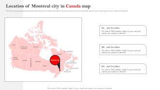
This slide shows geographical placement of Montreal area in southern east part of Canada in province of Quebec along with name of surrounding region such as Ontario and Manitoba. Introducing our premium set of slides with Location Of Montreal City In Canada Map. Ellicudate the three stages and present information using this PPT slide. This is a completely adaptable PowerPoint template design that can be used to interpret topics like Location Of Montreal, City In Canada Map. So download instantly and tailor it with your information.
-
Location Of Calgary City In Canada Map
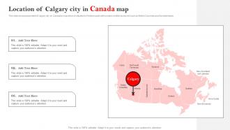
This slide shows placement of Calgary city on Canadian map which is situated in Western parts with borders of other provinces such as British Columbia and Saskatchewan. Presenting our set of slides with Location Of Calgary City In Canada Map. This exhibits information on three stages of the process. This is an easy to edit and innovatively designed PowerPoint template. So download immediately and highlight information on Location Of Calgary, City In Canada Map.
-
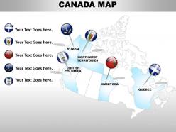
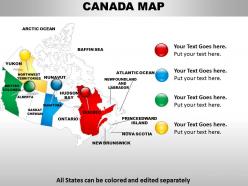
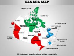
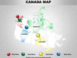
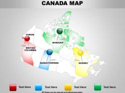
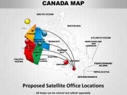
Canada country powerpoint maps
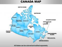
These high quality, editable powerpoint state maps have been carefully created by our professional team to display location and other geographic details in your PowerPoint presentation. Each map is vector based and is 100% editable in powerpoint. Each and every property of any region - color, size, shading etc can be modified to help you build an effective powerpoint presentation. Use these maps to show sales territories, business and new office locations, travel planning etc in your presentations. Any text can be entered at any point in the powerpoint map slide. Simply DOWNLOAD, TYPE and PRESENT!
-
Canada map travel information 1114
We are proud to present our canada map travel information 1114. Our canada map Travel information 1114 are aesthetically designed to attract attention. We guarantee that they will grab all the eyeballs you need.
-
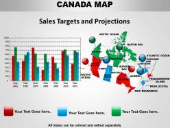
Bar graph with canada map 1114
We are proud to present our bar graph with canada map 1114. Our bar graph with canada map 1114 are topically designed to provide an attractive backdrop to any subject. Use them to look like a presentation pro.
-
Blank Map Of Canada With Bordered Provinces PPT Sample AT
Step up your game with our enchanting Blank Map Of Canada With Bordered Provinces PPT Sample AT deck, guaranteed to leave a lasting impression on your audience. Crafted with a perfect balance of simplicity, and innovation, our deck empowers you to alter it to your specific needs. You can also change the color theme of the slide to mold it to your companys specific needs. Save time with our ready-made design, compatible with Microsoft versions and Google Slides. Additionally, its available for download in various formats including JPG, JPEG, and PNG. Outshine your competitors with our fully editable and customized deck.
-
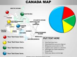
Canada map and pie chart 1114
We are proud to present our canada map and pie chart 1114. Subscribe to our canada map and pie chart 1114 and receive great value for your money. Be assured of finding the best projection to highlight your words.
-
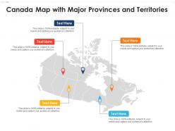
Canada map with major provinces and territories
Introducing our premium set of slides with Canada Map With Major Provinces And Territories. Elucidate the five stages and present information using this PPT slide. This is a completely adaptable PowerPoint template design that can be used to interpret topics like Canada Map With Major Provinces And Territories. So download instantly and tailor it with your information.
-
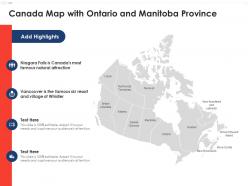
Canada map with ontario and manitoba province
Presenting our set of slides with Canada Map With Ontario And Manitoba Province. This exhibits information on four stages of the process. This is an easy-to-edit and innovatively designed PowerPoint template. So download immediately and highlight information on Canada Map With Ontario And Manitoba Province.
-
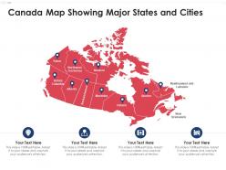
Canada map showing major states and cities
Presenting our set of slides with Canada Map Showing Major States And Cities. This exhibits information on four stages of the process. This is an easy-to-edit and innovatively designed PowerPoint template. So download immediately and highlight information on Canada Map Showing Major States And Cities.
-
Canada Maps Powerpoint Ppt Template Bundles
Deliver a credible and compelling presentation by deploying this Canada Maps Powerpoint Ppt Template Bundles. Intensify your message with the right graphics, images, icons, etc. presented in this complete deck. This PPT template is a great starting point to convey your messages and build a good collaboration. The nine slides added to this PowerPoint slideshow helps you present a thorough explanation of the topic. You can use it to study and present various kinds of information in the form of stats, figures, data charts, and many more. This Canada Maps Powerpoint Ppt Template Bundles PPT slideshow is available for use in standard and widescreen aspects ratios. So, you can use it as per your convenience. Apart from this, it can be downloaded in PNG, JPG, and PDF formats, all completely editable and modifiable. The most profound feature of this PPT design is that it is fully compatible with Google Slides making it suitable for every industry and business domain.
-
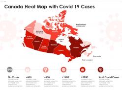
Real Time Analysis Of Canadas COVID Heat Map PPT Summary AT
Revolutionize your presentations with our Real Time Analysis of Canadas COVID Heat Map PPT Summary. This meticulously crafted PowerPoint template offers a dynamic way to visualize data, featuring editable slides that showcase the latest trends in COVID-19 statistics across Canada. Perfect for health professionals, policymakers, and educators, this presentation deck combines professional aesthetics with powerful data visualization techniques. Engage your audience with compelling infographic templates and creative layouts that transform complex information into clear, impactful narratives. Elevate your corporate presentations or pitch decks with this essential tool, ensuring your insights resonate and inspire action.
-
Professional Canada Geographic Map Overview PPT Template AT
Crafted for the discerning presenter, the Professional Canada Geographic Map Overview PPT Template elevates your visual storytelling to new heights. This meticulously designed presentation deck features editable slides that seamlessly integrate stunning infographic templates, ensuring your data visualization is both impactful and engaging. Perfect for corporate presentations or educational settings, this template empowers you to showcase Canadas diverse geography with precision and flair. Utilize professional PPT layouts to captivate your audience, whether in Google Slides or Keynote. Transform your pitch deck into a compelling narrative that resonates, making complex information easily digestible and visually appealing.
-
Canada country map design 1114
We are proud to present our canada country map design 1114. Use our canada country map design 1114 to effectively help you save your valuable time. They are readymade to fit into any presentation structure.
-
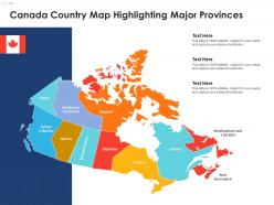
Canada country map highlighting major provinces
Presenting our set of slides with Canada Country Map Highlighting Major Provinces. This exhibits information on one stage of the process. This is an easy-to-edit and innovatively designed PowerPoint template. So download immediately and highlight information on Canada Country Map Highlighting Major Provinces.
-
Canada heat map with covid 19 cases
Introducing our premium set of slides with Canada Heat Map With Covid 19 Cases. Elucidate the six stages and present information using this PPT slide. This is a completely adaptable PowerPoint template design that can be used to interpret topics like Canada Heat Map With Covid 19 Cases. So download instantly and tailor it with your information.
-
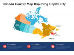
Canada country map displaying capital city
Introducing our premium set of slides with Canada Country Map Displaying Capital City. Elucidate the three stages and present information using this PPT slide. This is a completely adaptable PowerPoint template design that can be used to interpret topics like Canada Country Map Displaying Capital City. So download instantly and tailor it with your information.
-
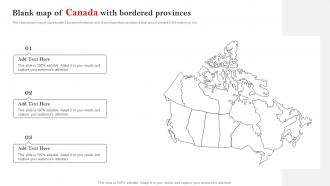
Blank Map Of Canada With Bordered Provinces
This slide shows map of Canada with 3 bordered territories and 10 provinces that constitute a total area of around 9.985 million sq. km. Presenting our set of slides with Blank Map Of Canada With Bordered Provinces. This exhibits information on three stages of the process. This is an easy to edit and innovatively designed PowerPoint template. So download immediately and highlight information on Blank Map Of Canada, Bordered Provinces.
-
Detailed map of canada 1114
We are proud to present our detailed map of canada 1114. Our Detailed Map Of Canada 1114 Provide You With A Vast Range Of Viable Options. Select The Appropriate Ones And Just Fill In Your Text.
-
Map of canada country 1314
We are proud to present our map of canada country 1314. Our Map Of Canada Country are specially created by a professional team with vast experience. They diligently strive to come up with the right vehicle for your brilliant Ideas.
-
Canada country powerpoint map 1114
We are proud to present our canada country powerpoint map 1114. Our canada country powerpoint map 1114 provide you with a vast range of viable options. Select the appropriate ones and just fill in your text.
-
Interactive map of canada country 1114
We are proud to present our interactive map of canada country 1114. Use our interactive map of canada country 1114 to effectively help you save your valuable time. They are readymade to fit into any presentation structure.
-
Map of canada icon with canadian flag
Presenting this set of slides with name Map Of Canada Icon With Canadian Flag. The topics discussed in these slides are Canada Flag, Map Of Canada, Sunset. This is a completely editable PowerPoint presentation and is available for immediate download. Download now and impress your audience.
-
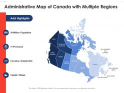
Administrative map of canada with multiple regions
Presenting our set of slides with Administrative Map Of Canada With Multiple Regions. This exhibits information on four stages of the process. This is an easy-to-edit and innovatively designed PowerPoint template. So download immediately and highlight information on Administrative Map Of Canada With Multiple Regions.
-
Colored map of canada with survey results
Introducing our premium set of slides with Colored Map Of Canada With Survey Results. Elucidate the four stages and present information using this PPT slide. This is a completely adaptable PowerPoint template design that can be used to interpret topics like Colored Map Of Canada With Survey Results. So download instantly and tailor it with your information.
-
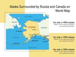
Alaska surrounded by russia and canada on world map
Presenting this set of slides with name Alaska Surrounded By Russia And Canada On World Map. This is a one stage process. The stages in this process are Alaska Surrounded By Russia And Canada On World Map. This is a completely editable PowerPoint presentation and is available for immediate download. Download now and impress your audience.
-
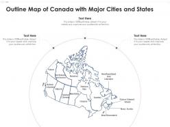
Outline map of canada with major cities and states
Introducing our premium set of slides with Outline Map Of Canada With Major Cities And States. Elucidate the one stage and present information using this PPT slide. This is a completely adaptable PowerPoint template design that can be used to interpret topics like Outline Map Of Canada With Major Cities And States. So download instantly and tailor it with your information.
-
Digital interconnected map of canada
Presenting our set of slides with Digital Interconnected Map Of Canada. This exhibits information on one stage of the process. This is an easy-to-edit and innovatively designed PowerPoint template. So download immediately and highlight information on Digital Interconnected Map Of Canada.
-
Map Of United States With Canada
This slide shows US country map with Canadian borders which is approximately 8,891 km in length. Introducing our premium set of slides with Map Of United States With Canada. Ellicudate the three stages and present information using this PPT slide. This is a completely adaptable PowerPoint template design that can be used to interpret topics like Borders, Approximately, Map. So download instantly and tailor it with your information.
-
Canadian Cities A Province By Province Breakdown PPT Information AT
Ditch the Dull templates and opt for our engaging Canadian Cities A Province By Province Breakdown PPT Information AT deck to attract your audience. Our visually striking design effortlessly combines creativity with functionality, ensuring your content shines through. Compatible with Microsoft versions and Google Slides, it offers seamless integration of presentation. Save time and effort with our pre-designed PPT layout, while still having the freedom to customize fonts, colors, and everything you ask for. With the ability to download in various formats like JPG, JPEG, and PNG, sharing your slides has never been easier. From boardroom meetings to client pitches, this deck can be the secret weapon to leaving a lasting impression.
-
Canadas Ten Provinces And Their Key Cities PPT Information AT
While your presentation may contain top-notch content, if it lacks visual appeal, you are not fully engaging your audience. Introducing our Canadas Ten Provinces And Their Key Cities PPT Information AT deck, designed to engage your audience. Our complete deck boasts a seamless blend of Creativity and versatility. You can effortlessly customize elements and color schemes to align with your brand identity. Save precious time with our pre-designed template, compatible with Microsoft versions and Google Slides. Plus, its downloadable in multiple formats like JPG, JPEG, and PNG. Elevate your presentations and outshine your competitors effortlessly with our visually stunning 100 percent editable deck.
-
North America Map Showing Caribbean And Central America PPT Summary AT
Step up your game with our enchanting North America Map Showing Caribbean And Central America PPT Summary AT deck, guaranteed to leave a lasting impression on your audience. Crafted with a perfect balance of simplicity, and innovation, our deck empowers you to alter it to your specific needs. You can also change the color theme of the slide to mold it to your companys specific needs. Save time with our ready made design, compatible with Microsoft versions and Google Slides. Additionally, its available for download in various formats including JPG, JPEG, and PNG. Outshine your competitors with our fully editable and customized deck.
-
North America Map With Countries And Cities PPT Designs AT
While your presentation may contain top notch content, if it lacks visual appeal, you are not fully engaging your audience. Introducing our North America Map With Countries And Cities PPT Designs AT deck, designed to engage your audience. Our complete deck boasts a seamless blend of Creativity and versatility. You can effortlessly customize elements and color schemes to align with your brand identity. Save precious time with our pre designed template, compatible with Microsoft versions and Google Slides. Plus, its downloadable in multiple formats like JPG, JPEG, and PNG. Elevate your presentations and outshine your competitors effortlessly with our visually stunning 100 percent editable deck.
-
North America Map With Major Cities PPT Template AT
While your presentation may contain top notch content, if it lacks visual appeal, you are not fully engaging your audience. Introducing our North America Map With Major Cities PPT Template AT deck, designed to engage your audience. Our complete deck boasts a seamless blend of Creativity and versatility. You can effortlessly customize elements and color schemes to align with your brand identity. Save precious time with our pre designed template, compatible with Microsoft versions and Google Slides. Plus, its downloadable in multiple formats like JPG, JPEG, and PNG. Elevate your presentations and outshine your competitors effortlessly with our visually stunning 100 percent editable deck.
-
United States Map With Territories Overview PPT Template AT
Ditch the Dull templates and opt for our engaging United States Map With Territories Overview PPT Template AT deck to attract your audience. Our visually striking design effortlessly combines creativity with functionality, ensuring your content shines through. Compatible with Microsoft versions and Google Slides, it offers seamless integration of presentation. Save time and effort with our pre-designed PPT layout, while still having the freedom to customize fonts, colors, and everything you ask for. With the ability to download in various formats like JPG, JPEG, and PNG, sharing your slides has never been easier. From boardroom meetings to client pitches, this deck can be the secret weapon to leaving a lasting impression.
-
Canadas Largest Cities Across All Provinces PPT Graphics AT
Step up your game with our enchanting Canadas Largest Cities Across All Provinces PPT Graphics AT deck, guaranteed to leave a lasting impression on your audience. Crafted with a perfect balance of simplicity, and innovation, our deck empowers you to alter it to your specific needs. You can also change the color theme of the slide to mold it to your companys specific needs. Save time with our ready-made design, compatible with Microsoft versions and Google Slides. Additionally, its available for download in various formats including JPG, JPEG, and PNG. Outshine your competitors with our fully editable and customized deck.
-
Jamaica Map Montego Bay And Kingston Insights PPT Summary AT
Step up your game with our enchanting Jamaica Map Montego Bay And Kingston Insights PPT Summary AT deck, guaranteed to leave a lasting impression on your audience. Crafted with a perfect balance of simplicity, and innovation, our deck empowers you to alter it to your specific needs. You can also change the color theme of the slide to mold it to your companys specific needs. Save time with our ready made design, compatible with Microsoft versions and Google Slides. Additionally, its available for download in various formats including JPG, JPEG, and PNG. Outshine your competitors with our fully editable and customized deck.
-
North America Map For Business PPT Slides AT
Step up your game with our enchanting North America Map For Business PPT Slides AT deck, guaranteed to leave a lasting impression on your audience. Crafted with a perfect balance of simplicity, and innovation, our deck empowers you to alter it to your specific needs. You can also change the color theme of the slide to mold it to your companys specific needs. Save time with our ready-made design, compatible with Microsoft versions and Google Slides. Additionally, its available for download in various formats including JPG, JPEG, and PNG. Outshine your competitors with our fully editable and customized deck.
-
Map Switzerland With City Names Overview PPT Presentation AT
Do not compromise on a template that erodes your messages impact. Introducing our engaging Map Switzerland With City Names Overview PPT Presentation AT complete deck, thoughtfully crafted to grab your audiences attention instantly. With this deck, effortlessly download and adjust elements, streamlining the customization process. Whether you are using Microsoft versions or Google Slides, it fits seamlessly into your workflow. Furthermore, it is accessible in JPG, JPEG, PNG, and PDF formats, facilitating easy sharing and editing. Not only that you also play with the color theme of your slides making it suitable as per your audiences preference.
-
Canadian Provincial Capitals Overview PPT Summary AT
While your presentation may contain top-notch content, if it lacks visual appeal, you are not fully engaging your audience. Introducing our Canadian Provincial Capitals Overview PPT Summary AT deck, designed to engage your audience. Our complete deck boasts a seamless blend of Creativity and versatility. You can effortlessly customize elements and color schemes to align with your brand identity. Save precious time with our pre-designed template, compatible with Microsoft versions and Google Slides. Plus, its downloadable in multiple formats like JPG, JPEG, and PNG. Elevate your presentations and outshine your competitors effortlessly with our visually stunning 100 percent editable deck.
-
Exploring The Maps Of Kingston And Montego Bay PPT Information AT
Ditch the Dull templates and opt for our engaging Exploring The Maps Of Kingston And Montego Bay PPT Information AT deck to attract your audience. Our visually striking design effortlessly combines creativity with functionality, ensuring your content shines through. Compatible with Microsoft versions and Google Slides, it offers seamless integration of presentation. Save time and effort with our pre-designed PPT layout, while still having the freedom to customize fonts, colors, and everything you ask for. With the ability to download in various formats like JPG, JPEG, and PNG, sharing your slides has never been easier. From boardroom meetings to client pitches, this deck can be the secret weapon to leaving a lasting impression.
-
Maps Showing Caribbean Region Countries PPT Slides AT
While your presentation may contain top-notch content, if it lacks visual appeal, you are not fully engaging your audience. Introducing our Maps Showing Caribbean Region Countries PPT Slides AT deck, designed to engage your audience. Our complete deck boasts a seamless blend of Creativity and versatility. You can effortlessly customize elements and color schemes to align with your brand identity. Save precious time with our pre-designed template, compatible with Microsoft versions and Google Slides. Plus, its downloadable in multiple formats like JPG, JPEG, and PNG. Elevate your presentations and outshine your competitors effortlessly with our visually stunning 100 percent editable deck.
-
North America Continents Maps Overview PPT Outline AT
Ditch the Dull templates and opt for our engaging North America Continents Maps Overview PPT Outline AT deck to attract your audience. Our visually striking design effortlessly combines creativity with functionality, ensuring your content shines through. Compatible with Microsoft versions and Google Slides, it offers seamless integration of presentation. Save time and effort with our pre-designed PPT layout, while still having the freedom to customize fonts, colors, and everything you ask for. With the ability to download in various formats like JPG, JPEG, and PNG, sharing your slides has never been easier. From boardroom meetings to client pitches, this deck can be the secret weapon to leaving a lasting impression.
-
USA Map Split Into Census Regions PPT Summary AT
Do not compromise on a template that erodes your messages impact. Introducing our engaging USA Map Split Into Census Regions PPT Summary AT complete deck, thoughtfully crafted to grab your audiences attention instantly. With this deck, effortlessly download and adjust elements, streamlining the customization process. Whether you are using Microsoft versions or Google Slides, it fits seamlessly into your workflow. Furthermore, it is accessible in JPG, JPEG, PNG, and PDF formats, facilitating easy sharing and editing. Not only that you also play with the color theme of your slides making it suitable as per your audiences preference.
-
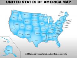
Usa country powerpoint maps
Skillfully designed USA country PowerPoint map suitable for professionals from diverse sectors i.e. scholars, teachers, business professionals, researchers, etc. Personalize it with brand name and logo of your own. Enough space available to put dummy content. Manually editable presentation graphics, text, font, colors, layout, region and shading. Use these maps to show sales territories, business and new office locations, travel planning etc. in your presentations. Well adaptable with all the software’s and Google slides. High resolution PowerPoint template theme. Simply click to add logo, trademark or name. Flexibility to convert in PDF or JPG form.
-
North America Map Country Comparison PPT Information AT
Ditch the Dull templates and opt for our engaging North America Map Country Comparison PPT Information AT deck to attract your audience. Our visually striking design effortlessly combines creativity with functionality, ensuring your content shines through. Compatible with Microsoft versions and Google Slides, it offers seamless integration of presentation. Save time and effort with our pre-designed PPT layout, while still having the freedom to customize fonts, colors, and everything you ask for. With the ability to download in various formats like JPG, JPEG, and PNG, sharing your slides has never been easier. From boardroom meetings to client pitches, this deck can be the secret weapon to leaving a lasting impression.
-
Canadian Provinces And Cities Overview PPT Demonstration AT
Ditch the Dull templates and opt for our engaging Canadian Provinces And Cities Overview PPT Demonstration AT deck to attract your audience. Our visually striking design effortlessly combines creativity with functionality, ensuring your content shines through. Compatible with Microsoft versions and Google Slides, it offers seamless integration of presentation. Save time and effort with our pre-designed PPT layout, while still having the freedom to customize fonts, colors, and everything you ask for. With the ability to download in various formats like JPG, JPEG, and PNG, sharing your slides has never been easier. From boardroom meetings to client pitches, this deck can be the secret weapon to leaving a lasting impression.
-
North America Map Labeled Overview PPT Demonstration AT
Step up your game with our enchanting North America Map Labeled Overview PPT Demonstration AT deck, guaranteed to leave a lasting impression on your audience. Crafted with a perfect balance of simplicity, and innovation, our deck empowers you to alter it to your specific needs. You can also change the color theme of the slide to mold it to your companys specific needs. Save time with our ready-made design, compatible with Microsoft versions and Google Slides. Additionally, its available for download in various formats including JPG, JPEG, and PNG. Outshine your competitors with our fully editable and customized deck.