Country Map PowerPoint Templates For Presentation
-
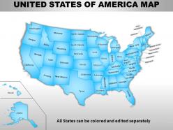 Usa country powerpoint maps
Skillfully designed USA country PowerPoint map suitable for professionals from diverse sectors i.e. scholars, teachers, business professionals, researchers, etc. Personalize it with brand name and logo of your own. Enough space available to put dummy content. Manually editable presentation graphics, text, font, colors, layout, region and shading. Use these maps to show sales territories, business and new office locations, travel planning etc. in your presentations. Well adaptable with all the software’s and Google slides. High resolution PowerPoint template theme. Simply click to add logo, trademark or name. Flexibility to convert in PDF or JPG form.
-
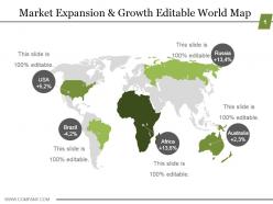 Market expansion and growth editable world map ppt model
Presenting market expansion and growth editable world map ppt model. This is a market expansion and growth editable world map ppt model. This is a five stage process. The stages in this process are usa, russia, brazil, africa, australia.
-
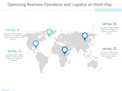 Optimizing business operations and logistics on world map ppt slide
Presenting optimizing business operations and logistics on world map ppt slide. This is a optimizing business operations and logistics on world map ppt slide. This is a four stage process. The stages in this process are business, strategy, location, globe, geography.
-
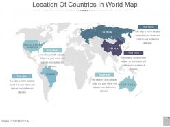 Location of countries in world map powerpoint slides
Presenting location of countries in world map powerpoint slides. This is a location of countries in world map powerpoint slides. This is a five stage process. The stages in this process are united states america, brazil, russia, china, australia.
-
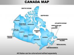 Canada country powerpoint maps
These high quality, editable powerpoint state maps have been carefully created by our professional team to display location and other geographic details in your PowerPoint presentation. Each map is vector based and is 100% editable in powerpoint. Each and every property of any region - color, size, shading etc can be modified to help you build an effective powerpoint presentation. Use these maps to show sales territories, business and new office locations, travel planning etc in your presentations. Any text can be entered at any point in the powerpoint map slide. Simply DOWNLOAD, TYPE and PRESENT!
-
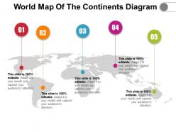 World map of the continents diagram
Presenting World Map Of The Continents Diagram. Change the colors, font type, font size, and the background of the slide as per choice and match it to your presentation theme. Get this readily available PPT template that is editable. Customize it as per your requirements. Convert it into various file formats, including JPG, PDF, and various other file formats. Present it in front of large audiences because of its splendid pixel quality. Enter the related content in the text placeholders.
-
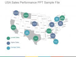 Usa sales performance ppt sample file
Fully editable USA sales performance PPT sample file presentation slideshow. Crafted using latest tools and techniques. These are trending these days due to their unique style. They can easily be converted to different file formats such as Jpeg and Pdf. They can be viewed in wide screens for more clear vision. They are result and technology oriented. They easily adapt the changes and work accordingly. Entirely compatible PPT slides with Google Slides. Presentation templates are easily modifiable as required.
-
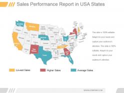 Sales performance report in usa states ppt sample
Introducing sales performance report in USA states PPT template. Replace the watermark with your company’s name or logo. Convertible into numerous format options like JPEG, JPG or PDF. User friendly structure of the slides. Access to edit the content, style, size and orientation of the PPT slides. Use of high resolution images and the graphics. Ease to share the Presentation slide in standard and widescreen view. Has a combination of attractive visuals and graphics. Valuable for the business presenters and entrepreneurs.
-
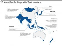 Asia pacific map with text holders
Presenting this set of slides with name - Asia Pacific Map With Text Holders. This is a one stage process. The stages in this process are Asia Pacific Map, Countries.
-
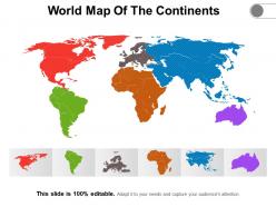 World map of the continents
Presenting World Map Of The Continents slideshow. You can easily download this into multiple images or document formats like JPEG and PDF. It supports both the standard and widescreen ratios. It is compatible with Google Slides and MS PowerPoint. Alter the style, size, background, and other attributes of the slide. High-quality graphics will ensure that distortion does not occur.
-
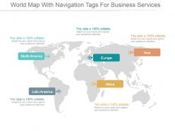 World map with navigation tags for business services ppt slide styles
Presenting world map with navigation tags for business services ppt slide styles. This is a world map with navigation tags for business services ppt slide styles. This is a five stage process. The stages in this process are north america, europe, asia, latin america, africa.
-
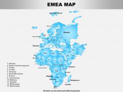 Emea powerpoint maps
Presenting this set of slides with name Emea Powerpoint Maps. The topics discussed in these slides are Map, Country. This is a completely editable PowerPoint presentation and is available for immediate download. Download now and impress your audience.
-
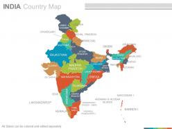 India country powerpoint maps
Presenting india country powerpoint maps. These high quality, editable powerpoint state maps have been carefully created by our professional team to display location and other geographic details in your PowerPoint presentation. Each map is vector based and is 100 percent editable in powerpoint. Each and every property of any region - color, size, shading etc can be modified to help you build an effective powerpoint presentation. Use these maps to show sales territories, business and new office locations, travel planning etc in your presentations. Any text can be entered at any point in the powerpoint map slide. Simply DOWNLOAD, TYPE and PRESENT.
-
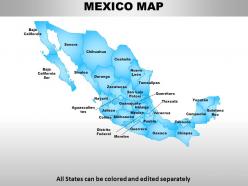 Mexico country powerpoint maps
These high quality, editable powerpoint state maps have been carefully created by our professional team to display location and other geographic details in your PowerPoint presentation. Each map is vector based and is 100% editable in powerpoint. Each and every property of any region - color, size, shading etc can be modified to help you build an effective powerpoint presentation. Use these maps to show sales territories, business and new office locations, travel planning etc in your presentations. Any text can be entered at any point in the powerpoint map slide. Simply DOWNLOAD, TYPE and PRESENT!
-
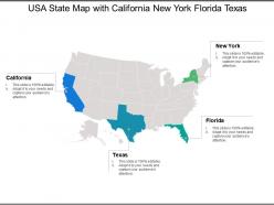 Usa state map with california new york florida texas
Presenting this set of slides with name - Usa State Map With California New York Florida Texas. This is a four stage process. The stages in this process are Usa State Map, Usa State Area, Usa State Location.
-
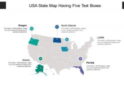 Usa state map having five text boxes
Presenting this set of slides with name - Usa State Map Having Five Text Boxes. This is a five stage process. The stages in this process are Usa State Map, Usa State Area, Usa State Location.
-
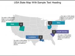 Usa state map with sample text heading
Presenting this set of slides with name - Usa State Map With Sample Text Heading. This is a four stage process. The stages in this process are Usa State Map, Usa State Area, Usa State Location.
-
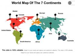 World map of the 7 continents
• Ease of download • Thoroughly editable slides. • High resolution visuals which do not decipher in quality when projected on wide screen. • Impressive picture quality. • Compatibility with numerous online and offline software options. • Compatible with multiple formats. • Ease of addition and exclusion of slide content as and when needed by the presenter. • Ease of including company specific name, logo and trademark for personalization • Used by geography students and teachers.
-
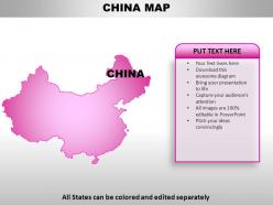 China country powerpoint maps
These high quality, editable powerpoint country maps have been carefully created by our professional team to display location and other geographic details in your PowerPoint presentation. Each map is vector based and is 100% editable in powerpoint. Each and every property of any region - color, size, shading etc can be modified to help you build an effective powerpoint presentation. Use these maps to show sales territories, business and new office locations, travel planning etc in your presentations. Any text can be entered at any point in the powerpoint map slide. Simply DOWNLOAD, TYPE and PRESENT!
-
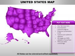 United states country powerpoint maps
These high quality, editable powerpoint country maps have been carefully created by our professional team to display location and other geographic details in your PowerPoint presentation. Each map is vector based and is 100% editable in powerpoint. Each and every property of any region - color, size, shading etc can be modified to help you build an effective powerpoint presentation. Use these maps to show sales territories, business and new office locations, travel planning etc in your presentations. Any text can be entered at any point in the powerpoint map slide. Simply DOWNLOAD, TYPE and PRESENT!
-
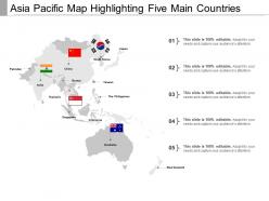 Asia pacific map
Presenting this set of slides with name - Asia Pacific Map. This is a one stage process. The stages in this process are Asia Pacific Map, Countries.
-
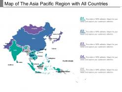 Map of the asia pacific region with all countries
Presenting this set of slides with name - Map Of The Asia Pacific Region With All Countries. This is a one stage process. The stages in this process are Asia Pacific Map, Countries.
-
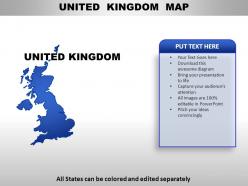 United kingdom country powerpoint maps
These high quality, editable powerpoint country maps have been carefully created by our professional team to display location and other geographic details in your PowerPoint presentation. Each map is vector based and is 100% editable in powerpoint. Each and every property of any region - color, size, shading etc can be modified to help you build an effective powerpoint presentation. Use these maps to show sales territories, business and new office locations, travel planning etc in your presentations. Any text can be entered at any point in the powerpoint map slide. Simply DOWNLOAD, TYPE and PRESENT!
-
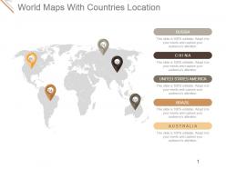 World maps with countries location presentation diagrams
Presenting world maps with countries location presentation diagrams. This is a world maps with countries location presentation diagrams. This is a five stage process. The stages in this process are russia, china, united states america, brazil, australia.
-
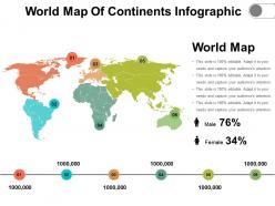 World map of continents infographic
Presenting world map of continents infographic. This is a world map of continents infographic. This is a six stage process. The stages in this process are world map of the continents, worldwide, continents map.
-
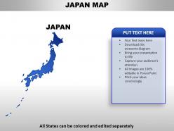 Japan country powerpoint maps
This PowerPoint design can be used for expressing your business strategies in the following locations in an attractive manner. The colors of the states shown can be altered in any PowerPoint software. The text shown in the slide can also be according to your analytics. Downloading this slide will give you access to its full version, where you can access all this.
-
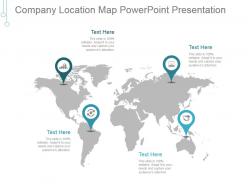 Company location map powerpoint presentation
Presenting company location map powerpoint presentation. This is a company location map powerpoint presentation. This is a four stage process. The stages in this process are map, pointers, globe, business, marketing.
-
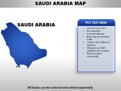 Saudi arabia country powerpoint maps
These high quality, editable powerpoint country maps have been carefully created by our professional team to display location and other geographic details in your PowerPoint presentation. Each map is vector based and is 100% editable in powerpoint. Each and every property of any region - color, size, shading etc can be modified to help you build an effective powerpoint presentation. Use these maps to show sales territories, business and new office locations, travel planning etc in your presentations. Any text can be entered at any point in the powerpoint map slide. Simply DOWNLOAD, TYPE and PRESENT!
-
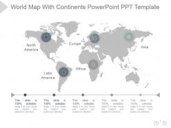 World map with continents powerpoint ppt template
Presenting world map with continents powerpoint ppt template. Presenting world map with continents powerpoint ppt template. This is a world map with continents powerpoint ppt template. This is a five stage process. The stages in this process are world map, continents, geographical, location, strategy.
-
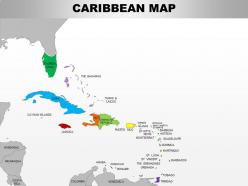 0714 caribbean region powerpoint maps showing bahamas haiti etc
Use of high-resolution, pixel friendly graphics in the slide design. Access to customize the entire ribbon of the slide icon. Allow to adjust the aspect ratio or the cropping of images. Offer insertion of elements from online platforms. Enjoy removing background and redesigning it. Functional for the business managers, marketing people, developers and relevant employees.
-
 Global business leadership team on world map powerpoint slide themes
Presenting global business leadership team on world map powerpoint slide themes. This is a global business leadership team on world map powerpoint slide themes. This is a five stage process. The stages in this process are charlie albert, sofia clark, kelly hansen, marcus owen, jessica disuza.
-
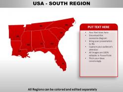 Usa south region country powerpoint maps
These high quality, editable powerpoint state maps have been carefully created by our professional team to display location and other geographic details in your PowerPoint presentation. Each map is vector based and is 100% editable in powerpoint. Each and every property of any region - color, size, shading etc can be modified to help you build an effective powerpoint presentation. Use these maps to show sales territories, business and new office locations, travel planning etc in your presentations. Any text can be entered at any point in the powerpoint map slide. Simply DOWNLOAD, TYPE and PRESENT!
-
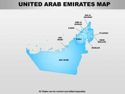 United arab emirates powerpoint maps
Hassle free download in easy steps. Fully modifiable text as per the context. Insert your own brand name, logo, trademark etc. Absolutely modifiable color, contrast, orientation and size of PPT icons. Edit PPT images as per requirement without any resolution change. Works smoothly with any software and fully compatible with Google slides. Convert into PDF or JPG according to requirement.
-
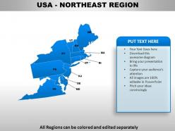 Usa northeast region country powerpoint maps
These high quality, editable powerpoint state maps have been carefully created by our professional team to display location and other geographic details in your PowerPoint presentation. Each map is vector based and is 100% editable in powerpoint. Each and every property of any region - color, size, shading etc can be modified to help you build an effective powerpoint presentation. Use these maps to show sales territories, business and new office locations, travel planning etc in your presentations. Any text can be entered at any point in the powerpoint map slide. Simply DOWNLOAD, TYPE and PRESENT!
-
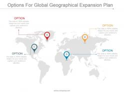 Options for global geographical expansion plan ppt slide examples
Presenting options for global geographical expansion plan PPT slide examples. Bright and informative PowerPoint presentation slides to gives regulations to achieve business targets. Predesigned formats to save time. Include your company logo and researched data by editing. Edit the color schemes, replace icons, change the font type and size. Convert the PPT design to pdf or jpeg formats needed. Compatible with Google slides and various offline and online options. Available in both standard 4:3 and widescreen format 16:9 after downloading. Download in a snap to explore full features.
-
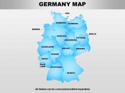 Germany powerpoint maps
Allow editing or replacing of the icons. Provided instructions to change and edit the slide icon. Easy to download and save in the Jpg or PDF format. Access to open on a wide screen view. Offer to change the content, size, style and orientation of the slide icons. Useful for the sales professionals and the business learners and geography students.
-
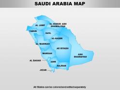 South arabia powerpoint maps
Quick to download in simple steps. Edit as per liking with undiminished high resolution. No space constraint for titles and subtitles. Absolutely compatible with Google slides and easily convertible into PDF, JPG. Fully editable text and modifiable color, contrast, size and orientation of infographics. Equally suitable for business professionals, trainers, educators and public officials.
-
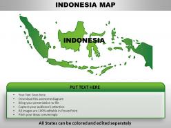 Indonesia country powerpoint maps
These high quality, editable powerpoint country maps have been carefully created by our professional team to display location and other geographic details in your PowerPoint presentation. Each map is vector based and is 100% editable in powerpoint. Each and every property of any region - color, size, shading etc can be modified to help you build an effective powerpoint presentation. Use these maps to show sales territories, business and new office locations, travel planning etc in your presentations. Any text can be entered at any point in the powerpoint map slide. Simply DOWNLOAD, TYPE and PRESENT!
-
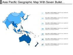 Asia pacific geographic map with seven bullet points
Presenting this set of slides with name - Asia Pacific Geographic Map With Seven Bullet Points. This is a one stage process. The stages in this process are Asia Pacific Map, Countries.
-
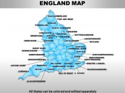 Uk england country powerpoint maps
These high quality, editable powerpoint state maps have been carefully created by our professional team to display location and other geographic details in your PowerPoint presentation. Each map is vector based and is 100% editable in powerpoint. Each and every property of any region - color, size, shading etc can be modified to help you build an effective powerpoint presentation. Use these maps to show sales territories, business and new office locations, travel planning etc in your presentations. Any text can be entered at any point in the powerpoint map slide. Simply DOWNLOAD, TYPE and PRESENT!
-
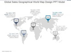 Global sales geographical world map design ppt model
Presenting global sales geographical world map design ppt model. This is a global sales geographical world map design ppt model. This is a five stage process. The stages in this process are location, business, strategy, marketing, analysis.
-
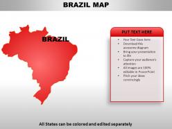 Brazil country powerpoint maps
These high quality, editable powerpoint country maps have been carefully created by our professional team to display location and other geographic details in your PowerPoint presentation. Each map is vector based and is 100% editable in powerpoint. Each and every property of any region - color, size, shading etc can be modified to help you build an effective powerpoint presentation. Use these maps to show sales territories, business and new office locations, travel planning etc in your presentations. Any text can be entered at any point in the powerpoint map slide. Simply DOWNLOAD, TYPE and PRESENT!
-
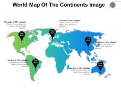 World map of the continents image
Presenting World Map Of the Continents Highlight Image. This slide is compatible with Google Slides, which is an added advantage. The slide is completely customizable in PowerPoint and other related software. Modify the font style, font color, and other components with ease. Transform this PPT into numerous documents or image formats like PDF or JPEG. High-quality graphics ensure that the picture quality is maintained.
-
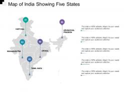 Map of india showing five states
Presenting this set of slides with name - Map Of India Showing Five States. This is a one stage process. The stages in this process are India, South Asian Country,.
-
 Australia country powerpoint maps
High quality visuals which do not pixelate when projected on wide screen. Ease of inclusion and exclusion of content as per the need of the organization. Execute the changes in the shape, color, text and content of the slide content. Compatible with multiple number of software options available both online and offline. Harmonious with set of formats. You may increase the level of customization with personalization. Used by sales team, entrepreneurs, marketers, strategists, analysts and scholars.
-
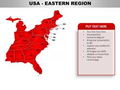 Usa eastern region country powerpoint maps
These high quality, editable powerpoint state maps have been carefully created by our professional team to display location and other geographic details in your PowerPoint presentation. Each map is vector based and is 100% editable in powerpoint. Each and every property of any region - color, size, shading etc can be modified to help you build an effective powerpoint presentation. Use these maps to show sales territories, business and new office locations, travel planning etc in your presentations. Any text can be entered at any point in the powerpoint map slide. Simply DOWNLOAD, TYPE and PRESENT!
-
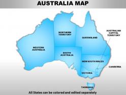 Australia continents powerpoint maps with act territory
We are proud to present our australia continents powerpoint maps with act territory. Our Australia Continents PowerPoint Maps with ACT Territory Power Point Templates Are Topically Designed To Provide An Attractive Backdrop To Any Subject. Use Them To Look Like A Presentation Pro. Use Our Australia Continents PowerPoint Maps with ACT Territory Power Point Templates To Effectively Help You Save Your Valuable Time. They Are Readymade To Fit Into Any Presentation Structure.
-
 Geographical Coverage Powerpoint Presentation Slides
Introducing Geographical Coverage PowerPoint Presentation Slides. This presentation includes 24 professionally designed PPT templates, all of them being 100 % editable in PowerPoint. Edit the fonts, colors, and slide background as per your needs. When you download the presentation, you get the templates in both widescreen and standard screen. The presentation is compatible with Google Slides and can be saved in JPG or PDF format.
-
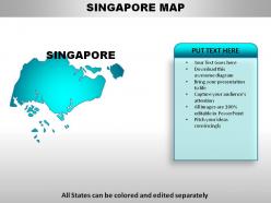 Singapore country powerpoint maps
These high quality, editable powerpoint country maps have been carefully created by our professional team to display location and other geographic details in your PowerPoint presentation. Each map is vector based and is 100% editable in powerpoint. Each and every property of any region - color, size, shading etc can be modified to help you build an effective powerpoint presentation. Use these maps to show sales territories, business and new office locations, travel planning etc in your presentations. Any text can be entered at any point in the powerpoint map slide. Simply DOWNLOAD, TYPE and PRESENT!
-
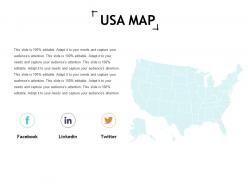 Usa map ppt slides icon
Presenting this set of slides with name - Usa Map Ppt Slides Icon. This is a one stage process. The stages in this process are Business, Management, Strategy, Analysis, Marketing.
-
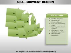 Usa midwest region country powerpoint maps
These high quality, editable powerpoint state maps have been carefully created by our professional team to display location and other geographic details in your PowerPoint presentation. Each map is vector based and is 100% editable in powerpoint. Each and every property of any region - color, size, shading etc can be modified to help you build an effective powerpoint presentation. Use these maps to show sales territories, business and new office locations, travel planning etc in your presentations. Any text can be entered at any point in the powerpoint map slide. Simply DOWNLOAD, TYPE and PRESENT!
-
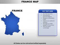 France country powerpoint maps
These high quality, editable powerpoint country maps have been carefully created by our professional team to display location and other geographic details in your PowerPoint presentation. Each map is vector based and is 100% editable in powerpoint. Each and every property of any region - color, size, shading etc can be modified to help you build an effective powerpoint presentation. Use these maps to show sales territories, business and new office locations, travel planning etc in your presentations. Any text can be entered at any point in the powerpoint map slide. Simply DOWNLOAD, TYPE and PRESENT!
-
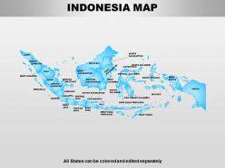 Indonesia powerpoint maps
Swift and simple to download without unnecessary hassles. Easily modifiable text as per your requirement. Incorporate seamlessly with Google slides. Totally modifiable PPT infographics- change color, size, orientation and contrast. Simple to convert into PDF or JPG format. Works smoothly with any software. No change in original resolution of PPT images after editing.
-
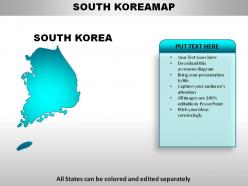 South korea country powerpoint maps
These high quality, editable powerpoint country maps have been carefully created by our professional team to display location and other geographic details in your PowerPoint presentation. Each map is vector based and is 100% editable in powerpoint. Each and every property of any region - color, size, shading etc can be modified to help you build an effective powerpoint presentation. Use these maps to show sales territories, business and new office locations, travel planning etc in your presentations. Any text can be entered at any point in the powerpoint map slide. Simply DOWNLOAD, TYPE and PRESENT!
-
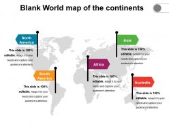 Blank world map of the continents
Presenting Blank World Map Of The Continents. The slide is completely customizable in PowerPoint and other related software. This slide is compatible with Google Slides, which is an added advantage. Modify the font style, font color, and other components with ease. Transform this PPT into numerous documents or image formats like PDF or JPEG. High-quality graphics ensure that the picture quality is maintained.
-
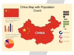 China map with population count
Presenting China Map With Population Count PPT slide is one of the best presentation diagrams that has been professionally designed and is fully editable in PowerPoint.You can easily adjust the font size, text icon , diagram and any color as per your needs and requirement. You can easily include your company name and logo in the slide. You can replace the existing content with the new one. You can save this PPT in JPG or PDF format without any issue. It enables you to study the dynamics properly and clearly.
-
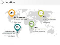 Location presentation diagrams
Presenting location presentation diagrams. This is a location presentation diagrams. This is a four stage process. The stages in this process are latin america, north america, africa, asia.
-
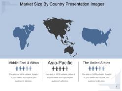 Market size by country presentation images
Presenting market size by country presentation images. This is a market size by country presentation images. This is a three stage process. The stages in this process are middle east and africa, asia pacific, asia pacific, the united states.
-
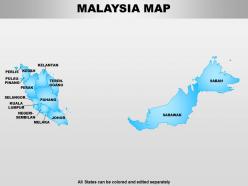 Malaysia powerpoint maps
Presenting malaysia powerpoint maps. This Power Point template diagram has been crafted with graphic of map for Malaysia country. Use this PPT diagram for business and travel information for this country .This PPT diagram can be used for business and travel related presentation.
-
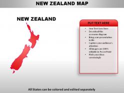 New zealand country powerpoint maps
These high quality, editable powerpoint country maps have been carefully created by our professional team to display location and other geographic details in your PowerPoint presentation. Each map is vector based and is 100% editable in powerpoint. Each and every property of any region - color, size, shading etc can be modified to help you build an effective powerpoint presentation. Use these maps to show sales territories, business and new office locations, travel planning etc in your presentations. Any text can be entered at any point in the powerpoint map slide. Simply DOWNLOAD, TYPE and PRESENT!


