


Uzbekistan country powerpoint maps




Try Before you Buy Download Free Sample Product
 Impress Your
 Audience
 100%
100% Editable
 Save Hours
 of Time


Our Uzbekistan Country Powerpoint Maps have a far reaching impact. Give greater longevity to your ideas.
People who downloaded this PowerPoint presentation also viewed the following :
Uzbekistan country powerpoint maps with all 7 slides:
Our Uzbekistan Country Powerpoint Maps are a bag of tricks. They will conjure up whatever effect you desire.


FAQs for Uzbekistan
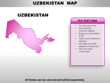
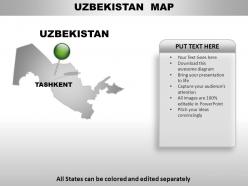
Uzbekistan's geographical maps emphasize current administrative divisions, major cities like Tashkent and Samarkand, transportation networks, and natural resources including cotton-producing regions and mineral deposits. Historical maps of the region reveal the evolution from ancient Silk Road trade routes, shifting borders of empires like the Timurid and Khanate periods, ultimately showing how modern infrastructure development has transformed this strategically important Central Asian crossroads.
Topographic maps of Uzbekistan reveal elevation changes through contour lines, color gradients, and terrain symbols that distinguish the Tian Shan mountains in the east from the Kyzylkum Desert's flat expanses in the central regions. These detailed cartographic representations enable geographers, urban planners, and resource management teams to analyze terrain variations, plan infrastructure projects, and assess agricultural potential, ultimately delivering strategic insights for development initiatives across this geographically diverse Central Asian nation.
Digital maps enhance learning about Uzbekistan's cultural and historical sites by providing interactive layers, virtual tours, multimedia integration, timeline features, and comparative analysis tools. These technologies enable students and researchers to explore ancient Silk Road routes, visualize architectural evolution in cities like Samarkand and Bukhara, and access detailed historical contexts, ultimately delivering immersive educational experiences that traditional static resources cannot match.
Thematic maps visualize Uzbekistan's demographic patterns through population density indicators, age distributions, ethnic compositions, urban-rural ratios, and migration trends across regions. These specialized maps enable government agencies, urban planners, and international organizations to identify population clusters, plan infrastructure development, and allocate resources strategically, ultimately delivering targeted public services and informed policy decisions for Uzbekistan's diverse communities.
Interactive maps enhance tourist navigation in Uzbekistan by providing real-time GPS tracking, offline accessibility, multilingual support, and integrated attraction details with reviews and ratings. These digital tools streamline exploration of cities like Tashkent, Samarkand, and Bukhara by offering route optimization, transportation options, and cultural site information, ultimately delivering seamless travel experiences while maximizing time efficiency for discovering Uzbekistan's rich heritage.
**INPUT**: What historical events are best represented through political maps of Uzbekistan? **OUTPUT**: Political maps of Uzbekistan effectively illustrate the Silk Road trade networks, Soviet administrative reorganizations, independence in 1991, regional autonomy developments, and border demarcations with neighboring Central Asian states. These cartographic representations enable historians, educators, and policy analysts to visualize territorial evolution, administrative changes, and geopolitical shifts, with many institutions finding that layered historical mapping delivers enhanced understanding of regional development and strategic positioning. [Word count: 60]
Climate maps of Uzbekistan inform agricultural practices by revealing precipitation patterns, temperature zones, soil moisture levels, and seasonal variations across different regions. These detailed geographic insights enable farmers to select appropriate crops, optimize irrigation timing, and implement water-efficient techniques, with agricultural cooperatives in Ferghana Valley and Khorezm finding that strategic crop rotation ultimately enhances yields while minimizing resource waste.
GIS delivers significant benefits for urban planning in cities like Tashkent through enhanced spatial analysis, infrastructure optimization, demographic mapping, and resource allocation management. These systems enable planners to visualize development patterns, assess traffic flow, monitor utilities distribution, and predict growth impacts, ultimately streamlining decision-making processes while delivering more efficient city services and sustainable urban development.
Educational institutions can utilize Uzbekistan maps to teach Central Asian geography by exploring regional connectivity, trade routes, cultural exchanges, and geopolitical relationships across the broader region. Through interactive mapping exercises, students examine how Uzbekistan's position influences regional dynamics, resource distribution, and historical Silk Road connections, while geography departments find that comparative analysis with neighboring countries enhances understanding of Central Asian interconnectedness and strategic importance.
High-quality Uzbekistan maps for academic and professional use include government cartographic institutes, international mapping organizations like USGS and European Space Agency, GIS databases such as OpenStreetMap and ArcGIS, and specialized academic publishers. These resources deliver detailed topographical data, administrative boundaries, and demographic overlays through digital platforms and print formats, with many researchers and consultants finding that combining multiple sources enhances accuracy for strategic planning and analysis.
Uzbekistan's transportation maps showcase extensive railway networks connecting major cities like Tashkent, Samarkand, and Bukhara, alongside strategic highways linking Central Asian neighbors and China's Belt and Road corridors. These infrastructure arteries reflect the country's position as a regional trade hub, with improved connectivity facilitating cotton exports, mineral transport, and cross-border commerce, ultimately enhancing economic integration and competitive advantage.
Cartography promotes Uzbekistan's cultural heritage and tourism by highlighting Silk Road routes, UNESCO World Heritage sites like Samarkand and Bukhara, traditional crafts regions, and architectural landmarks through visually compelling maps. These strategic mapping tools enhance visitor experiences by showcasing cultural corridors and historical connections, ultimately delivering greater tourism engagement and cultural appreciation, with many destinations finding that detailed cartographic presentations significantly increase visitor interest and cultural understanding.
Cartographers mapping Uzbekistan's remote areas face challenges including limited ground access across vast desert regions, sparse infrastructure in rural zones, rapidly changing agricultural boundaries, and coordination across multiple administrative districts. These obstacles require strategic combinations of satellite imagery, local partnerships, and field verification teams, with many mapping organizations finding that collaborative approaches with regional authorities ultimately deliver more accurate representations and enhanced geographic understanding.
Maps assist in understanding historical Silk Road routes through Uzbekistan by visualizing ancient trade pathways, geographic obstacles, and strategic city locations like Samarkand and Bukhara. These cartographic tools enable researchers, educators, and tourism professionals to trace commercial networks, identify cultural exchange points, and analyze how natural barriers shaped trading patterns, ultimately delivering deeper insights into Central Asian economic history and enhancing heritage tourism experiences.
**INPUT**: What innovations in mapping technology are shaping the future of cartography for Uzbekistan? **OUTPUT**: Mapping innovations transforming Uzbekistan's cartography include satellite imaging, GIS integration, drone surveying, 3D modeling, and real-time data analytics. These technologies streamline urban planning, agricultural monitoring, and infrastructure development by enhancing accuracy, reducing survey costs, and enabling faster decision-making, with government agencies and development organizations finding competitive advantages in resource management and strategic planning initiatives.
-
Perfect template with attractive color combination.
-
Excellent Designs.