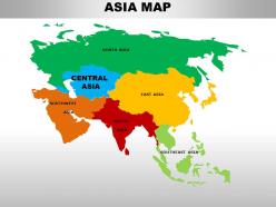
Powerpoint Templates for Maps
Save time and engage your audience with our fully editable PowerPoint PPT Templates and Slides.
-

Countries Maps Powerpoint Ppt Template Bundles
If you require a professional template with great design, then this Countries Maps Powerpoint Ppt Template Bundles is an ideal fit for you. Deploy it to enthrall your audience and increase your presentation threshold with the right graphics, images, and structure. Portray your ideas and vision using one hundred seventy four slides included in this complete deck. This template is suitable for expert discussion meetings presenting your views on the topic. With a variety of slides having the same thematic representation, this template can be regarded as a complete package. It employs some of the best design practices, so everything is well-structured. Not only this, it responds to all your needs and requirements by quickly adapting itself to the changes you make. This PPT slideshow is available for immediate download in PNG, JPG, and PDF formats, further enhancing its usability. Grab it by clicking the download button.
-

Usa maps flags landmarks monuments city and skyline deck powerpoint template
Presenting USA Maps Flags Landmarks Monuments City And Skyline Deck Powerpoint Template. Transform this presentation into formats like PDF, JPG, and PNG with ease. It is adaptable with Google Slides which makes it accessible at once. You can edit the PPT as per your requirements. This slideshow is available in both the standard and widescreen aspect ratios. High-quality graphics ensures that there is no room for deterioration.
-
America Geographic Maps Outline In Powerpoint Bundles
If you require a professional template with great design, then this America Geographic Maps Outline In Powerpoint Bundles is an ideal fit for you. Deploy it to enthrall your audience and increase your presentation threshold with the right graphics, images, and structure. Portray your ideas and vision using eighty one slides included in this complete deck. This template is suitable for expert discussion meetings presenting your views on the topic. With a variety of slides having the same thematic representation, this template can be regarded as a complete package. It employs some of the best design practices, so everything is well-structured. Not only this, it responds to all your needs and requirements by quickly adapting itself to the changes you make. This PPT slideshow is available for immediate download in PNG, JPG, and PDF formats, further enhancing its usability. Grab it by clicking the download button.
-
Turkey maps country and state powerpoint template
Presenting our Turkey country and states map PowerPoint template. This PPT layout holds a total of eighty-four slides and each slide is accessible in standard as well as wide-screen formats. It is completely editable as per your requirements and preferences as well. You can use it with Microsoft Office, Google slides, and many other presentation software.
-
Turkey country and state maps powerpoint template
This is a Turkey Country And State Maps Powerpoint Template. Showcase the emerging economical parameters of your country using this PowerPoint complete deck. This is a comprehensive set with a visually-appealing aesthetic design that will indisputably increase audience engagement. Use it to highlight the major landmarks of your country, its traditional features, and demographics with eighty three slides included in this set. You can also use the maps, charts, graphs, themes, and other components of this deck to bring more attention to the country dynamics, making it popular worldwide. Considering the information presented and showcased, this PowerPoint template can be used for the global expansion of your operations, with vivid colors, graphics, and visuals. This PPT template can be reproduced in PDF, PNG, and JPG formats, thus giving you a high level of control over its application and usage.
-
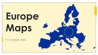
Europe Maps Powerpoint PPT Template Bundles PU Maps
Deliver a lucid presentation by utilizing this Europe Maps Powerpoint PPT Template Bundles PU Maps. Use it to present an overview of the topic with the right visuals, themes, shapes, and graphics. This is an expertly designed complete deck that reinforces positive thoughts and actions. Use it to provide visual cues to your audience and help them make informed decisions. A wide variety of discussion topics can be covered with this creative bundle such as sixty seven. All the sixty seven slides are available for immediate download and use. They can be edited and modified to add a personal touch to the presentation. This helps in creating a unique presentation every time. Not only that, with a host of editable features, this presentation can be used by any industry or business vertical depending on their needs and requirements. The compatibility with Google Slides is another feature to look out for in the PPT slideshow.
-
France maps flags landmarks monuments city and skyline deck powerpoint template
Presenting our France maps flags landmarks monuments city and skyline deck PowerPoint template. This PPT layout holds a total of seventy five slides and each slide is accessible in standard as well as wide-screen formats. It is completely editable as per your requirements and preferences as well. You can use it with Microsoft Office, Google slides, and many other presentation software.
-
Turkey maps flags landmarks monuments city and skyline deck powerpoint template
Presenting our Turkey maps flags landmarks monuments city and skyline deck PowerPoint template. This PPT layout holds a total of sixty-nine slides and each slide is accessible in standard as well as wide-screen formats. It is completely editable as per your requirements and preferences as well. You can use it with Microsoft Office, Google slides, and many other presentation software.
-
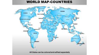
World continents powerpoint maps
Presenting world continents PowerPoint maps slide. This presentation diagram has been designed by professionals and its layout is fully customizable. You can convert the font type, font size, colors of the diagram, and background color as per your requirement. Easy to put in company logo, trademark or name; accommodate words to support the key points. Replace the dummy content in text placeholders with your presentation content. The slide is fully compatible with Google slides and can be saved in JPG or PDF format without any hassle. High quality graphics and icons ensure that there is no deterioration in quality.
-
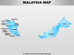
Malaysia powerpoint maps
Presenting malaysia powerpoint maps. This Power Point template diagram has been crafted with graphic of map for Malaysia country. Use this PPT diagram for business and travel information for this country .This PPT diagram can be used for business and travel related presentation.
-
Uk england country powerpoint maps
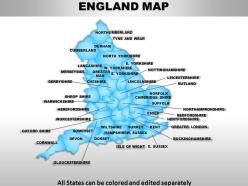
These high quality, editable powerpoint state maps have been carefully created by our professional team to display location and other geographic details in your PowerPoint presentation. Each map is vector based and is 100% editable in powerpoint. Each and every property of any region - color, size, shading etc can be modified to help you build an effective powerpoint presentation. Use these maps to show sales territories, business and new office locations, travel planning etc in your presentations. Any text can be entered at any point in the powerpoint map slide. Simply DOWNLOAD, TYPE and PRESENT!
-
Finding Your Way With Maps Effectively PPT Guidelines AT
Do not compromise on a template that erodes your messages impact. Introducing our engaging Finding Your Way With Maps Effectively PPT Guidelines AT complete deck, thoughtfully crafted to grab your audiences attention instantly. With this deck, effortlessly download and adjust elements, streamlining the customization process. Whether you are using Microsoft versions or Google Slides, it fits seamlessly into your workflow. Furthermore, it is accessible in JPG, JPEG, PNG, and PDF formats, facilitating easy sharing and editing. Not only that you also play with the color theme of your slides making it suitable as per your audiences preference.
-
Square Block Journey Maps For Stepwise Business Strategy Planning PPT Mockup AT
While your presentation may contain top-notch content, if it lacks visual appeal, you are not fully engaging your audience. Introducing our Square Block Journey Maps For Stepwise Business Strategy Planning PPT Mockup AT deck, designed to engage your audience. Our complete deck boasts a seamless blend of Creativity and versatility. You can effortlessly customize elements and color schemes to align with your brand identity. Save precious time with our pre-designed template, compatible with Microsoft versions and Google Slides. Plus, its downloadable in multiple formats like JPG, JPEG, and PNG. Elevate your presentations and outshine your competitors effortlessly with our visually stunning 100 percent editable deck.
-
Usa country powerpoint maps
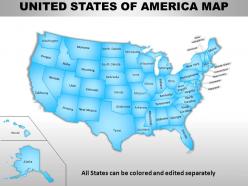
Skillfully designed USA country PowerPoint map suitable for professionals from diverse sectors i.e. scholars, teachers, business professionals, researchers, etc. Personalize it with brand name and logo of your own. Enough space available to put dummy content. Manually editable presentation graphics, text, font, colors, layout, region and shading. Use these maps to show sales territories, business and new office locations, travel planning etc. in your presentations. Well adaptable with all the software’s and Google slides. High resolution PowerPoint template theme. Simply click to add logo, trademark or name. Flexibility to convert in PDF or JPG form.
-
Spain powerpoint maps
Swift and simple to download at your convenience. Absolutely editable PPT infographics-change colors, contrast, orientation and sizes to your liking. Original resolution of PPT images unchanged after editing. Insert your own company logo, icons, company name, trademark, brand name etc. Fits seamlessly anywhere in your own presentation wherever needed.
-
Germany powerpoint maps
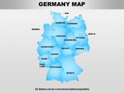
Allow editing or replacing of the icons. Provided instructions to change and edit the slide icon. Easy to download and save in the Jpg or PDF format. Access to open on a wide screen view. Offer to change the content, size, style and orientation of the slide icons. Useful for the sales professionals and the business learners and geography students.
-
United arab emirates powerpoint maps
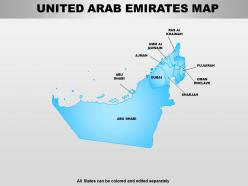
Hassle free download in easy steps. Fully modifiable text as per the context. Insert your own brand name, logo, trademark etc. Absolutely modifiable color, contrast, orientation and size of PPT icons. Edit PPT images as per requirement without any resolution change. Works smoothly with any software and fully compatible with Google slides. Convert into PDF or JPG according to requirement.
-
New zealand powerpoint maps
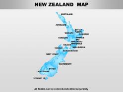
Presenting new zealand powerpoint maps. This Power Point template diagram has been crafted with graphic of map for Newzealand country. Use this PPT diagram for education opportunity and travel information for this country .This PPT diagram can be used for education and travel related presentation.
-
South africa powerpoint maps
Presenting south africa powerpoint maps. This Power Point template diagram has been crafted with graphic of map for country South Africa. Explain all major issues related with business for this country. Build an innovative presentation for South Africa related topics in any presentation.
-
Belgium powerpoint maps
Presenting belgium powerpoint maps. This Power Point template diagram has been crafted with graphic of state map for Belgium. Define any information related with country Belgium and make an impressive presentation for your viewers.
-
Pakistan powerpoint maps
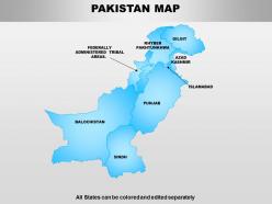
Presenting pakistan powerpoint maps. This Power Point template diagram has been crafted with graphic of map for Pakistan country. Use this PPT diagram for foreign affair and defence issues related topics for this country .This PPT diagram can be used for politics and defence related presentation.
-
Sweden powerpoint maps
Presenting sweden powerpoint maps. This Power Point template diagram has been crafted with graphic of map for country Sweden. This PPT diagram is a good choice for business related topics for this country. Use this PPT diagram and get good remarks for your presentation.
-
Maps Navigation A Comprehensive Overview Today PPT Summary AT
Step up your game with our enchanting Maps Navigation A Comprehensive Overview Today PPT Summary AT deck, guaranteed to leave a lasting impression on your audience. Crafted with a perfect balance of simplicity, and innovation, our deck empowers you to alter it to your specific needs. You can also change the color theme of the slide to mold it to your companys specific needs. Save time with our ready-made design, compatible with Microsoft versions and Google Slides. Additionally, its available for download in various formats including JPG, JPEG, and PNG. Outshine your competitors with our fully editable and customized deck.
-
Netherland powerpoint maps
Presenting netherland powerpoint maps. This Power Point template diagram has been crafted with graphic of map for country Netherland. This PPT diagram contains the state map for this country. Use this PPT diagram for business and international matters related presentations.
-
Kenya powerpoint maps
Presenting kenya powerpoint maps. This Power Point template diagram has been crafted with graphic of map for Kenya country. Use this PPT diagram for tourism and travel information for this country .This PPT diagram can be used for business and travel related presentation.
-
Ireland powerpoint maps
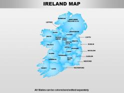
Presenting ireland powerpoint maps. This Power Point template diagram has been crafted with graphic of map for Ireland country. Use this PPT diagram for business issues and location navigation related topics .This PPT diagram can be used for business and management related presentation.
-
Portugal powerpoint maps
These diagrams are popular and in demand due to their incomparability. They have the ability to benefit different businesses. They can be modified by changing their colours and contents. They do not require any spiralised knowledge to use them. Their merger is easy and error free.
-
Germany maps flags landmarks monuments city and skyline deck powerpoint template
Presenting our Germany maps flags landmarks monuments city and skyline deck PowerPoint template. This PPT layout holds a total of sixty four slides and each slide is accessible in standard as well as wide-screen formats. It is completely editable as per your requirements and preferences as well. You can use it with Microsoft Office, Google slides, and many other presentation software.
-
Ukraine powerpoint maps
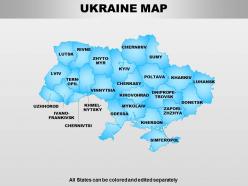
Presenting ukraine powerpoint maps. This Power Point template diagram has been crafted with graphic of state map for Ukraine. Define any social and general topics related with this country and build an impressive presentation for your viewers.
-
Finland powerpoint maps
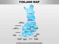
Presenting finland powerpoint maps. This Power Point template diagram has been crafted with graphic of Finland countrys map. Define any social and political matters related with country Finland and make build a quality presentation for your viewers.
-
Czech republic powerpoint maps
The colour scheme and pattern used in these are amazing and can easily grab viewers’ attention. They possess clear and bold graphics for better understanding and clarity. These can be viewed in widescreen. Their downloading is easy and effortless. They are well matched with google framework.
-
Maps Mastery Navigating The Digital Terrain PPT Summary AT
While your presentation may contain top-notch content, if it lacks visual appeal, you are not fully engaging your audience. Introducing our Maps Mastery Navigating The Digital Terrain PPT Summary AT deck, designed to engage your audience. Our complete deck boasts a seamless blend of Creativity and versatility. You can effortlessly customize elements and color schemes to align with your brand identity. Save precious time with our pre-designed template, compatible with Microsoft versions and Google Slides. Plus, its downloadable in multiple formats like JPG, JPEG, and PNG. Elevate your presentations and outshine your competitors effortlessly with our visually stunning 100 percent editable deck.
-
Papua new guinea powerpoint maps
Presenting papua new guinea powerpoint maps. This Power Point template diagram has been crafted with graphic of map for Papua New Guinea country. Use this PPT diagram for business strategy and technical info related topics for this country .This PPT diagram can be used for business and marketing related presentation.
-
Ecuador powerpoint maps
Presenting ecuador powerpoint maps. This Power Point template diagram has been crafted with graphic of map for Ecuador country. Use this PPT diagram for information and location related topics .This PPT diagram can be used for business and marketing related presentations.
-
Mastering Maps Essential Features For Navigation PPT Information AT
Do not compromise on a template that erodes your messages impact. Introducing our engaging Mastering Maps Essential Features For Navigation PPT Information AT complete deck, thoughtfully crafted to grab your audiences attention instantly. With this deck, effortlessly download and adjust elements, streamlining the customization process. Whether you are using Microsoft versions or Google Slides, it fits seamlessly into your workflow. Furthermore, it is accessible in JPG, JPEG, PNG, and PDF formats, facilitating easy sharing and editing. Not only that you also play with the color theme of your slides making it suitable as per your audiences preference.
-
Enhancing With Accurate Map Locations PPT Sample AT
While your presentation may contain top-notch content, if it lacks visual appeal, you are not fully engaging your audience. Introducing our Enhancing With Accurate Map Locations PPT Sample AT deck, designed to engage your audience. Our complete deck boasts a seamless blend of Creativity and versatility. You can effortlessly customize elements and color schemes to align with your brand identity. Save precious time with our pre-designed template, compatible with Microsoft versions and Google Slides. Plus, its downloadable in multiple formats like JPG, JPEG, and PNG. Elevate your presentations and outshine your competitors effortlessly with our visually stunning 100 percent editable deck.
-
Europe continents powerpoint maps
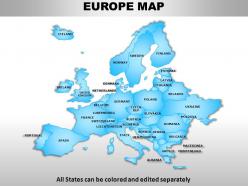
These high quality, editable powerpoint country maps have been carefully created by our professional team to display location and other geographic details in your PowerPoint presentation. Each map is vector based and is 100% editable in powerpoint. Each and every property of any region - color, size, shading etc can be modified to help you build an effective powerpoint presentation. Use these maps to show sales territories, business and new office locations, travel planning etc in your presentations. Any text can be entered at any point in the powerpoint map slide. Simply DOWNLOAD, TYPE and PRESENT!
-
South arabia powerpoint maps
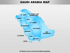
Quick to download in simple steps. Edit as per liking with undiminished high resolution. No space constraint for titles and subtitles. Absolutely compatible with Google slides and easily convertible into PDF, JPG. Fully editable text and modifiable color, contrast, size and orientation of infographics. Equally suitable for business professionals, trainers, educators and public officials.
-
Data Visualization With Graphs And Maps PPT Presentation AT
Do not compromise on a template that erodes your messages impact. Introducing our engaging Data Visualization With Graphs And Maps PPT Presentation AT complete deck, thoughtfully crafted to grab your audiences attention instantly. With this deck, effortlessly download and adjust elements, streamlining the customization process. Whether you are using Microsoft versions or Google Slides, it fits seamlessly into your workflow. Furthermore, it is accessible in JPG, JPEG, PNG, and PDF formats, facilitating easy sharing and editing. Not only that you also play with the color theme of your slides making it suitable as per your audiences preference.
-
Italy powerpoint maps
Easy to download and save in the format you like. Replace the content with your business information. Access to use with the Google Slides. Pixel friendly images and graphics in the slide design. Open on a wide screen view without any fear of pixelating. Useful for the business managers, sales professionals and the business learners and geography students.
-
South asia continents powerpoint maps
These high quality, editable powerpoint country maps have been carefully created by our professional team to display location and other geographic details in your PowerPoint presentation. Each map is vector based and is 100% editable in powerpoint. Each and every property of any region - color, size, shading etc can be modified to help you build an effective powerpoint presentation. Use these maps to show sales territories, business and new office locations, travel planning etc in your presentations. Any text can be entered at any point in the powerpoint map slide. Simply DOWNLOAD, TYPE and PRESENT!
-
Maps For Immersive Route Visualization And Navigation PPT Graphics AT
Ditch the Dull templates and opt for our engaging Maps For Immersive Route Visualization And Navigation PPT Graphics AT deck to attract your audience. Our visually striking design effortlessly combines creativity with functionality, ensuring your content shines through. Compatible with Microsoft versions and Google Slides, it offers seamless integration of presentation. Save time and effort with our pre-designed PPT layout, while still having the freedom to customize fonts, colors, and everything you ask for. With the ability to download in various formats like JPG, JPEG, and PNG, sharing your slides has never been easier. From boardroom meetings to client pitches, this deck can be the secret weapon to leaving a lasting impression.
-
Jordan powerpoint maps
These diagrams are crafted by cautiously reviewing the viewer needs. These can save both time and effort as they are pre-designed. These are compatible with Google. They are action and result oriented. They can be tailored by any user at any time. They impose a strong impact on the audience.
-
Chile powerpoint maps
Presenting chile powerpoint maps. This Power Point template diagram has been crafted with graphic of map. We have used map of Chile with state division. Use this PPT diagram for business opportunities and management analysis related topics for this country. Build an exclusive presentation for your viewers.
-
Venezuela powerpoint maps
Presenting venezuela powerpoint maps. This Power Point template diagram has been crafted with graphic of map for Venezuela country. Use this PPT diagram for cultural heritage and information related topics for this country .This PPT diagram can be used for business and marketing related presentation.
-
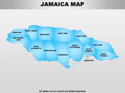
Jamaica powerpoint maps
These diagrams are created by carefully analyzing the market trends. They offer easy and convenient merger with your presentation. These have time-saving capabilities. These are compatible with Google. They display professionalism and are result oriented. They can be modified by any user at any time.
-
South america continents powerpoint maps
PowerPoint slide can be edited into JPEG and PDF. Alternate to adjust the PPT diagram as per the desire. Pixels don’t break even when you share in widescreen display. Presentation template functions well with Google slides. Superlative quality images and graphics are used in the PPT graphic. Download comes with different nodes and stages. Easy to amend and add business credentials such as logo, name and other elements that you want to add.
-
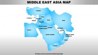
Middle east asia continents powerpoint maps
These high quality, editable powerpoint country maps have been carefully created by our professional team to display location and other geographic details in your PowerPoint presentation. Each map is vector based and is 100% editable in powerpoint. Each and every property of any region - color, size, shading etc can be modified to help you build an effective powerpoint presentation. Use these maps to show sales territories, business and new office locations, travel planning etc in your presentations. Any text can be entered at any point in the powerpoint map slide. Simply DOWNLOAD, TYPE and PRESENT!
-
Mastering Maps Compass And GPS Systems PPT Sample AT
Ditch the Dull templates and opt for our engaging Mastering Maps Compass And GPS Systems PPT Sample AT deck to attract your audience. Our visually striking design effortlessly combines creativity with functionality, ensuring your content shines through. Compatible with Microsoft versions and Google Slides, it offers seamless integration of presentation. Save time and effort with our pre designed PPT layout, while still having the freedom to customize fonts, colors, and everything you ask for. With the ability to download in various formats like JPG, JPEG, and PNG, sharing your slides has never been easier. From boardroom meetings to client pitches, this deck can be the secret weapon to leaving a lasting impression.
-
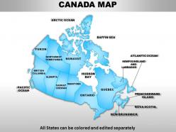
Canada country powerpoint maps
These high quality, editable powerpoint state maps have been carefully created by our professional team to display location and other geographic details in your PowerPoint presentation. Each map is vector based and is 100% editable in powerpoint. Each and every property of any region - color, size, shading etc can be modified to help you build an effective powerpoint presentation. Use these maps to show sales territories, business and new office locations, travel planning etc in your presentations. Any text can be entered at any point in the powerpoint map slide. Simply DOWNLOAD, TYPE and PRESENT!
-
Australia continents powerpoint maps with act territory
We are proud to present our australia continents powerpoint maps with act territory. Our Australia Continents PowerPoint Maps with ACT Territory Power Point Templates Are Topically Designed To Provide An Attractive Backdrop To Any Subject. Use Them To Look Like A Presentation Pro. Use Our Australia Continents PowerPoint Maps with ACT Territory Power Point Templates To Effectively Help You Save Your Valuable Time. They Are Readymade To Fit Into Any Presentation Structure.
-
Uk scotland country powerpoint maps
User friendly and highly organised PPT templates. Customization of Presentation graphics and diagrams according to desire and need. Fit into widescreen. Effortless conversion into PDF/ JPG format. Personalisation by insertion of company name, trademark or logo. Compatible with Google slides. Beneficial for multinational firms, diverse companies, travel planning, sales management, professors, teachers, students.
-
Uk wales country powerpoint maps
These high quality, editable powerpoint state maps have been carefully created by our professional team to display location and other geographic details in your PowerPoint presentation. Each map is vector based and is 100% editable in powerpoint. Each and every property of any region - color, size, shading etc can be modified to help you build an effective powerpoint presentation. Use these maps to show sales territories, business and new office locations, travel planning etc in your presentations. Any text can be entered at any point in the powerpoint map slide. Simply DOWNLOAD, TYPE and PRESENT!
-
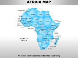
Africa continents powerpoint maps
We present to you our Africa Continents PowerPoint maps. You can save this slideshow in PDF or JPG format conveniently. After you download this presentation, it can be viewed in standard size display ratio of 4:3 or widescreen display ratio of 16:9. This maps PPT is fully editable so you can easily add or delete any given feature or the text used in the pre- designed slideshow. This Maps PPT template is Google Slides friendly which makes it very easy to use.
-
Maps Essential Tools For Navigation Today PPT Guidelines AT
Ditch the Dull templates and opt for our engaging Maps Essential Tools For Navigation Today PPT Guidelines AT deck to attract your audience. Our visually striking design effortlessly combines creativity with functionality, ensuring your content shines through. Compatible with Microsoft versions and Google Slides, it offers seamless integration of presentation. Save time and effort with our pre-designed PPT layout, while still having the freedom to customize fonts, colors, and everything you ask for. With the ability to download in various formats like JPG, JPEG, and PNG, sharing your slides has never been easier. From boardroom meetings to client pitches, this deck can be the secret weapon to leaving a lasting impression.
-
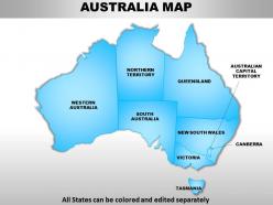
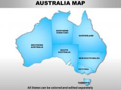
Australia continents powerpoint maps
These high quality, editable powerpoint country maps have been carefully created by our professional team to display location and other geographic details in your PowerPoint presentation. Each map is vector based and is 100% editable in powerpoint. Each and every property of any region - color, size, shading etc can be modified to help you build an effective powerpoint presentation. Use these maps to show sales territories, business and new office locations, travel planning etc in your presentations. Any text can be entered at any point in the powerpoint map slide. Simply DOWNLOAD, TYPE and PRESENT!
-
Greece powerpoint maps
Presenting greece powerpoint maps. This Power Point template diagram has been crafted with graphic of map for Greece country. Use this PPT diagram for geography and location related topics .This PPT diagram can be used for business and marketing related presentations.
-
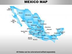
Mexico country powerpoint maps
These high quality, editable powerpoint state maps have been carefully created by our professional team to display location and other geographic details in your PowerPoint presentation. Each map is vector based and is 100% editable in powerpoint. Each and every property of any region - color, size, shading etc can be modified to help you build an effective powerpoint presentation. Use these maps to show sales territories, business and new office locations, travel planning etc in your presentations. Any text can be entered at any point in the powerpoint map slide. Simply DOWNLOAD, TYPE and PRESENT!
-
South east asia continents powerpoint maps
These high quality, editable powerpoint country maps have been carefully created by our professional team to display location and other geographic details in your PowerPoint presentation. Each map is vector based and is 100% editable in powerpoint. Each and every property of any region - color, size, shading etc can be modified to help you build an effective powerpoint presentation. Use these maps to show sales territories, business and new office locations, travel planning etc in your presentations. Any text can be entered at any point in the powerpoint map slide. Simply DOWNLOAD, TYPE and PRESENT!
-
Central asia continents powerpoint maps
These high quality, editable powerpoint country maps have been carefully created by our professional team to display location and other geographic details in your PowerPoint presentation. Each map is vector based and is 100% editable in powerpoint. Each and every property of any region - color, size, shading etc can be modified to help you build an effective powerpoint presentation. Use these maps to show sales territories, business and new office locations, travel planning etc in your presentations. Any text can be entered at any point in the powerpoint map slide. Simply DOWNLOAD, TYPE and PRESENT!