


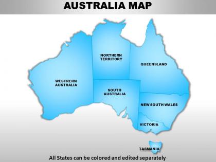
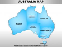
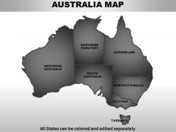
Australia continents powerpoint maps




Try Before you Buy Download Free Sample Product
 Impress Your
 Audience
 100%
100% Editable
 Save Hours
 of Time


Converge your thoughts onto our Australia Continents PowerPoint maps. Convert your team to your way of thinking.
People who downloaded this PowerPoint presentation also viewed the following :
Australia continents powerpoint maps with all 61 slides:
Make your ideas clearly understood. Elaborate on your logic with our Australia Continents PowerPoint maps.


FAQs for Australia
Australia features topographical maps showing terrain and elevation, political maps displaying states and territories, climate maps illustrating weather patterns, geological maps revealing mineral resources, and road maps for navigation. These maps serve diverse purposes across sectors, with mining companies using geological surveys for resource exploration, urban planners utilizing topographical data for development projects, and tourism operators leveraging road maps for route planning, ultimately enhancing decision-making and operational efficiency.
Thematic maps enhance understanding of Australia's demographic and cultural diversity by visualizing population distributions, ethnic compositions, language patterns, and cultural centers across different regions through color coding, symbols, and data overlays. These specialized maps enable researchers, policymakers, and educators to identify settlement patterns, multicultural hotspots, and regional variations, ultimately delivering deeper insights for community planning and cultural integration strategies.
Topographic maps serve as essential navigation tools for hiking, camping, mountaineering, and wilderness exploration across Australia's diverse terrain, providing detailed elevation contours, water sources, trail networks, and hazard identification. These maps enable adventurers to plan safe routes through the Outback, Blue Mountains, or Tasmania's wilderness, while assessing difficulty levels, camping locations, and emergency access points, ultimately delivering enhanced safety and more successful outdoor experiences.
GIS and digital mapping have revolutionized Australian map interaction through real-time data integration, interactive visualization, precise GPS navigation, and dynamic environmental monitoring. These technologies enable government agencies, mining companies, and urban planners to analyze land use patterns, track bushfire progression, and optimize resource management with unprecedented accuracy, ultimately delivering faster decision-making and enhanced operational efficiency.
Key historical milestones in Australian cartography include Dutch explorations by Willem Janszoon (1606), James Cook's detailed coastal mapping (1770), Matthew Flinders' complete continental circumnavigation (1801-1803), and the establishment of colonial surveying departments. These developments revolutionized land management, resource discovery, and settlement planning, with many modern Australian institutions finding that these foundational mapping efforts ultimately delivered strategic territorial understanding and enhanced administrative efficiency across the expanding continent.
Political maps reflect Australia's evolving governance through state boundary modifications, territorial status changes, and administrative restructuring over time. These cartographic representations showcase federation developments, indigenous land recognition, and local government area consolidations, with many regional authorities finding that updated mapping enhances resource allocation, policy implementation, and democratic representation across diverse communities.
Maps effectively illustrate Australia's environmental concerns by visualizing temperature changes, rainfall patterns, deforestation rates, biodiversity loss, and conservation zones across different regions and timeframes. These visual tools enable government agencies, environmental organizations, and businesses to communicate complex climate data, track conservation progress, and identify priority areas for intervention, ultimately delivering clearer environmental messaging and more strategic resource allocation for sustainability initiatives.
Australia's significant physical features include the Great Dividing Range, the vast Outback desert regions, the Great Barrier Reef, Murray-Darling River system, and extensive coastline. These geographic elements enable diverse economic opportunities across mining, agriculture, and tourism sectors, with many organizations leveraging detailed mapping data to optimize resource allocation, infrastructure development, and strategic planning across the continent's varied landscapes.
Interactive maps improve user experience in Australian cities and regional areas by providing real-time traffic updates, customizable routing options, integrated public transport information, and location-based services tailored to local conditions. These digital tools streamline navigation through complex urban centers like Sydney and Melbourne while enhancing accessibility to remote destinations, ultimately delivering faster travel times and reduced frustration for both residents and tourists exploring Australia's diverse landscapes.
Cartographers face challenges including Australia's vast scale requiring multiple projection systems, remote area data collection difficulties, rapidly changing urban boundaries, and balancing detail with readability across diverse terrains. These complexities demand strategic combinations of satellite imagery, ground surveys, and digital modeling, with many mapping organizations finding that specialized regional expertise and advanced GIS technologies ultimately deliver more accurate representations and enhanced user experiences.
Educational institutions can utilize Australian maps to enhance curriculum by incorporating topographical studies, historical settlement patterns, indigenous land connections, climate zone analysis, and urban development tracking. Through interactive digital mapping tools, schools streamline lesson planning while delivering hands-on learning experiences, with many geography and history departments finding that map-based activities significantly improve student engagement and spatial understanding skills.
Indigenous maps hold profound spiritual and cultural significance, representing Dreamtime stories, ancestral pathways, sacred sites, traditional boundaries, and ecological knowledge passed down through generations. These living documents connect Aboriginal and Torres Strait Islander peoples to Country through songlines and creation narratives, with many communities finding that mapping initiatives strengthen cultural preservation while enhancing land rights recognition and intergenerational knowledge transfer.
Transport maps enhance Australian travel efficiency by providing comprehensive route information, real-time transit updates, distance calculations, and multimodal connection points across states. These detailed mapping systems enable travelers and logistics companies to optimize journey planning, reduce fuel costs, and minimize travel time, with many freight operators and tourism businesses finding that strategic route visualization ultimately delivers significant operational advantages in Australia's vast continental landscape.
Custom Australia mapping tools include ArcGIS Online, QGIS, Google My Maps, Mapbox, and the Australian Bureau of Statistics' TableBuilder for demographic overlays. These platforms enable businesses and researchers to incorporate geospatial data, census information, and industry-specific datasets, with many organizations finding that targeted regional mapping enhances market analysis, logistics planning, and strategic decision-making across diverse Australian markets.
Historical maps of Australia reveal the progression of European settlement patterns, indigenous land displacement, agricultural expansion, and urban development from the late 18th century onward. These cartographic records enable researchers, educators, and policymakers to analyze territorial changes, resource exploitation, and settlement strategies across different regions, with many institutions finding that comparing colonial-era maps to contemporary surveys delivers crucial insights into land management practices and their long-term environmental impacts.
-
Qualitative and comprehensive slides.
-
Attractive design and informative presentation.